Randonnée Marche Montréal - St Jacques Étape 27 réalisée - Photo

St Jacques Étape 27 réalisée

 Jean-MarieFaux
Jean-MarieFaux

Utilisateur

© OpenStreetMap contributors
Longueur
Longueur
28 km
Altitude max
Altitude max
180 m
Dénivelé positif
Dénivelé positif
374 m
Km-Effort
Km-Effort  
33 km
Altitude min
Altitude min
81 m
Dénivelé négatif
Dénivelé négatif
359 m
Boucle
Boucle
Non
Date de création :
2016-03-09 00:00:00.0
Dernière modification :
2016-03-09 00:00:00.0

(0 Avis)

Marche
Marche
6h58
Difficulté : Très facile

Scannez ce code QR pour ouvrir la randonnée dans l'application SityTrail

Application GPS de randonnée GRATUITE

Logo SityTrail SityTrail

IGN / Instituts géographiques

Télécharger SityTrail sur l'App Store Télécharger SityTrail sur Google Play

Logo SityTrail SityTrail World

Le monde est à vous

Télécharger SityTrail sur l'App Store Télécharger SityTrail sur Google Play Télécharger SityTrail sur Huawei AppGallery

À propos

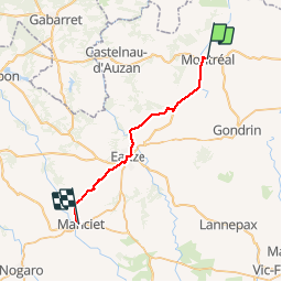
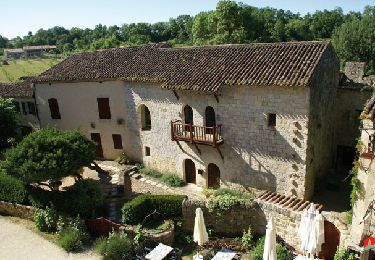
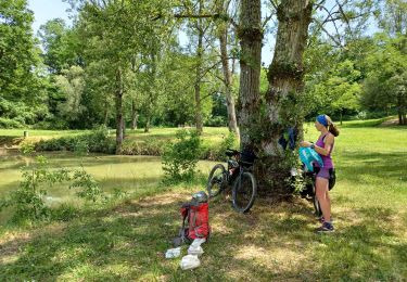
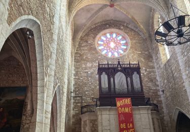
Randonnée Marche de 28 km à découvrir à Occitanie, Gers, Montréal. Cette randonnée est proposée par Jean-MarieFaux.

Description

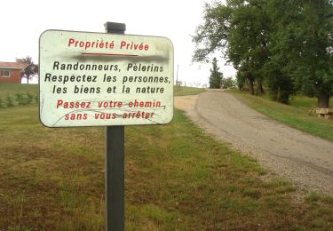
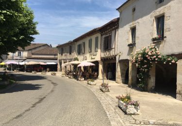
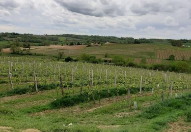
De Montréal du Gers à Manciet. A travers coteaux, champ et vignes du Gers. Beaucoup de chemin agricoles dangereux lorsqu'il pleut. Et c'était le cas.

Profil altimétrique

Localisation

Pays :
France
Région :
Occitanie
Département/Province :
Gers
Commune :
Montréal
Localité :
Unknown
Départ:(Dec)
Départ:(UTM)
275344 ; 4870107 (31T) N.

Randonnées à proximité

Randonnée Marche Montréal - fources  - Photo
Marche
DuMarsan

Marche

Facile
(1)
Montréal, Occitanie, Gers, France
21 km | 25 km-effort
5h 28min
Oui
Randonnée Marche Montréal - CC_Velay_EF_22_Montreal_Manciet_20080822 - Photo
Marche
patrickdanilo

Marche

Facile
Montréal, Occitanie, Gers, France
28 km | 33 km-effort
6h 30min
Non
Randonnée Vélo électrique Montréal - 04-06-19 - Photo
Vélo électrique
lviallet

Vélo électrique

Montréal, Occitanie, Gers, France
44 km | 0 m-effort
2h 56min
Oui
Randonnée Marche Montréal - chemin de la Tenareze à Montréal du gers - Photo
Marche
Forsans

Marche

Très facile
Montréal, Occitanie, Gers, France
10,8 km | 13,1 km-effort
3h 4min
Oui
Randonnée Vélo Montréal - Montréal - Fourcès - Larressingle - Photo
Vélo
lviallet

Vélo

Facile
Montréal, Occitanie, Gers, France
42 km | 49 km-effort
2h 47min
Oui
Randonnée V.T.T. Montréal - Montréal du gers, eauze,aire sur adour, - Photo
V.T.T.
lablaquiere

V.T.T.

Moyen
Montréal, Occitanie, Gers, France
68 km | 80 km-effort
9h 21min
Non
Randonnée Marche Montréal - GR 65  Montréal > Eauze  - Photo
Marche
choubaka77

Marche

Facile
Montréal, Occitanie, Gers, France
18 km | 21 km-effort
4h 38min
Non
Randonnée Marche Montréal - Montréal du Gers, sur les traces des romains  - Photo
Marche
Santblasi

Marche

Facile
Montréal, Occitanie, Gers, France
11,5 km | 13,9 km-effort
3h 0min
Oui
Randonnée Marche Fourcès - De Fources à Condom - Photo
Marche
tracegps

Marche

Difficile
Fourcès, Occitanie, Gers, France
21 km | 26 km-effort
5h 0min
Non


Fermer
Mes abonnements