Randonnée Marche Vecoux - Marche gourmande de Vecoux - Photo

Marche gourmande de Vecoux

 jeanclaude12
jeanclaude12

Utilisateur

© OpenStreetMap contributors
Longueur
Longueur
10,9 km
Altitude max
Altitude max
624 m
Dénivelé positif
Dénivelé positif
329 m
Km-Effort
Km-Effort  
15,3 km
Altitude min
Altitude min
400 m
Dénivelé négatif
Dénivelé négatif
327 m
Boucle
Boucle
Oui
Date de création :
2015-06-07 00:00:00.0
Dernière modification :
2015-06-07 00:00:00.0

(0 Avis)

Marche
Marche
4h11
Difficulté : Facile

Scannez ce code QR pour ouvrir la randonnée dans l'application SityTrail

Application GPS de randonnée GRATUITE

Logo SityTrail SityTrail

IGN / Instituts géographiques

Télécharger SityTrail sur l'App Store Télécharger SityTrail sur Google Play

Logo SityTrail SityTrail World

Le monde est à vous

Télécharger SityTrail sur l'App Store Télécharger SityTrail sur Google Play Télécharger SityTrail sur Huawei AppGallery

À propos

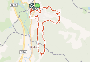
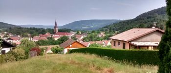
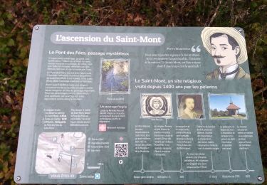
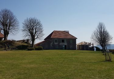
Randonnée Marche de 10,9 km à découvrir à Grand Est, Vosges, Vecoux. Cette randonnée est proposée par jeanclaude12.

Description

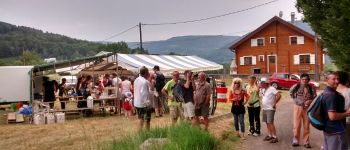
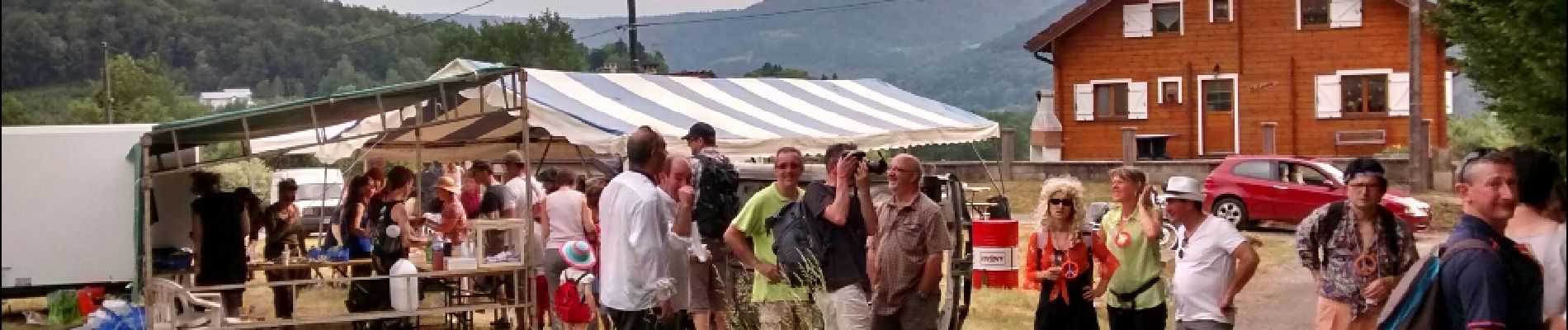
Onze km de marche en boucle, au rythme des arrêts-gourmandise  préparés avec bonheur par les organisateurs de cette manifestation très conviviale.

Profil altimétrique

Photos

Points d'intérêt

Point d'intérêt Vecoux - Stand 1  Collation - Photo
jeanclaude12
Point d'intérêt Rupt-sur-Moselle - Stand 3 : Soupe - Photo
jeanclaude12
RUPT-SUR-MOSELLE 
Point d'intérêt Rupt-sur-Moselle - Chalet de la Roulotte - Photo
jeanclaude12
RUPT-SUR-MOSELLE 
Point d'intérêt Vecoux - Stand Foie Gras - Photo
jeanclaude12
Point d'intérêt Vecoux - Station Plat - Photo
jeanclaude12
VECOUX 
Point d'intérêt Vecoux - Point Fromage - Photo
jeanclaude12
Point d'intérêt Vecoux - Station Dessert - Photo
jeanclaude12

Localisation

Pays :
France
Région :
Grand Est
Département/Province :
Vosges
Commune :
Vecoux
Localité :
Unknown
Départ:(Dec)
Départ:(UTM)
323617 ; 5316697 (32T) N.

Randonnées à proximité

Randonnée Marche Saint-Amé - carrière de Saint Amé - Photo
Marche
EricMathieu

Marche

Moyen
(1)
Saint-Amé, Grand Est, Vosges, France
8,6 km | 12,6 km-effort
2h 13min
Oui
Randonnée Marche Remiremont - Remiremont (Girmont-Val-d'Ajol) 22 880m +729m - Photo
Marche
DanielROLLET

Marche

Très difficile
(1)
Remiremont, Grand Est, Vosges, France
23 km | 33 km-effort
7h 24min
Oui
Randonnée Marche Saint-Étienne-lès-Remiremont - rando chanoinesses 2024 - Photo
Marche
Le grand Claude

Marche

Moyen
Saint-Étienne-lès-Remiremont, Grand Est, Vosges, France
12,5 km | 18 km-effort
2h 32min
Non
Randonnée Marche Vecoux - Chalet avuxon / La Vrille / Col de Xiard variante - Photo
Marche
Emmanuel Remy

Marche

Très difficile
(1)
Vecoux, Grand Est, Vosges, France
12,3 km | 19,1 km-effort
4h 20min
Oui
Randonnée Randonnée équestre Dommartin-lès-Remiremont - 2022-06-06 Rando CVA Dommartin Les Remiremont Le Tholy - Photo
Randonnée équestre
GUIDE
holtzv

Randonnée équestre

Moyen
Dommartin-lès-Remiremont, Grand Est, Vosges, France
22 km | 31 km-effort
3h 56min
Non
Randonnée Marche Saint-Étienne-lès-Remiremont - 20220324_rando_ST-ETIENNE-LES-REMIREMONT_N_Sur_les_pas_de_St_Romary - Photo
Marche
nfranche

Marche

Très difficile
Saint-Étienne-lès-Remiremont, Grand Est, Vosges, France
15,8 km | 25 km-effort
5h 36min
Oui
Randonnée A pied Girmont-Val-d'Ajol - La Beuille, sur la ligne de partage des eaux - Photo
A pied
PRO

A pied

Facile
(1)
Girmont-Val-d'Ajol, Grand Est, Vosges, France
8,7 km | 12,1 km-effort
2h 45min
Oui
Randonnée Marche Rupt-sur-Moselle - Vosges 2019 : réserve de Rupt-sur-Moselle.ori - Photo
Marche
PatDev

Marche

Moyen
Rupt-sur-Moselle, Grand Est, Vosges, France
11,4 km | 17,7 km-effort
5h 13min
Oui
Randonnée Marche Saint-Étienne-lès-Remiremont - Le sentier des Pourdingues - Photo
Marche
viam19

Marche

Facile
Saint-Étienne-lès-Remiremont, Grand Est, Vosges, France
10,7 km | 15,3 km-effort
2h 25min
Oui


Fermer
Mes abonnements