Randonnée Marche Marcy - Marcy 2010-08-25 - Photo
 gael.simon
gael.simon

Utilisateur

© OpenStreetMap contributors
Longueur
Longueur
4,5 km
Altitude max
Altitude max
401 m
Dénivelé positif
Dénivelé positif
122 m
Km-Effort
Km-Effort  
6,1 km
Altitude min
Altitude min
287 m
Dénivelé négatif
Dénivelé négatif
121 m
Boucle
Boucle
Oui
Date de création :
2014-12-10 00:00:00.0
Dernière modification :
2014-12-10 00:00:00.0

(0 Avis)

Marche
Marche
--
Difficulté : Inconnu

Scannez ce code QR pour ouvrir la randonnée dans l'application SityTrail

Application GPS de randonnée GRATUITE

Logo SityTrail SityTrail

IGN / Instituts géographiques

Télécharger SityTrail sur l'App Store Télécharger SityTrail sur Google Play

Logo SityTrail SityTrail World

Le monde est à vous

Télécharger SityTrail sur l'App Store Télécharger SityTrail sur Google Play Télécharger SityTrail sur Huawei AppGallery

À propos

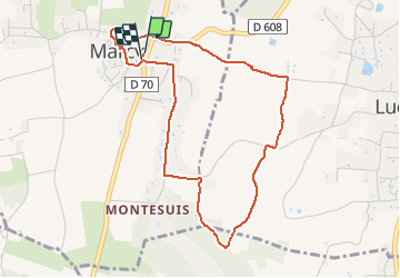
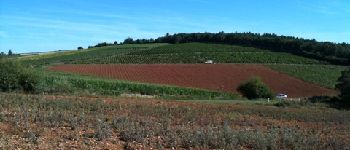
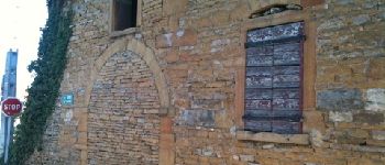
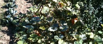
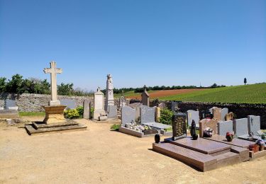
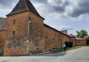
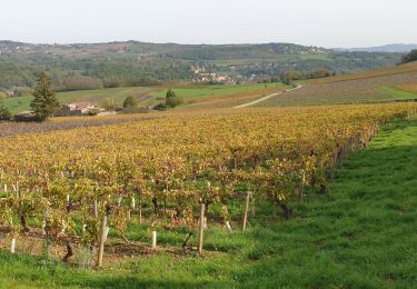
Randonnée Marche de 4,5 km à découvrir à Auvergne-Rhône-Alpes, Rhône, Marcy. Cette randonnée est proposée par gael.simon.

Profil altimétrique

Photos

Points d'intérêt

Point d'intérêt Lucenay - Vignes - Photo
gael.simon
LUCENAY 
Point d'intérêt Marcy - télégraphe - Photo
gael.simon
Point d'intérêt Lucenay - Paysage - Photo
gael.simon
LUCENAY 
Point d'intérêt Lucenay - Vigne - Photo
gael.simon
LUCENAY 
Point d'intérêt Lucenay - Borne - Photo
gael.simon
LUCENAY 
Point d'intérêt Morancé - Vue sur les vignes - Photo
gael.simon
Point d'intérêt Lucenay - Entretien des vignes - Photo
gael.simon
Point d'intérêt Lucenay - Chaleins Croix - Photo
gael.simon
Point d'intérêt Marcy - Vierge au loin - Photo
gael.simon
Point d'intérêt Marcy - Travail - Photo
gael.simon
MARCY 
Point d'intérêt Marcy - Maison - Photo
gael.simon
MARCY 
Point d'intérêt Marcy - Maison - Photo
gael.simon
MARCY 
Point d'intérêt Marcy - Choux et Citrouilles - Photo
gael.simon
Point d'intérêt Marcy - Tracteur - Photo
gael.simon
MARCY 
Point d'intérêt Marcy - Clocher Eglise de Marcy - Photo
gael.simon
Point d'intérêt Marcy - Puits - Photo
gael.simon
MARCY 

Localisation

Pays :
France
Région :
Auvergne-Rhône-Alpes
Département/Province :
Rhône
Commune :
Marcy
Localité :
Unknown
Départ:(Dec)
Départ:(UTM)
630359 ; 5085968 (31T) N.

Randonnées à proximité

Randonnée A pied Saint-Jean-des-Vignes - De Bagnols à Lozanne - Photo
A pied
PRO

A pied

Facile
Saint-Jean-des-Vignes, Auvergne-Rhône-Alpes, Rhône, France
4 km | 5 km-effort
1h 7min
Non
Randonnée Marche nordique Bagnols - bagnol - Photo
Marche nordique
isabelle.xavier

Marche nordique

Très facile
(1)
Bagnols, Auvergne-Rhône-Alpes, Rhône, France
6,8 km | 8,4 km-effort
1h 40min
Oui
Randonnée Marche Saint-Jean-des-Vignes - A_ST JEAN DES VIGNES 69380 Pierre Folle - Fontainebleau - Photo
Marche
ANDREJAC

Marche

Facile
(1)
Saint-Jean-des-Vignes, Auvergne-Rhône-Alpes, Rhône, France
8 km | 11 km-effort
3h 0min
Oui
Randonnée Marche Morancé - morance - Photo
Marche
6974gros

Marche

Très facile
(1)
Morancé, Auvergne-Rhône-Alpes, Rhône, France
7,9 km | 9,7 km-effort
1h 46min
Oui
Randonnée Randonnée équestre Les Chères - 5 nov formation - Photo
Randonnée équestre
HOUDA DRIF

Randonnée équestre

Facile
(2)
Les Chères, Auvergne-Rhône-Alpes, Rhône, France
13,6 km | 15 km-effort
1h 58min
Oui
Randonnée Marche Chessy - Chessy à Bagnols - Photo
Marche
Jean-Marc C

Marche

Difficile
(1)
Chessy, Auvergne-Rhône-Alpes, Rhône, France
12,5 km | 15,8 km-effort
3h 35min
Oui
Randonnée Marche Charnay - Charnay (12 km - D. 330 m) - Photo
Marche
Thomasdanielle

Marche

Facile
Charnay, Auvergne-Rhône-Alpes, Rhône, France
12,5 km | 16,9 km-effort
3h 7min
Oui
Randonnée Marche Chessy - Chessy - Carrières de Gray - Photo
Marche
PhilDomDoxa

Marche

Très facile
Chessy, Auvergne-Rhône-Alpes, Rhône, France
9,7 km | 13 km-effort
2h 33min
Oui
Randonnée Marche Theizé - Theizé (11 km - D. 310 m) - Photo
Marche
Thomasdanielle

Marche

Moyen
Theizé, Auvergne-Rhône-Alpes, Rhône, France
11,3 km | 15,5 km-effort
2h 43min
Oui


Fermer
Mes abonnements