Randonnée Marche Ispagnac - Ispagnac et Quezac - Photo

Ispagnac et Quezac

 PascaleJ
PascaleJ

Utilisateur

© OpenStreetMap contributors
Longueur
Longueur
8,8 km
Altitude max
Altitude max
752 m
Dénivelé positif
Dénivelé positif
280 m
Km-Effort
Km-Effort  
12,5 km
Altitude min
Altitude min
502 m
Dénivelé négatif
Dénivelé négatif
281 m
Boucle
Boucle
Oui
Date de création :
2015-07-25 00:00:00.0
Dernière modification :
2015-07-25 00:00:00.0

(1 Avis)

Marche
Marche
2h22
Difficulté : Facile

Scannez ce code QR pour ouvrir la randonnée dans l'application SityTrail

Application GPS de randonnée GRATUITE

Logo SityTrail SityTrail

IGN / Instituts géographiques

Télécharger SityTrail sur l'App Store Télécharger SityTrail sur Google Play

Logo SityTrail SityTrail World

Le monde est à vous

Télécharger SityTrail sur l'App Store Télécharger SityTrail sur Google Play Télécharger SityTrail sur Huawei AppGallery

À propos

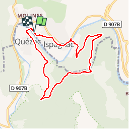
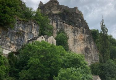
Randonnée Marche de 8,8 km à découvrir à Occitanie, Lozère, Ispagnac. Cette randonnée est proposée par PascaleJ.
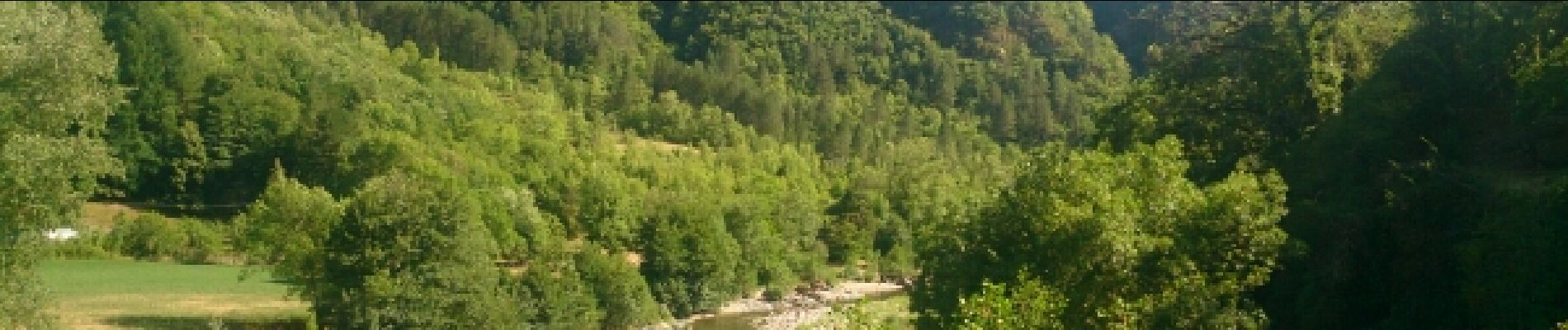
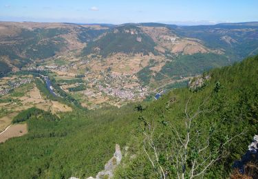
Description

2 rives du Tarn

Profil altimétrique

Photos

Localisation

Pays :
France
Région :
Occitanie
Département/Province :
Lozère
Commune :
Ispagnac
Localité :
Unknown
Départ:(Dec)
Départ:(UTM)
541984 ; 4913466 (31T) N.

Commentaires

Veuillez vous connecter pour laisser un commentaire ou une note


Randonnées à proximité

Randonnée Marche Florac Trois Rivières - Etape 8 Florac/Cassagnas - Photo
Marche
Nathalie. Mercier

Marche

Moyen
Florac Trois Rivières, Occitanie, Lozère, France
20 km | 26 km-effort
5h 20min
Non
Randonnée Marche Gorges du Tarn Causses - La Condamine, le Single  - Photo
Marche
Gegetop

Marche

Facile
Gorges du Tarn Causses, Occitanie, Lozère, France
11,3 km | 14,8 km-effort
3h 15min
Oui
Randonnée Marche Gorges du Tarn Causses - Sainte enfiliez - Photo
Marche
ezola

Marche

Moyen
Gorges du Tarn Causses, Occitanie, Lozère, France
17 km | 22 km-effort
4h 36min
Oui
Randonnée Cheval Gorges du Tarn Causses - Nissoulorgues-L'Hom - Photo
Cheval
alfreson

Cheval

Facile
Gorges du Tarn Causses, Occitanie, Lozère, France
28 km | 40 km-effort
5h 14min
Non
Randonnée Cheval Gorges du Tarn Causses - Nissoulorgues-L'Hom - Photo
Cheval
alfreson

Cheval

Facile
Gorges du Tarn Causses, Occitanie, Lozère, France
28 km | 40 km-effort
5h 14min
Non
Randonnée Marche Florac Trois Rivières - Florac - Cassagnas - Photo
Marche
ploizon

Marche

Facile
(1)
Florac Trois Rivières, Occitanie, Lozère, France
19,4 km | 25 km-effort
4h 16min
Non
Randonnée Marche Gorges du Tarn Causses - Camping les osiers fraissinet par les moines -moujiks - Photo
Marche
sportifheureux

Marche

Difficile
Gorges du Tarn Causses, Occitanie, Lozère, France
7,9 km | 13,7 km-effort
2h 12min
Oui
Randonnée V.T.T. Gorges du Tarn Causses - boucle castelbouc - Photo
V.T.T.
chauffmarcel

V.T.T.

Moyen
Gorges du Tarn Causses, Occitanie, Lozère, France
15,2 km | 19,4 km-effort
1h 42min
Oui
Randonnée Marche Ispagnac - lonjagne - Photo
Marche
monique.dron@wanadoo.fr

Marche

Difficile
Ispagnac, Occitanie, Lozère, France
10,8 km | 16 km-effort
3h 35min
Oui


Fermer
Mes abonnements