Randonnée Marche Nólsoy - Nólsoy Kallur Lighthouse - Photo
 Geert H.
Geert H.

Utilisateur

© OpenStreetMap contributors
Longueur
Longueur
14,8 km
Altitude max
Altitude max
220 m
Dénivelé positif
Dénivelé positif
464 m
Km-Effort
Km-Effort  
21 km
Altitude min
Altitude min
2 m
Dénivelé négatif
Dénivelé négatif
464 m
Boucle
Boucle
Oui
Date de création :
2025-06-29 08:57:03.258
Dernière modification :
2025-07-08 14:30:16.751

(0 Avis)

Marche
Marche
3h33
Difficulté : Difficile

Scannez ce code QR pour ouvrir la randonnée dans l'application SityTrail

Application GPS de randonnée GRATUITE

Logo SityTrail SityTrail

IGN / Instituts géographiques

Télécharger SityTrail sur l'App Store Télécharger SityTrail sur Google Play

Logo SityTrail SityTrail Plus

Le monde est à vous

Télécharger SityTrail sur l'App Store Télécharger SityTrail sur Google Play Télécharger SityTrail sur Huawei AppGallery

À propos

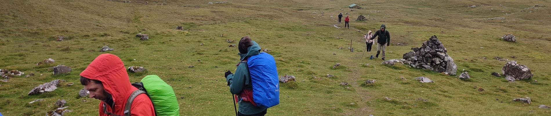
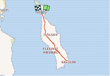
Randonnée Marche de 14,8 km à découvrir à Streymoyar sýsla, Inconnu, Nólsoy. Cette randonnée est proposée par Geert H..
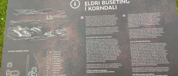
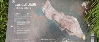
Description

The small white and red painted lighthouse is nestled on the northernmost tip on the island. Everyone wanting to visit the scenery will go for a hike. Kallur Lighthouse was built in 1927 and is now steadily growing in popularity.

Profil altimétrique

Photos

Points d'intérêt

Point d'intérêt Nólsoy - POI sans nom - Photo
Geert H.
NÓLSOY 
Point d'intérêt Nólsoy - POI sans nom - Photo
Geert H.
NÓLSOY 

Localisation

Pays :
Îles Féroé
Région :
Streymoyar sýsla
Département/Province :
Inconnu
Commune :
Nólsoy
Localité :
Unknown
Départ:(UTM)
621890 ; 6877081 (29V) N.


Fermer
Mes abonnements