Randonnée Marche Saint-Hubert - FOURNEAU St-Michel ( Al Pèle) - Photo

FOURNEAU St-Michel ( Al Pèle)

 GerardBouche
GerardBouche

Utilisateur

© OpenStreetMap contributors
Longueur
Longueur
10,9 km
Altitude max
Altitude max
519 m
Dénivelé positif
Dénivelé positif
241 m
Km-Effort
Km-Effort  
14,1 km
Altitude min
Altitude min
299 m
Dénivelé négatif
Dénivelé négatif
232 m
Boucle
Boucle
Oui
Date de création :
2017-03-24 00:00:00.0
Dernière modification :
2017-03-24 00:00:00.0

(1 Avis)

Marche
Marche
3h03
Difficulté : Facile

Scannez ce code QR pour ouvrir la randonnée dans l'application SityTrail

Application GPS de randonnée GRATUITE

Logo SityTrail SityTrail

IGN / Instituts géographiques

Télécharger SityTrail sur l'App Store Télécharger SityTrail sur Google Play

Logo SityTrail SityTrail World

Le monde est à vous

Télécharger SityTrail sur l'App Store Télécharger SityTrail sur Google Play Télécharger SityTrail sur Huawei AppGallery

À propos

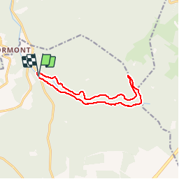
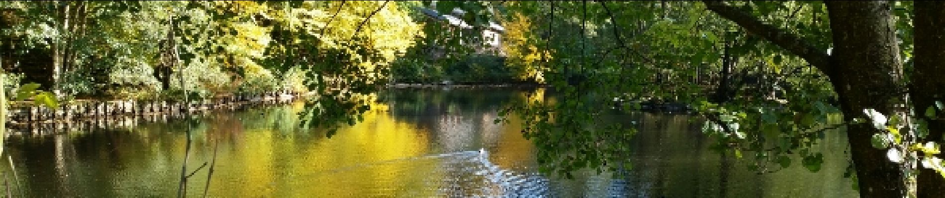
Randonnée Marche de 10,9 km à découvrir à Wallonie, Luxembourg, Saint-Hubert. Cette randonnée est proposée par GerardBouche.

Description

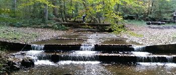
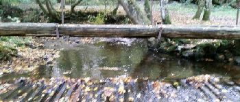
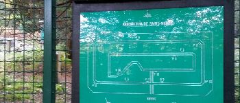
Départ de la brasserie "Al Pèle " par  l'arboretum-> le passage à gué et suivre la Masblette par le Tier des Grippes. Retour par le Ri du Pied de Boeuf et Plain St-Michel.

Profil altimétrique

Photos

Points d'intérêt

Point d'intérêt Saint-Hubert - Fourneau St-Michel - Photo
GerardBouche
SAINT-HUBERT 
Point d'intérêt Saint-Hubert - Point 2 - Photo
GerardBouche
SAINT-HUBERT 
Point d'intérêt Saint-Hubert - Point 3 - Photo
GerardBouche
SAINT-HUBERT 
Point d'intérêt Saint-Hubert - Point 12 - Photo
GerardBouche
SAINT-HUBERT 
Point d'intérêt Saint-Hubert - Point 14 - Photo
GerardBouche
SAINT-HUBERT 
Point d'intérêt Saint-Hubert - Point 16 - Photo
GerardBouche
SAINT-HUBERT 
Point d'intérêt Saint-Hubert - Point 17 - Photo
GerardBouche
SAINT-HUBERT 
Point d'intérêt Saint-Hubert - Point 19 - Photo
GerardBouche
SAINT-HUBERT 

Localisation

Pays :
Belgique
Région :
Wallonie
Département/Province :
Luxembourg
Commune :
Saint-Hubert
Localité :
Saint-Hubert
Départ:(Dec)
Départ:(UTM)
667488 ; 5550451 (31U) N.

Commentaires

Veuillez vous connecter pour laisser un commentaire ou une note


Randonnées à proximité

Randonnée Marche Saint-Hubert - Saint-Hubert - Les Abanages (SH03) - Photo
Marche
GUIDE+

Marche

Difficile
(11)
Saint-Hubert, Wallonie, Luxembourg, Belgique
9,8 km | 13,1 km-effort
2h 49min
Oui
Randonnée Marche Tellin - RL-GG-13_Grupont_Poix-Saint-Hubert - Photo
Marche
PRO

Marche

Très difficile
(2)
Tellin, Wallonie, Luxembourg, Belgique
26 km | 34 km-effort
7h 23min
Non
Randonnée Marche Tellin - Balade à Grupont - Photo
Marche
GUIDE
Desrumaux

Marche

Facile
(1)
Tellin, Wallonie, Luxembourg, Belgique
8,4 km | 11,9 km-effort
2h 33min
Oui
Randonnée Marche Tellin - Grupont - Promenade du bois de Machi - Photo
Marche
GUIDE+

Marche

Moyen
(1)
Tellin, Wallonie, Luxembourg, Belgique
8,6 km | 12,6 km-effort
2h 37min
Oui
Randonnée Marche Saint-Hubert - Saint-Hubert - Circuit Natura 2000, des sites qui valent le détour - Lx16 - Photo
Marche
GUIDE+

Marche

Moyen
(3)
Saint-Hubert, Wallonie, Luxembourg, Belgique
9,8 km | 13 km-effort
1h 11min
Oui
Randonnée Marche Nassogne - RB-Lu-07_Masbourg_via-racc-1 - Photo
Marche
PRO

Marche

Moyen
(3)
Nassogne, Wallonie, Luxembourg, Belgique
20 km | 29 km-effort
6h 0min
Oui
Randonnée Vélo Nassogne - Massif de Nassogne - Photo
Vélo
GUIDE+

Vélo

Moyen
(2)
Nassogne, Wallonie, Luxembourg, Belgique
14,2 km | 19 km-effort
1h 4min
Oui
Randonnée Vélo Nassogne - Massif de Nassogne : variante 1 - Photo
Vélo
GUIDE+

Vélo

Moyen
(1)
Nassogne, Wallonie, Luxembourg, Belgique
6,4 km | 8,1 km-effort
27min
Oui
Randonnée Marche Nassogne - nassogne ac - Photo
Marche
colsonandre

Marche

Moyen
(1)
Nassogne, Wallonie, Luxembourg, Belgique
39 km | 48 km-effort
5h 30min
Non


Fermer
Mes abonnements