Randonnée Marche Servance-Miellin - Les Mille Étangs en Vosges Saônoises - Photo

Les Mille Étangs en Vosges Saônoises

 jeanclaude12
jeanclaude12

Utilisateur

© OpenStreetMap contributors
Longueur
Longueur
19,2 km
Altitude max
Altitude max
676 m
Dénivelé positif
Dénivelé positif
266 m
Km-Effort
Km-Effort  
23 km
Altitude min
Altitude min
572 m
Dénivelé négatif
Dénivelé négatif
266 m
Boucle
Boucle
Oui
Date de création :
2015-10-13 00:00:00.0
Dernière modification :
2015-10-13 00:00:00.0

(0 Avis)

Marche
Marche
4h57
Difficulté : Facile

Scannez ce code QR pour ouvrir la randonnée dans l'application SityTrail

Application GPS de randonnée GRATUITE

Logo SityTrail SityTrail

IGN / Instituts géographiques

Télécharger SityTrail sur l'App Store Télécharger SityTrail sur Google Play

Logo SityTrail SityTrail World

Le monde est à vous

Télécharger SityTrail sur l'App Store Télécharger SityTrail sur Google Play Télécharger SityTrail sur Huawei AppGallery

À propos

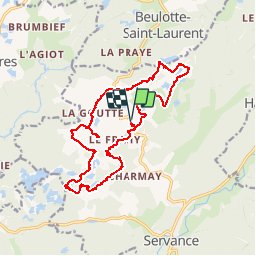
Randonnée Marche de 19,2 km à découvrir à Bourgogne-Franche-Comté, Haute-Saône, Servance-Miellin. Cette randonnée est proposée par jeanclaude12.

Description

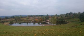
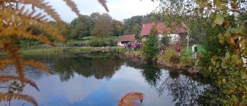
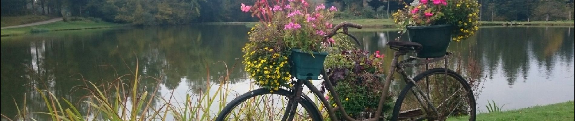
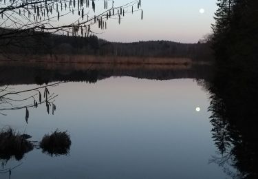
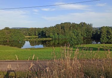
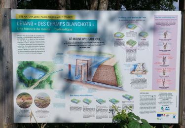
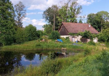
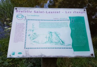
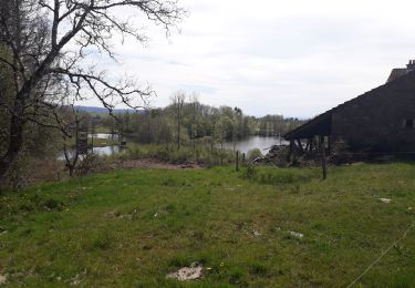
Au départ du Plateau des Grilloux, cette envoûtante randonnée automnale longe un cortège d'étangs millénaires, tous aussi beaux les uns que les autres. L'âme de chacun s'y reflète dès les premiers pas. Quelle paix!

Profil altimétrique

Photos

Points d'intérêt

Point d'intérêt Servance-Miellin - La Goutte du Frêne - Photo
jeanclaude12
SERVANCE-MIELLIN 
Point d'intérêt Servance-Miellin - Aube - Photo
jeanclaude12
SERVANCE-MIELLIN 
Point d'intérêt Servance-Miellin - Les Rouillons - Photo
jeanclaude12
SERVANCE-MIELLIN 

Localisation

Pays :
France
Région :
Bourgogne-Franche-Comté
Département/Province :
Haute-Saône
Commune :
Servance-Miellin
Localité :
Servance
Départ:(Dec)
Départ:(UTM)
325441 ; 5300978 (32T) N.

Randonnées à proximité

Randonnée Marche Beulotte-Saint-Laurent - Randonnée des étangs - Beulotte Saint Laurent  - Photo
Marche
tracegps

Marche

Moyen
(4)
Beulotte-Saint-Laurent, Bourgogne-Franche-Comté, Haute-Saône, France
10,7 km | 13,9 km-effort
2h 30min
Oui
Randonnée Marche Faucogney-et-la-Mer - 08-02-20 La mer, étang de Pierre Plate et retour. - Photo
Marche
annefrance70

Marche

Très facile
(1)
Faucogney-et-la-Mer, Bourgogne-Franche-Comté, Haute-Saône, France
9,9 km | 12,3 km-effort
2h 4min
Oui
Randonnée Marche Beulotte-Saint-Laurent - Beulotte-Saint-Laurent 13 700m + 317m - Photo
Marche
DanielROLLET

Marche

Facile
(1)
Beulotte-Saint-Laurent, Bourgogne-Franche-Comté, Haute-Saône, France
13,7 km | 17,9 km-effort
3h 50min
Oui
Randonnée Marche Esmoulières - 08-07-23 circuit du plateau d'Esmoulieres - Photo
Marche
annefrance70

Marche

Moyen
Esmoulières, Bourgogne-Franche-Comté, Haute-Saône, France
8,7 km | 11 km-effort
2h 2min
Oui
Randonnée Marche Esmoulières - Esmoulières rando réelle  - Photo
Marche
Sugg

Marche

Moyen
Esmoulières, Bourgogne-Franche-Comté, Haute-Saône, France
9,2 km | 11,5 km-effort
3h 11min
Oui
Randonnée Marche Servance-Miellin - 20230616 la petite Finlande  - Photo
Marche
Sugg

Marche

Moyen
Servance-Miellin, Bourgogne-Franche-Comté, Haute-Saône, France
8,4 km | 10 km-effort
3h 25min
Oui
Randonnée Marche Faucogney-et-la-Mer - la mzr - Photo
Marche
tessy74

Marche

Très difficile
Faucogney-et-la-Mer, Bourgogne-Franche-Comté, Haute-Saône, France
18,7 km | 24 km-effort
6h 17min
Oui
Randonnée Marche Beulotte-Saint-Laurent - Beulotte St Laurent - le plateau des Mille Etangs - Photo
Marche
Bart2015

Marche

Difficile
Beulotte-Saint-Laurent, Bourgogne-Franche-Comté, Haute-Saône, France
22 km | 28 km-effort
4h 45min
Oui
Randonnée Marche Esmoulières - randonnée Esmoulières - Photo
Marche
Raphaël K

Marche

Moyen
Esmoulières, Bourgogne-Franche-Comté, Haute-Saône, France
8,3 km | 10,5 km-effort
2h 4min
Oui


Fermer
Mes abonnements