Randonnée Marche Belforêt-en-Perche - Tour des Collines du Perche 7 - Photo

Tour des Collines du Perche 7

 togolo28
togolo28

Utilisateur

© OpenStreetMap contributors
Longueur
Longueur
27 km
Altitude max
Altitude max
242 m
Dénivelé positif
Dénivelé positif
422 m
Km-Effort
Km-Effort  
33 km
Altitude min
Altitude min
109 m
Dénivelé négatif
Dénivelé négatif
500 m
Boucle
Boucle
Non
Date de création :
2016-10-18 00:00:00.0
Dernière modification :
2016-10-18 00:00:00.0

(0 Avis)

Marche
Marche
7h05
Difficulté : Moyen

Scannez ce code QR pour ouvrir la randonnée dans l'application SityTrail

Application GPS de randonnée GRATUITE

Logo SityTrail SityTrail

IGN / Instituts géographiques

Télécharger SityTrail sur l'App Store Télécharger SityTrail sur Google Play

Logo SityTrail SityTrail World

Le monde est à vous

Télécharger SityTrail sur l'App Store Télécharger SityTrail sur Google Play Télécharger SityTrail sur Huawei AppGallery

À propos

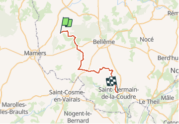
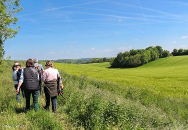
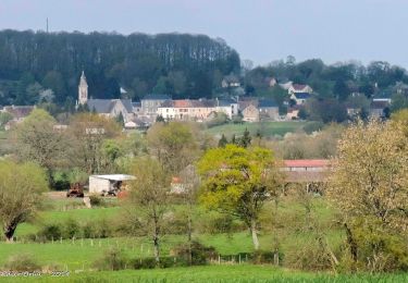
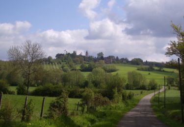
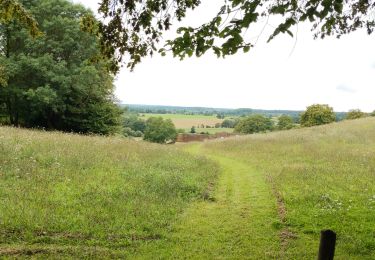
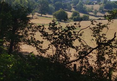
Randonnée Marche de 27 km à découvrir à Normandie, Orne, Belforêt-en-Perche. Cette randonnée est proposée par togolo28.

Description

Le Tour des Collines du Perche à été réalisé par l'association « Itinéraires Ruraux » de Pervenchères (orne).Vous pouvez consulter leur site internet :http://itinerairesduperche.org

Profil altimétrique

Localisation

Pays :
France
Région :
Normandie
Département/Province :
Orne
Commune :
Belforêt-en-Perche
Localité :
Unknown
Départ:(Dec)
Départ:(UTM)
310669 ; 5362746 (31U) N.

Randonnées à proximité

Randonnée Marche Belforêt-en-Perche - La Perrière, forêt et village - Photo
Marche
jeannine grandjean

Marche

Difficile
Belforêt-en-Perche, Normandie, Orne, France
11,1 km | 13,8 km-effort
3h 8min
Oui
Randonnée Marche Belforêt-en-Perche - le chêne de l'école - Photo
Marche
fournieralain

Marche

Très facile
Belforêt-en-Perche, Normandie, Orne, France
15,7 km | 19,7 km-effort
6h 47min
Oui
Randonnée Marche Belforêt-en-Perche -  La Perrière - Saint-Germain-de-la-Coudre via Bellême (TCP) 28 km - Photo
Marche

Marche

Moyen
Belforêt-en-Perche, Normandie, Orne, France
28 km | 35 km-effort
7h 16min
Non
Randonnée Marche Belforêt-en-Perche - La Perrière - Saint-Germain-de-la-Coudre via Igé (TCP) 27 km - Photo
Marche

Marche

Facile
Belforêt-en-Perche, Normandie, Orne, France
27 km | 33 km-effort
7h 2min
Non
Randonnée Marche Belforêt-en-Perche - La Perrière - Mortagne-au-Perche (TCP) 29 km - Photo
Marche

Marche

Difficile
Belforêt-en-Perche, Normandie, Orne, France
29 km | 34 km-effort
7h 18min
Non
Randonnée Marche Belforêt-en-Perche - La Perrière : village millénaire - Photo
Marche
tracegps

Marche

Moyen
Belforêt-en-Perche, Normandie, Orne, France
11,1 km | 14 km-effort
3h 0min
Oui
Randonnée Marche Belforêt-en-Perche - la perrière par la forêt  - Photo
Marche
Krissray

Marche

Moyen
Belforêt-en-Perche, Normandie, Orne, France
5,6 km | 7,6 km-effort
1h 45min
Oui
Randonnée Marche Belforêt-en-Perche - fourneaux gr jusqu'au ruisseau - Photo
Marche
Krissray

Marche

Moyen
Belforêt-en-Perche, Normandie, Orne, France
5 km | 6,7 km-effort
1h 15min
Oui
Randonnée Voiture Belforêt-en-Perche - 2023-12-6 Bellême VduP - Photo
Voiture
patrick2m

Voiture

Belforêt-en-Perche, Normandie, Orne, France
47 km | 56 km-effort
2h 48min
Non


Fermer
Mes abonnements