Randonnée Autre activité Riom - riom chatel - Photo
 kungpow
kungpow

Utilisateur

© OpenStreetMap contributors
Longueur
Longueur
22 km
Altitude max
Altitude max
675 m
Dénivelé positif
Dénivelé positif
480 m
Km-Effort
Km-Effort  
28 km
Altitude min
Altitude min
322 m
Dénivelé négatif
Dénivelé négatif
478 m
Boucle
Boucle
Oui
Date de création :
2016-05-15 00:00:00.0
Dernière modification :
2016-05-15 00:00:00.0

(0 Avis)

Autre activité
Autre activité
5h22
Difficulté : Inconnu

Scannez ce code QR pour ouvrir la randonnée dans l'application SityTrail

Application GPS de randonnée GRATUITE

Logo SityTrail SityTrail

IGN / Instituts géographiques

Télécharger SityTrail sur l'App Store Télécharger SityTrail sur Google Play

Logo SityTrail SityTrail World

Le monde est à vous

Télécharger SityTrail sur l'App Store Télécharger SityTrail sur Google Play Télécharger SityTrail sur Huawei AppGallery

À propos

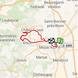
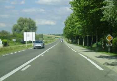
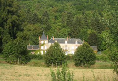
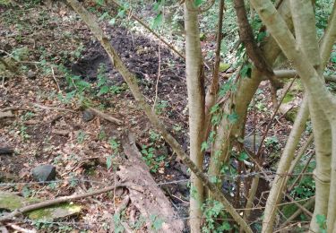
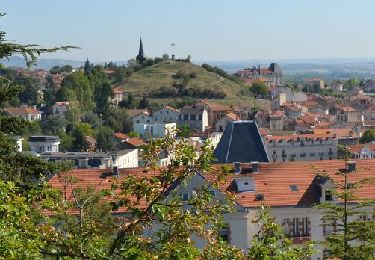
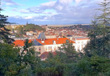
Randonnée Autre activité de 22 km à découvrir à Auvergne-Rhône-Alpes, Puy-de-Dôme, Riom. Cette randonnée est proposée par kungpow.

Profil altimétrique

Photos

Points d'intérêt

Point d'intérêt Châtel-Guyon - Belvédère  - Photo
kungpow
CHÂTEL-GUYON 

Localisation

Pays :
France
Région :
Auvergne-Rhône-Alpes
Département/Province :
Puy-de-Dôme
Commune :
Riom
Localité :
Unknown
Départ:(Dec)
Départ:(UTM)
508876 ; 5082142 (31T) N.

Randonnées à proximité

Randonnée Marche Châtel-Guyon - Les Briffons-Bois d'Agnat - Photo
Marche
Gegetop

Marche

Facile
(2)
Châtel-Guyon, Auvergne-Rhône-Alpes, Puy-de-Dôme, France
10,6 km | 14,8 km-effort
3h 14min
Oui
Randonnée Marche Châtel-Guyon - Chazeron sans souci - Photo
Marche
Gegetop

Marche

Facile
(1)
Châtel-Guyon, Auvergne-Rhône-Alpes, Puy-de-Dôme, France
6,6 km | 9,7 km-effort
1h 45min
Oui
Randonnée Marche Châtel-Guyon - Le tour de Montaclier - Saint Hippolyte - Photo
Marche
tracegps

Marche

Difficile
(1)
Châtel-Guyon, Auvergne-Rhône-Alpes, Puy-de-Dôme, France
14 km | 19,6 km-effort
3h 30min
Oui
Randonnée A pied Châtel-Guyon - La Vallée du Sans-Souci - Photo
A pied
PRO

A pied

Facile
Châtel-Guyon, Auvergne-Rhône-Alpes, Puy-de-Dôme, France
4,4 km | 6,5 km-effort
1h 28min
Oui
Randonnée A pied Châtel-Guyon - Les Vignes de Ronchalon - Photo
A pied
PRO

A pied

Facile
Châtel-Guyon, Auvergne-Rhône-Alpes, Puy-de-Dôme, France
8,8 km | 11,4 km-effort
2h 35min
Oui
Randonnée A pied Châteaugay - Les Côteaux du Plateau de Lachaud - Photo
A pied
PRO

A pied

Facile
Châteaugay, Auvergne-Rhône-Alpes, Puy-de-Dôme, France
14,2 km | 17,8 km-effort
4h 2min
Oui
Randonnée Marche Malauzat - depuis de marcoing - Photo
Marche
jeriom

Marche

Facile
Malauzat, Auvergne-Rhône-Alpes, Puy-de-Dôme, France
7,5 km | 10 km-effort
2h 49min
Non
Randonnée Marche Châtel-Guyon -  Chatel_Cote_Ronde_Percieres - Photo
Marche
GUIDE
jagarnier

Marche

Facile
Châtel-Guyon, Auvergne-Rhône-Alpes, Puy-de-Dôme, France
7 km | 9,8 km-effort
2h 0min
Oui
Randonnée Marche Châtel-Guyon - Chatel_Ronchalon - Photo
Marche
GUIDE
jagarnier

Marche

Facile
Châtel-Guyon, Auvergne-Rhône-Alpes, Puy-de-Dôme, France
7,5 km | 9,3 km-effort
2h 15min
Oui


Fermer
Mes abonnements