Randonnée Marche Châtel-Montagne - Chatel Montagne - centrale hydroelectrique - Photo

Chatel Montagne - centrale hydroelectrique

 coco03
coco03

Utilisateur

© OpenStreetMap contributors
Longueur
Longueur
11,9 km
Altitude max
Altitude max
538 m
Dénivelé positif
Dénivelé positif
387 m
Km-Effort
Km-Effort  
17,1 km
Altitude min
Altitude min
343 m
Dénivelé négatif
Dénivelé négatif
389 m
Boucle
Boucle
Oui
Date de création :
2016-07-17 00:00:00.0
Dernière modification :
2016-07-17 00:00:00.0

(0 Avis)

Marche
Marche
3h40
Difficulté : Facile

Scannez ce code QR pour ouvrir la randonnée dans l'application SityTrail

Application GPS de randonnée GRATUITE

Logo SityTrail SityTrail

IGN / Instituts géographiques

Télécharger SityTrail sur l'App Store Télécharger SityTrail sur Google Play

Logo SityTrail SityTrail World

Le monde est à vous

Télécharger SityTrail sur l'App Store Télécharger SityTrail sur Google Play Télécharger SityTrail sur Huawei AppGallery

À propos

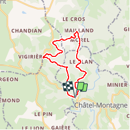
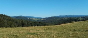
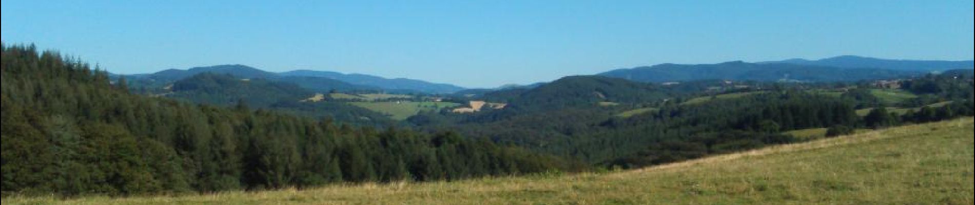
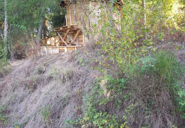
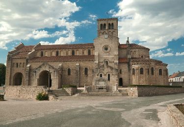
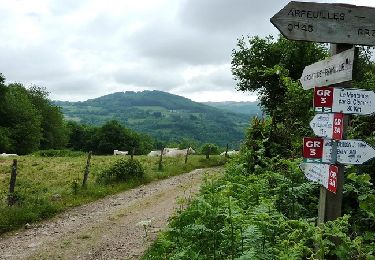
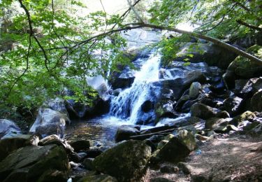
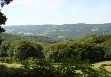
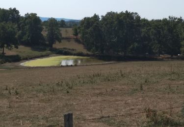
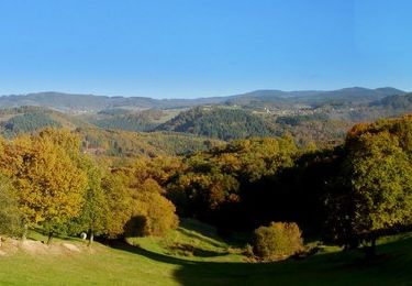
Randonnée Marche de 11,9 km à découvrir à Auvergne-Rhône-Alpes, Allier, Châtel-Montagne. Cette randonnée est proposée par coco03.

Profil altimétrique

Photos

Points d'intérêt

Point d'intérêt Nizerolles - poi1 - Photo
coco03
NIZEROLLES 

Localisation

Pays :
France
Région :
Auvergne-Rhône-Alpes
Département/Province :
Allier
Commune :
Châtel-Montagne
Localité :
Unknown
Départ:(Dec)
Départ:(UTM)
551418 ; 5107254 (31T) N.

Randonnées à proximité

Randonnée Course à pied Châtel-Montagne - jour 7 CAP Jeanot - Photo
Course à pied
jeannat

Course à pied

Très facile
Châtel-Montagne, Auvergne-Rhône-Alpes, Allier, France
33 km | 43 km-effort
4h 29min
Non
Randonnée Marche Châtel-Montagne - Charguéraud a La Croix Bruyère  - Photo
Marche
NANE51

Marche

Facile
Châtel-Montagne, Auvergne-Rhône-Alpes, Allier, France
12,2 km | 16,9 km-effort
3h 9min
Non
Randonnée Marche Châtel-Montagne - Le Puy du Roc - Châtel-Montagne - Photo
Marche
tracegps

Marche

Moyen
Châtel-Montagne, Auvergne-Rhône-Alpes, Allier, France
10,2 km | 15,3 km-effort
3h 0min
Oui
Randonnée V.T.T. Arfeuilles - La vallée du Barbenan (VTT-2011) - Arfeuilles - Photo
V.T.T.
tracegps

V.T.T.

Très difficile
Arfeuilles, Auvergne-Rhône-Alpes, Allier, France
53 km | 77 km-effort
5h 0min
Oui
Randonnée Marche Arfeuilles - La Pisserote - Arfeuilles - Photo
Marche
tracegps

Marche

Difficile
(1)
Arfeuilles, Auvergne-Rhône-Alpes, Allier, France
14,9 km | 22 km-effort
4h 0min
Non
Randonnée Marche Le Mayet-de-Montagne - Saint Clément - Photo
Marche
tracegps

Marche

Difficile
Le Mayet-de-Montagne, Auvergne-Rhône-Alpes, Allier, France
15,9 km | 23 km-effort
3h 30min
Oui
Randonnée V.T.C. Châtel-Montagne - jour 7 - Photo
V.T.C.
nathbab

V.T.C.

Très facile
Châtel-Montagne, Auvergne-Rhône-Alpes, Allier, France
27 km | 32 km-effort
2h 6min
Non
Randonnée Marche Châtel-Montagne - Balade autour du Mont Aigu - Le Moulin Chatel - Photo
Marche
tracegps

Marche

Moyen
Châtel-Montagne, Auvergne-Rhône-Alpes, Allier, France
10,4 km | 14,1 km-effort
2h 30min
Oui
Randonnée Marche Châtel-Montagne - Autour du mont Aigu -  Châtel-Montagne - Photo
Marche
tracegps

Marche

Difficile
Châtel-Montagne, Auvergne-Rhône-Alpes, Allier, France
14 km | 19,9 km-effort
4h 0min
Oui


Fermer
Mes abonnements