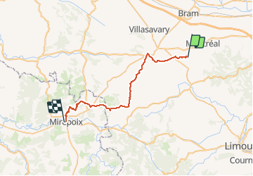
16,9 km | 21 km-effort
GR78 - Etape 2 - Montréal-Mirepoix
patoche2009
Utilisateur
Longueur
34 km
Altitude max
454 m
Dénivelé positif
810 m
Km-Effort
45 km
Altitude min
188 m
Dénivelé négatif
693 m
Boucle
Non
Date de création :
2017-02-26 00:00:00.0
Dernière modification :
2017-02-26 00:00:00.0
9h22
Difficulté : Facile
Application GPS de randonnée GRATUITE
À propos
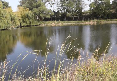
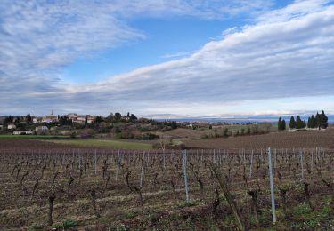
Randonnée Marche de 34 km à découvrir à Occitanie, Aude, Villeneuve-lès-Montréal. Cette randonnée est proposée par patoche2009.
Description
Voir étape 1 Carcassonne - Ville neuve les Montréal
Localisation
Pays :
France
Région :
Occitanie
Département/Province :
Aude
Commune :
Villeneuve-lès-Montréal
Localité :
Unknown
Départ:(Dec)
Départ:(UTM)
427869 ; 4781216 (31T) N.
Commentaires
Randonnées à proximité
Lasserre de prouilhe 17 kms
Marche
Moyen
(1)
Lasserre-de-Prouille,
Occitanie,
Aude,
France
4h 25min
Oui
À travers Champs et Vignes
A pied
Moyen
Ferran,
Occitanie,
Aude,
France
17,2 km | 21 km-effort
4h 49min
Oui
Sentier des bucherons
Marche
Très facile
Montréal,
Occitanie,
Aude,
France
7,1 km | 9,7 km-effort
2h 18min
Oui
papillon cailhau
Marche
Très facile
Cailhau,
Occitanie,
Aude,
France
9,9 km | 12 km-effort
2h 52min
Oui
papillon de Cailhau
Marche
Facile
Cailhau,
Occitanie,
Aude,
France
10,5 km | 12,6 km-effort
3h 0min
Non
Lasserre de prouillhe
Marche
Moyen
Lasserre-de-Prouille,
Occitanie,
Aude,
France
8,9 km | 11,5 km-effort
2h 39min
Non
Petit tour Montréal Est
Marche
Facile
Montréal,
Occitanie,
Aude,
France
3,2 km | 4,2 km-effort
90h 39min
Oui
Les bois du Chapitre Montrŕal d'aude
Marche
Moyen
Montréal,
Occitanie,
Aude,
France
7,5 km | 9,6 km-effort
34h 17min
Oui
Compost.Montré-Hounoux 2
Marche
Très difficile
Montréal,
Occitanie,
Aude,
France
20 km | 26 km-effort
5h 59min
Non