Randonnée Marche Nasbinals - Nasbinal vers Saint Chely d'Aubrac - Photo

Nasbinal vers Saint Chely d'Aubrac

 choubaka77
choubaka77

Utilisateur

© OpenStreetMap contributors
Longueur
Longueur
15,9 km
Altitude max
Altitude max
1369 m
Dénivelé positif
Dénivelé positif
250 m
Km-Effort
Km-Effort  
20 km
Altitude min
Altitude min
816 m
Dénivelé négatif
Dénivelé négatif
633 m
Boucle
Boucle
Non
Date de création :
2017-08-14 00:00:00.0
Dernière modification :
2017-08-14 00:00:00.0

(1 Avis)

Marche
Marche
4h37
Difficulté : Moyen

Scannez ce code QR pour ouvrir la randonnée dans l'application SityTrail

Application GPS de randonnée GRATUITE

Logo SityTrail SityTrail

IGN / Instituts géographiques

Télécharger SityTrail sur l'App Store Télécharger SityTrail sur Google Play

Logo SityTrail SityTrail World

Le monde est à vous

Télécharger SityTrail sur l'App Store Télécharger SityTrail sur Google Play Télécharger SityTrail sur Huawei AppGallery

À propos

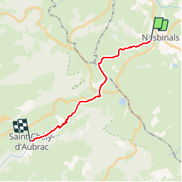
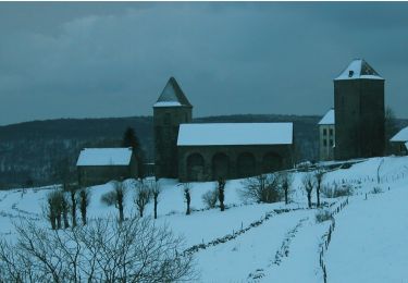
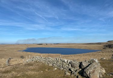
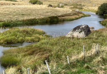
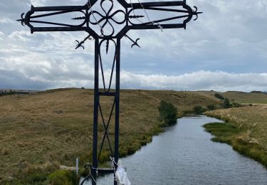
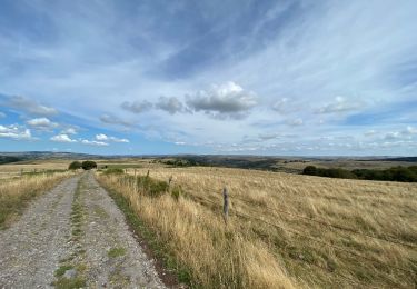
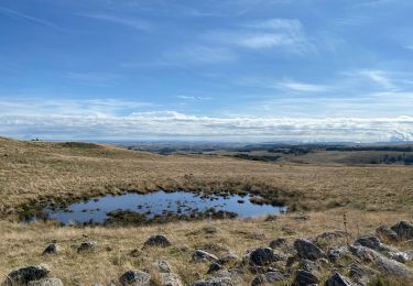
Randonnée Marche de 15,9 km à découvrir à Occitanie, Lozère, Nasbinals. Cette randonnée est proposée par choubaka77.

Description

Superbe itinéraire sur le chemin de Saint-Jacques. Bonne distance pour une première journée ou transition.

Profil altimétrique

Photos

Localisation

Pays :
France
Région :
Occitanie
Département/Province :
Lozère
Commune :
Nasbinals
Localité :
Unknown
Départ:(Dec)
Départ:(UTM)
502924 ; 4945226 (31T) N.

Commentaires

Veuillez vous connecter pour laisser un commentaire ou une note


Randonnées à proximité

Randonnée Marche Saint-Chély-d'Aubrac - Aubrac - St Côme d'Olt - Chemin de St-Jacques de Compostelle - Photo
Marche
tracegps

Marche

Très difficile
(1)
Saint-Chély-d'Aubrac, Occitanie, Aveyron, France
23 km | 30 km-effort
5h 0min
Non
Randonnée A pied Nasbinals - chemin de Saint-Jacques-de-Compostelle pour randonneurs avec animaux (chien, ane, cheval) ou VTT - Photo
A pied
PRO

A pied

Facile
Nasbinals, Occitanie, Lozère, France
5,7 km | 7,3 km-effort
1h 38min
Non
Randonnée Marche Saint-Urcize - Des estives et des croix  - Photo
Marche
GUIDE
antignacs

Marche

Facile
Saint-Urcize, Auvergne-Rhône-Alpes, Cantal, France
19,8 km | 25 km-effort
5h 19min
Oui
Randonnée Marche Nasbinals - Tour des lacs - Photo
Marche
GUIDE
antignacs

Marche

Facile
Nasbinals, Occitanie, Lozère, France
21 km | 25 km-effort
5h 8min
Oui
Randonnée Marche Marchastel - Phot’Aubrac 2023 - Photo
Marche
GUIDE
antignacs

Marche

Très facile
Marchastel, Occitanie, Lozère, France
12,6 km | 14,6 km-effort
4h 0min
Oui
Randonnée Marche Marchastel - Le Bes Rieutord Montgros variante  - Photo
Marche
GUIDE
antignacs

Marche

Très facile
Marchastel, Occitanie, Lozère, France
11,6 km | 14,2 km-effort
2h 55min
Oui
Randonnée Marche Recoules-d'Aubrac - Recoules Bouchabes  - Photo
Marche
GUIDE
antignacs

Marche

Très facile
Recoules-d'Aubrac, Occitanie, Lozère, France
14,4 km | 18,6 km-effort
3h 38min
Oui
Randonnée Marche Nasbinals - Nasbinals col d’Aubrac Montorzier - Photo
Marche
GUIDE
antignacs

Marche

Moyen
Nasbinals, Occitanie, Lozère, France
23 km | 28 km-effort
5h 51min
Oui
Randonnée Marche Saint-Urcize - Carbonade Croix de Goutal  - Photo
Marche
GUIDE
antignacs

Marche

Très facile
Saint-Urcize, Auvergne-Rhône-Alpes, Cantal, France
9,5 km | 12,4 km-effort
2h 37min
Oui


Fermer
Mes abonnements