Randonnée Marche Saint-Émilion - LSG juin 2018 boucle Saint Emilion  - Photo

LSG juin 2018 boucle Saint Emilion

 lsg1956
lsg1956

Utilisateur

© OpenStreetMap contributors
Longueur
Longueur
13,5 km
Altitude max
Altitude max
98 m
Dénivelé positif
Dénivelé positif
167 m
Km-Effort
Km-Effort  
15,7 km
Altitude min
Altitude min
16 m
Dénivelé négatif
Dénivelé négatif
163 m
Boucle
Boucle
Non
Date de création :
2018-06-26 16:15:16.227
Dernière modification :
2020-01-04 11:15:15.862

(0 Avis)

Marche
Marche
3h14
Difficulté : Très facile

Scannez ce code QR pour ouvrir la randonnée dans l'application SityTrail

Application GPS de randonnée GRATUITE

Logo SityTrail SityTrail

IGN / Instituts géographiques

Télécharger SityTrail sur l'App Store Télécharger SityTrail sur Google Play

Logo SityTrail SityTrail World

Le monde est à vous

Télécharger SityTrail sur l'App Store Télécharger SityTrail sur Google Play Télécharger SityTrail sur Huawei AppGallery

À propos

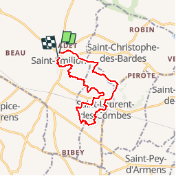
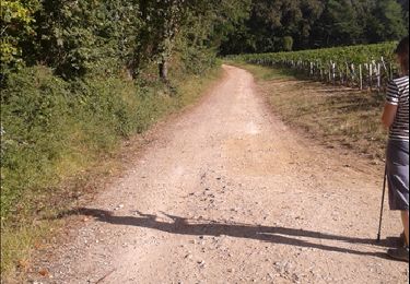
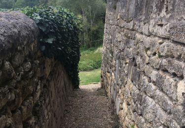
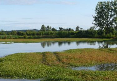
Randonnée Marche de 13,5 km à découvrir à Nouvelle-Aquitaine, Gironde, Saint-Émilion. Cette randonnée est proposée par lsg1956.

Profil altimétrique

Points d'intérêt

Point d'intérêt Saint-Laurent-des-Combes - Point 1 - Photo
lsg1956
SAINT-LAURENT-DES-COMBES 
Point d'intérêt Saint-Christophe-des-Bardes - Point 2 - Photo
lsg1956
SAINT-CHRISTOPHE-DES-BARDES 

Localisation

Pays :
France
Région :
Nouvelle-Aquitaine
Département/Province :
Gironde
Commune :
Saint-Émilion
Localité :
Unknown
Départ:(Dec)
Départ:(UTM)
724613 ; 4975298 (30T) N.

Randonnées à proximité

Randonnée Marche Montagne - Le bon air de Montagne - Photo
Marche
tabb

Marche

Facile
Montagne, Nouvelle-Aquitaine, Gironde, France
9,1 km | 11,1 km-effort
2h 20min
Oui
Randonnée Marche Saint-Laurent-des-Combes - Saint Laurent des combes - Photo
Marche
sandrineh

Marche

Moyen
Saint-Laurent-des-Combes, Nouvelle-Aquitaine, Gironde, France
2,7 km | 3,5 km-effort
1h 49min
Oui
Randonnée V.T.T. Saint-Sulpice-de-Faleyrens - Saint Émilion en VTT - Photo
V.T.T.
tracegps

V.T.T.

Moyen
(1)
Saint-Sulpice-de-Faleyrens, Nouvelle-Aquitaine, Gironde, France
28 km | 32 km-effort
3h 0min
Oui
Randonnée Vélo de route Saint-Sulpice-de-Faleyrens - St Emilion visite - Photo
Vélo de route
Reichling

Vélo de route

Facile
Saint-Sulpice-de-Faleyrens, Nouvelle-Aquitaine, Gironde, France
10,8 km | 12,5 km-effort
2h 15min
Oui
Randonnée Marche Saint-Émilion - st emilion - Photo
Marche
plavengut

Marche

Facile
(1)
Saint-Émilion, Nouvelle-Aquitaine, Gironde, France
12,8 km | 15,1 km-effort
4h 17min
Oui
Randonnée Vélo électrique Saint-Émilion - Les grands crus de Saint-Emilion - Photo
Vélo électrique
lviallet

Vélo électrique

Très facile
Saint-Émilion, Nouvelle-Aquitaine, Gironde, France
16,4 km | 18,1 km-effort
Inconnu
Oui
Randonnée Autre activité Saint-Laurent-des-Combes - Saint Laurent de Combes - Photo
Autre activité
Lessire

Autre activité

Très facile
Saint-Laurent-des-Combes, Nouvelle-Aquitaine, Gironde, France
16,4 km | 19,8 km-effort
4h 15min
Oui
Randonnée Marche Saint-Laurent-des-Combes - CG33 _ Boucle de St Laurent-des-Combes - Photo
Marche
Elbe

Marche

Facile
Saint-Laurent-des-Combes, Nouvelle-Aquitaine, Gironde, France
7,9 km | 9,2 km-effort
2h 30min
Oui
Randonnée Marche Saint-Étienne-de-Lisse - Saint Émilion depuis Saint Etienne de Lisse - Photo
Marche
darancette

Marche

Facile
Saint-Étienne-de-Lisse, Nouvelle-Aquitaine, Gironde, France
21 km | 25 km-effort
6h 4min
Oui


Fermer
Mes abonnements