Trail Mountain bike Carnoux-en-Provence - Cap Canaille - Photo
 tracegps
tracegps

User

© OpenStreetMap contributors
Length
Length
44 km
Max alt
Max alt
373 m
Uphill gradient
Uphill gradient
1346 m
Km-Effort
Km-Effort  
62 km
Min alt
Min alt
4 m
Downhill gradient
Downhill gradient
1344 m
Boucle
Boucle
Yes
Creation date :
2014-12-10 00:00:00.0
Updated on :
2014-12-10 00:00:00.0

(0 Reviews)

Mountain bike
Mountain bike
4h10
Difficulty : Very difficult

Scan this QR Code to open this trail in the SityTrail application

FREE GPS app for hiking

Logo SityTrail SityTrail

IGN / Geographical institutes

Download SityTrail from the App Store Download SityTrail from Google Play

Logo SityTrail SityTrail World

The world is yours!

Download SityTrail from the App Store Download SityTrail from Google Play Download SityTrail on Huawei AppGallery

About

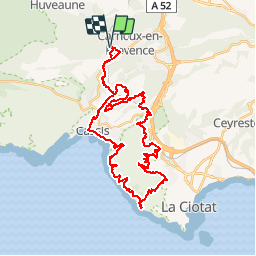
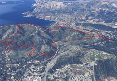
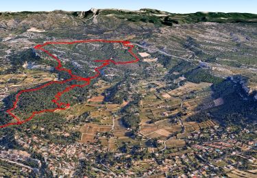
Trail Mountain bike of 44 km to be discovered at Provence-Alpes-Côte d'Azur, Bouches-du-Rhône, Carnoux-en-Provence. This trail is proposed by tracegps.

Description

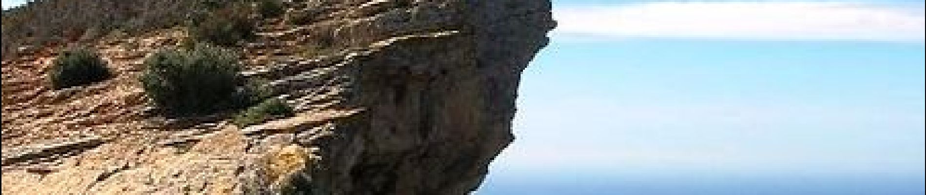
25 Mars 2006 Pour cette seconde journée nous allons de l'autre côté de Cassis, le cap Canaille qui est la plus haute falaise d'Europe (394m) D'autres infos ICI

Elevation profile

Photos

Positioning

Country:
France
Region :
Provence-Alpes-Côte d'Azur
Department/Province :
Bouches-du-Rhône
Municipality :
Carnoux-en-Provence
Location:
Unknown
Start:(UTM)
707180 ; 4792407 (31T) N.

Trails nearby

Trail Road bike Cassis - 7909608-TRIMRS2017_Parcours Bike L V5 - Photo
Road bike
GUIDE+

Road bike

Medium
(1)
Cassis, Provence-Alpes-Côte d'Azur, Bouches-du-Rhône, France
21 km | 26 km-effort
1h 31min
No
Trail Walking Cassis - SityTrail - cassis la couronne - Photo
Walking
GUIDE
affinetataille

Walking

Medium
(3)
Cassis, Provence-Alpes-Côte d'Azur, Bouches-du-Rhône, France
16.1 km | 24 km-effort
6h 0min
Yes
Trail Walking Cassis - les calanques de Cassis - Photo
Walking
th.feur

Walking

Medium
(1)
Cassis, Provence-Alpes-Côte d'Azur, Bouches-du-Rhône, France
15.9 km | 23 km-effort
6h 2min
No
Trail Walking Marseille - Calanques - Aiguille Eissadon - Col Devenson - En vau - Col l'Oule - Photo
Walking
GUIDE
R@ph

Walking

Difficult
(2)
Marseille, Provence-Alpes-Côte d'Azur, Bouches-du-Rhône, France
14.6 km | 22 km-effort
4h 48min
Yes
Trail Walking Cassis - La Pointe Sud d'en Vau, depuis Cassis - Photo
Walking
tracegps

Walking

Medium
(1)
Cassis, Provence-Alpes-Côte d'Azur, Bouches-du-Rhône, France
7.7 km | 11.9 km-effort
3h 30min
Yes
Trail Walking Cassis - Rando Cassis - Mont Gibaou - Photo
Walking
tracegps

Walking

Difficult
(4)
Cassis, Provence-Alpes-Côte d'Azur, Bouches-du-Rhône, France
9.2 km | 14.3 km-effort
3h 0min
Yes
Trail Walking Cassis - Le Mont Gibaou **(cassis 13) - Photo
Walking
GUIDE
affinetataille

Walking

Medium
Cassis, Provence-Alpes-Côte d'Azur, Bouches-du-Rhône, France
12.5 km | 18.7 km-effort
6h 0min
Yes
Trail On foot Aubagne - la coueste de moi - Photo
On foot
Coryphene

On foot

Easy
(1)
Aubagne, Provence-Alpes-Côte d'Azur, Bouches-du-Rhône, France
8.7 km | 12.5 km-effort
Unknown
Yes
Trail Walking Cassis - calanques 1 - Photo
Walking
lionel4806

Walking

Difficult
(1)
Cassis, Provence-Alpes-Côte d'Azur, Bouches-du-Rhône, France
14.6 km | 26 km-effort
5h 37min
No


Close
My subscriptions