Trail Walking Fellering - Ferme auberge du Felsac...le Rouge Gazon - Photo

Ferme auberge du Felsac...le Rouge Gazon

 margotte
margotte

User

© OpenStreetMap contributors
Length
Length
23 km
Max alt
Max alt
1188 m
Uphill gradient
Uphill gradient
969 m
Km-Effort
Km-Effort  
36 km
Min alt
Min alt
705 m
Downhill gradient
Downhill gradient
944 m
Boucle
Boucle
No
Creation date :
2019-06-11 14:15:22.5
Updated on :
2020-04-26 15:26:01.474

(0 Reviews)

Walking
Walking
7h22
Difficulty : Difficult

Scan this QR Code to open this trail in the SityTrail application

FREE GPS app for hiking

Logo SityTrail SityTrail

IGN / Geographical institutes

Download SityTrail from the App Store Download SityTrail from Google Play

Logo SityTrail SityTrail World

The world is yours!

Download SityTrail from the App Store Download SityTrail from Google Play Download SityTrail on Huawei AppGallery

About

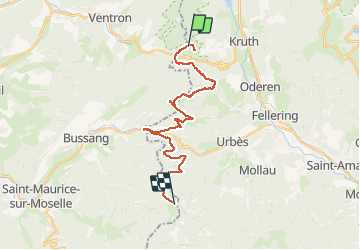
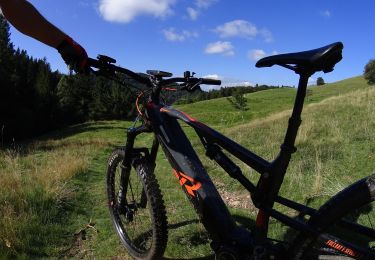
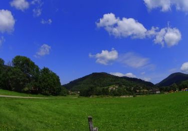
Trail Walking of 23 km to be discovered at Grand Est, Haut-Rhin, Fellering. This trail is proposed by margotte.

Description

Parcours un peu sinueux et pas forcément le plus court mais nous voulions redécouvrir des sentiers. Arrêt gourmand au Drumont avec une excellente tarte aux myrtilles mais la tarte à la rhubarbe meringuées est encore meilleure (malheureusement absente de la carte ..). Bon accueil au rouge Gazon mais soirée plus anonyme.

Elevation profile

Photos

Points of interest

Point of interest Fellering - borne des ducs de lorraine - Photo
margotte

Positioning

Country:
France
Region :
Grand Est
Department/Province :
Haut-Rhin
Municipality :
Fellering
Location:
Unknown
Start:(UTM)
345118 ; 5310347 (32T) N.

Trails nearby

Trail Walking Bussang - Col de Bussang - Rouge Gazon - Séchenat - Photo
Walking
VacheKiri67

Walking

Difficult
(1)
Bussang, Grand Est, Vosges, France
15 km | 24 km-effort
6h 0min
No
Trail Snowshoes Bussang - Circuit de raquette de Bussang - Photo
Snowshoes
tracegps

Snowshoes

Difficult
(1)
Bussang, Grand Est, Vosges, France
7.7 km | 11.2 km-effort
3h 0min
Yes
Trail Walking Ventron - L'Ermitage du Frère Joseph depuis Ventron - Photo
Walking
jeanclaude12

Walking

Easy
(1)
Ventron, Grand Est, Vosges, France
10.2 km | 15.4 km-effort
2h 49min
Yes
Trail Walking Fellering - Felsach _chapelle ST Nicolas_frenz - Photo
Walking
Le grand Claude

Walking

Difficult
(1)
Fellering, Grand Est, Haut-Rhin, France
9.6 km | 16.5 km-effort
3h 45min
Yes
Trail On foot Ventron - Circuit de la Croix de l’Hermite par Forgoutte - Photo
On foot
PRO

On foot

Easy
Ventron, Grand Est, Vosges, France
4.3 km | 6.6 km-effort
1h 29min
No
Trail On foot Ventron - Circuit panoramique de la Futaie - Photo
On foot
PRO

On foot

Easy
Ventron, Grand Est, Vosges, France
8.8 km | 12.6 km-effort
2h 52min
Yes
Trail Mountain bike Bussang - Bussang_20210918_101006 - Photo
Mountain bike
GUIDE
pascalou73

Mountain bike

Very easy
Bussang, Grand Est, Vosges, France
30 km | 43 km-effort
Unknown
No
Trail Mountain bike Bussang - Bussang_20210717_101651 - Photo
Mountain bike
GUIDE
pascalou73

Mountain bike

Very easy
Bussang, Grand Est, Vosges, France
32 km | 44 km-effort
Unknown
Yes
Trail Walking Oderen - 6146369-Chapelle St Nicolas 2 - Photo
Walking

Walking

Medium
(1)
Oderen, Grand Est, Haut-Rhin, France
10.9 km | 17.9 km-effort
3h 41min
Yes


Close
My subscriptions