Trail Mountain bike Yvetot - Montagne de la Durdent - Photo

Montagne de la Durdent

 tracegps
tracegps

User

© OpenStreetMap contributors
Length
Length
55 km
Max alt
Max alt
157 m
Uphill gradient
Uphill gradient
694 m
Km-Effort
Km-Effort  
65 km
Min alt
Min alt
35 m
Downhill gradient
Downhill gradient
691 m
Boucle
Boucle
Yes
Creation date :
2014-12-10 00:00:00.0
Updated on :
2014-12-10 00:00:00.0

(0 Reviews)

Mountain bike
Mountain bike
3h00
Difficulty : Difficult

Scan this QR Code to open this trail in the SityTrail application

FREE GPS app for hiking

Logo SityTrail SityTrail

IGN / Geographical institutes

Download SityTrail from the App Store Download SityTrail from Google Play

Logo SityTrail SityTrail World

The world is yours!

Download SityTrail from the App Store Download SityTrail from Google Play Download SityTrail on Huawei AppGallery

About

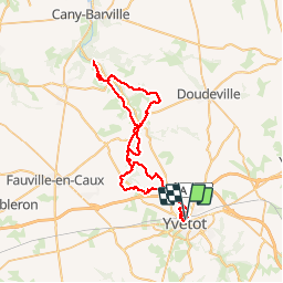
Trail Mountain bike of 55 km to be discovered at Normandy, Seine-Maritime, Yvetot. This trail is proposed by tracegps.

Description

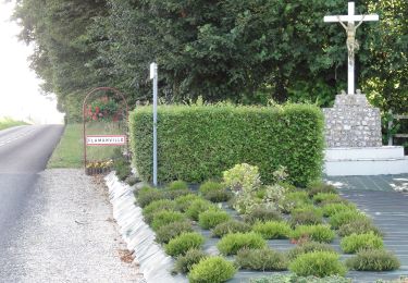
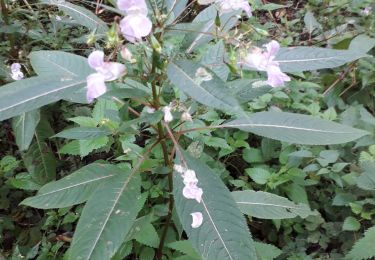
Voici une randonnée sympathique dans le Pays de Caux. C'est une randonnée organisée par le club d'Yvetot "CLUB CYCLOTOURISTE YVETOT". Il y a beaucoup de route dans la tracé. Une fois dans la vallée de durdent, c'est vraiment très joli. Pour ma part, j'ai pris beaucoup de plaisir à effectuer cette randonnée. Pour info, la prochaine randonnée sera réalisé dans la foret de Brotonne. Vous pouvez me contacter au mail suivant gibfen2(at)gmail.com. Bonne Randonnée à tous

Elevation profile

Positioning

Country:
France
Region :
Normandy
Department/Province :
Seine-Maritime
Municipality :
Yvetot
Location:
Unknown
Start:(UTM)
337885 ; 5498876 (31U) N.

Trails nearby

Trail On foot Ectot-lès-Baons - Circuit d'Ectot-les-Baons - Relais du Gal - Photo
On foot
PRO

On foot

Easy
Ectot-lès-Baons, Normandy, Seine-Maritime, France
6.7 km | 7.2 km-effort
1h 37min
No
Trail On foot Rocquefort - 211c - Photo
On foot
PRO

On foot

Easy
Rocquefort, Normandy, Seine-Maritime, France
12.9 km | 14.5 km-effort
3h 17min
No
Trail On foot Yvetot - FR-211a - Photo
On foot
PRO

On foot

Easy
Yvetot, Normandy, Seine-Maritime, France
9 km | 10.3 km-effort
2h 21min
No
Trail Walking Touffreville-la-Corbeline - Touffreville la Corbeline - Photo
Walking
MichelRando7656

Walking

Difficult
(2)
Touffreville-la-Corbeline, Normandy, Seine-Maritime, France
12.4 km | 14.4 km-effort
3h 20min
Yes
Trail On foot Étoutteville - La voie romaine - Photo
On foot
PRO

On foot

Easy
Étoutteville, Normandy, Seine-Maritime, France
7.2 km | 8.2 km-effort
1h 51min
Yes
Trail Walking Écalles-Alix - 076-06-Écalles-Alix 19.5km-738-807  - Photo
Walking
rvs147

Walking

Medium
Écalles-Alix, Normandy, Seine-Maritime, France
19.3 km | 23 km-effort
4h 57min
Yes
Trail Hybrid bike Yvetot - Au fil de la Risle - Photo
Hybrid bike
ves

Hybrid bike

Medium
Yvetot, Normandy, Seine-Maritime, France
178 km | 208 km-effort
Unknown
No
Trail Walking Yvetot - Les Fonds de Saint-Clair - Photo
Walking

Walking

Easy
Yvetot, Normandy, Seine-Maritime, France
13.7 km | 15.7 km-effort
3h 27min
Yes
Trail Mountain bike Yvetot - Yvetot St Wandrille - Photo
Mountain bike
ves

Mountain bike

Yvetot, Normandy, Seine-Maritime, France
36 km | 46 km-effort
2h 12min
No


Close
My subscriptions