


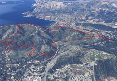
21 km | 26 km-effort

User


FREE GPS app for hiking
 SityTrail
IGN / Geographical institutes
SityTrail World
The world is yours!
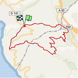
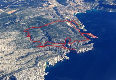
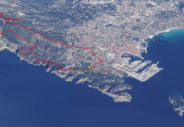
Trail Running of 9.8 km to be discovered at Provence-Alpes-Côte d'Azur, Bouches-du-Rhône, Cassis. This trail is proposed by tracegps.
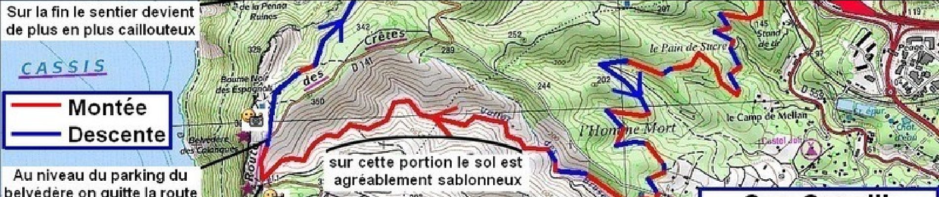
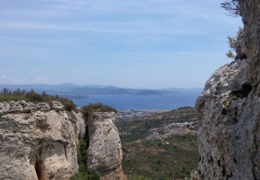
Le Cap Canaille en jogging, ça donne une autre dimension à la course à pied ...

Road bike
Walking
Walking
Walking
Walking

Walking

Walking
Walking

Walking