Trail Walking Laveissière - Les crêtes du Cantal - Le Lioran - Photo

Les crêtes du Cantal - Le Lioran

 tracegps
tracegps

User

© OpenStreetMap contributors
Length
Length
28 km
Max alt
Max alt
1769 m
Uphill gradient
Uphill gradient
1664 m
Km-Effort
Km-Effort  
51 km
Min alt
Min alt
922 m
Downhill gradient
Downhill gradient
1664 m
Boucle
Boucle
Yes
Creation date :
2014-12-10 00:00:00.0
Updated on :
2014-12-10 00:00:00.0

(4 Reviews)

Walking
Walking
7h30
Difficulty : Difficult

Scan this QR Code to open this trail in the SityTrail application

FREE GPS app for hiking

Logo SityTrail SityTrail

IGN / Geographical institutes

Download SityTrail from the App Store Download SityTrail from Google Play

Logo SityTrail SityTrail World

The world is yours!

Download SityTrail from the App Store Download SityTrail from Google Play Download SityTrail on Huawei AppGallery

About

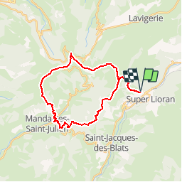
Trail Walking of 28 km to be discovered at Auvergne-Rhône-Alpes, Cantal, Laveissière. This trail is proposed by tracegps.

Description

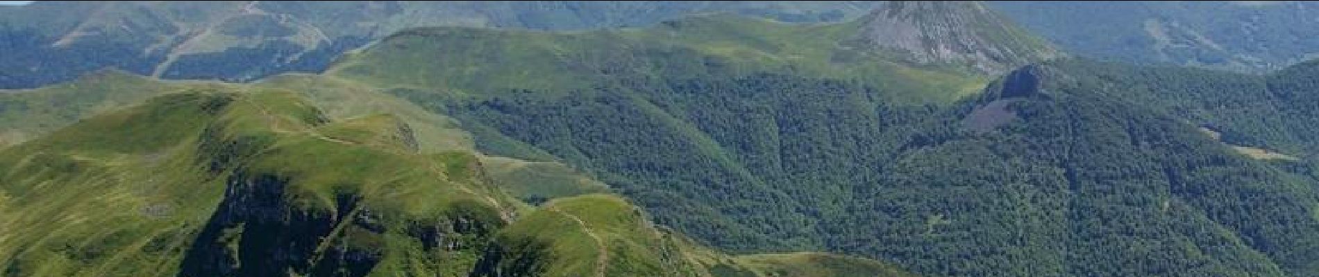
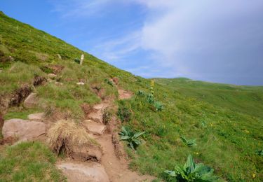
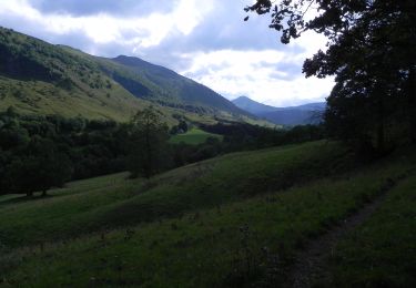
Circuit pouvant se faire sur 2 jours avec nuit à l'hôtel, maison d'hôte ou gîte d'étape à Mandailles (il y a aussi un camping à proximité) ou sur la journée pour les plus motivés (prévoir 8 bonnes heures avec le pique nique et quelques pauses). Circuit possible durant l'hiver si faible enneigement, mais prévoir crampons et piolets pour le passage ne nombreux névés sur les faces nord. Renseignez vous sur l'enneigement avant de partir. La première partie entre Le Lioran et Mandailles ne comporte pas de difficultés étant donné son profil plutôt descendant (800 m de dénivelé positif avec l'ascension du Griou). Il est possible de faire un aller/retour au sommet du Puy Griou en 30 minutes. Si vous êtes silencieux et observateur vous aurez peut être la chance de voir des marmottes sur les pentes du Griou (prévoyez les jumelles, ça vaut le coup!). S'en suit une longue descente en pente douce jusqu'au fond de la vallée de la Jordanne. La seconde partie s'avère plus ardue (1200 m de dénivelé positif) avec la montée assez raide jusqu'au Puy Chavaroche puis le Puy Mary. Sur cette partie vous pourrez apercevoir des chamois (pelage clair en été, noir en hiver, petites cornes) et des mouflons (grandes cornes en spirale chez les mâles).

Elevation profile

Photos

Points of interest

Point of interest Laveissière - Depart Le Lioran - Photo
tracegps
LAVEISSIÈRE 
Point of interest Mandailles-Saint-Julien - Etape Mandailles - Photo
tracegps
MANDAILLES-SAINT-JULIEN 
Point of interest Laveissière - Arrivee Le Lioran - Photo
tracegps
LAVEISSIÈRE 

Positioning

Country:
France
Region :
Auvergne-Rhône-Alpes
Department/Province :
Cantal
Municipality :
Laveissière
Location:
Unknown
Start:(UTM)
479474 ; 4992787 (31T) N.

Comments

Please log in to post a review or rate the element


Trails nearby

Trail Walking Albepierre-Bredons - Cantal - Col de Prat de Bouc Le Plomb du Cantal - 8.2km 450m 2h45 - 2019 07 06 - Photo
Walking
Orcal37

Walking

Medium
(1)
Albepierre-Bredons, Auvergne-Rhône-Alpes, Cantal, France
8.2 km | 14.2 km-effort
2h 45min
Yes
Trail Walking Lavigerie - Le Puy de Peyre Arse depuis la Gravière - Photo
Walking
tracegps

Walking

Difficult
(2)
Lavigerie, Auvergne-Rhône-Alpes, Cantal, France
11.2 km | 21 km-effort
4h 0min
Yes
Trail Walking Laveissière - Le Puy Griou de Super Lioran - Photo
Walking
tracegps

Walking

Medium
(2)
Laveissière, Auvergne-Rhône-Alpes, Cantal, France
11.9 km | 19.7 km-effort
5h 0min
Yes
Trail Walking Laveissière - Le plomb du Cantal - Le Lioran - Photo
Walking
tracegps

Walking

Medium
(1)
Laveissière, Auvergne-Rhône-Alpes, Cantal, France
14.4 km | 27 km-effort
6h 0min
Yes
Trail Walking Laveissière - le Peyre Arse - Le Lioran - Photo
Walking
tracegps

Walking

Difficult
(1)
Laveissière, Auvergne-Rhône-Alpes, Cantal, France
11.2 km | 19.4 km-effort
4h 0min
No
Trail Walking Laveissière - Lioran 2023-08-18 Col de Rombière Col du Pertus A/R - Photo
Walking
marionneau

Walking

Easy
(1)
Laveissière, Auvergne-Rhône-Alpes, Cantal, France
12.5 km | 18.8 km-effort
4h 14min
Yes
Trail Walking Laveissière - Lioran 2023-08-11 Col du Pertus - Photo
Walking
marionneau

Walking

Medium
(1)
Laveissière, Auvergne-Rhône-Alpes, Cantal, France
17.3 km | 25 km-effort
2h 57min
Yes
Trail Walking Laveissière - Lioran 2023-08-09 Puy de Seycheuse - Photo
Walking
marionneau

Walking

Very difficult
(1)
Laveissière, Auvergne-Rhône-Alpes, Cantal, France
13.9 km | 23 km-effort
5h 20min
Yes
Trail On foot Lavigerie - La Vallée de l'Impradine - Photo
On foot
PRO

On foot

Easy
Lavigerie, Auvergne-Rhône-Alpes, Cantal, France
5.5 km | 7.6 km-effort
1h 44min
Yes


Close
My subscriptions