Trail Walking Fontainebleau - Belle Croix - Photo
 aubr
aubr

User

© OpenStreetMap contributors
Length
Length
7.1 km
Max alt
Max alt
151 m
Uphill gradient
Uphill gradient
102 m
Km-Effort
Km-Effort  
8.5 km
Min alt
Min alt
87 m
Downhill gradient
Downhill gradient
100 m
Boucle
Boucle
Yes
Creation date :
2019-01-15 20:44:40.954
Updated on :
2019-01-15 20:44:40.954

(0 Reviews)

Walking
Walking
1h49
Difficulty : Easy

Scan this QR Code to open this trail in the SityTrail application

FREE GPS app for hiking

Logo SityTrail SityTrail

IGN / Geographical institutes

Download SityTrail from the App Store Download SityTrail from Google Play

Logo SityTrail SityTrail World

The world is yours!

Download SityTrail from the App Store Download SityTrail from Google Play Download SityTrail on Huawei AppGallery

About

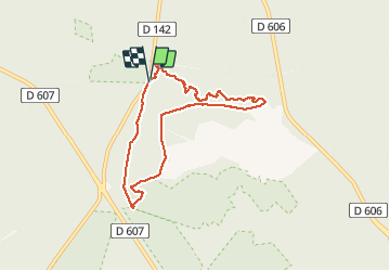
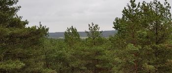
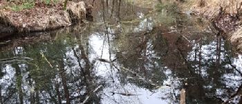
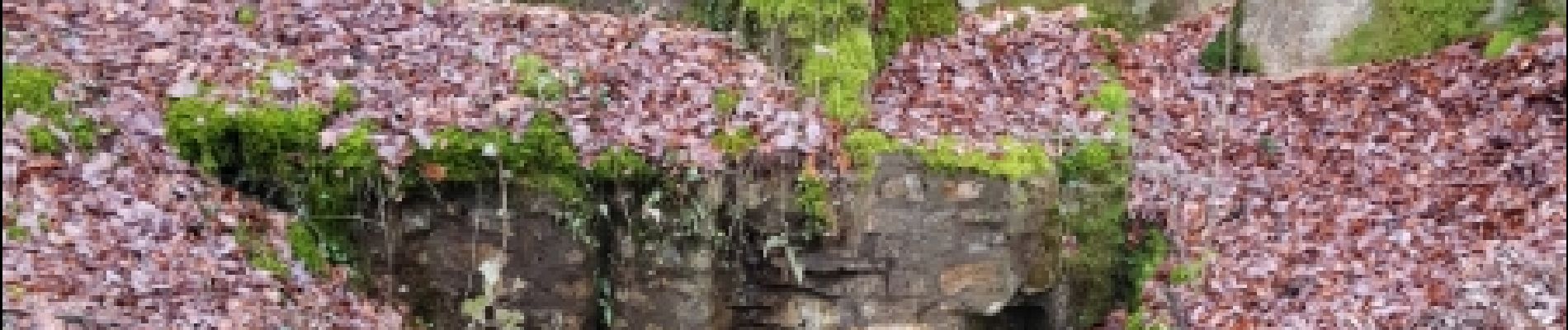
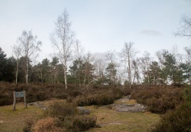
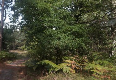
Trail Walking of 7.1 km to be discovered at Ile-de-France, Seine-et-Marne, Fontainebleau. This trail is proposed by aubr.

Description

Boucle d'environ 2 heures depuis le parking de Belle-Croix sur la route Ronde.
Elle suit majoritairement le sentier Denecourt n°4
Peut être réalisée depuis le parking Cabaret Masson

Elevation profile

Photos

Points of interest

Point of interest Fontainebleau - Unnamed POI - Photo
aubr
FONTAINEBLEAU 
Point of interest Fontainebleau - Unnamed POI - Photo
aubr
FONTAINEBLEAU 
Point of interest Fontainebleau - Unnamed POI - Photo
aubr
FONTAINEBLEAU 
Point of interest Fontainebleau - Mare aux Ligueurs - Photo
aubr
FONTAINEBLEAU 
Point of interest Fontainebleau - Fontaine Sanguinède - Photo
aubr
FONTAINEBLEAU 

Positioning

Country:
France
Region :
Ile-de-France
Department/Province :
Seine-et-Marne
Municipality :
Fontainebleau
Location:
Unknown
Start:(UTM)
475521 ; 5365444 (31U) N.

Trails nearby

Trail Walking Barbizon - Sentier des peintres - Photo
Walking
onftest

Walking

Medium
(11)
Barbizon, Ile-de-France, Seine-et-Marne, France
7.5 km | 8.2 km-effort
1h 25min
Yes
Trail Walking Fontainebleau - 3pi-150428 - DésertApremont-Jupiter - Photo
Walking
randodan

Walking

Easy
(1)
Fontainebleau, Ile-de-France, Seine-et-Marne, France
16 km | 19.4 km-effort
6h 30min
Yes
Trail Walking Bois-le-Roi - 170822 - RECO BoisLeRoi-Cmcas - Photo
Walking
MarcheEtReve

Walking

Very easy
(1)
Bois-le-Roi, Ile-de-France, Seine-et-Marne, France
8.7 km | 10 km-effort
2h 41min
Yes
Trail Walking Fontainebleau - 131204-GLM - CxToulouse-StLouis - Photo
Walking
randodan

Walking

Easy
(3)
Fontainebleau, Ile-de-France, Seine-et-Marne, France
9 km | 10.7 km-effort
3h 0min
Yes
Trail On foot Fontainebleau - SityTrail - JC 60 Fontainebleau, les rochers du long boyau, du Mt Morillon, des Demoiselles... - Photo
On foot

On foot

Difficult
(2)
Fontainebleau, Ile-de-France, Seine-et-Marne, France
14.6 km | 17.3 km-effort
3h 56min
Yes
Trail On foot Barbizon - Liaison Fontainebleau-Barbizon - Photo
On foot
PRO

On foot

Easy
Barbizon, Ile-de-France, Seine-et-Marne, France
9.9 km | 11.3 km-effort
2h 33min
No
Trail On foot Fontainebleau - Sentier des Carriers - Photo
On foot
PRO

On foot

Easy
Fontainebleau, Ile-de-France, Seine-et-Marne, France
6.7 km | 8.3 km-effort
1h 53min
Yes
Trail On foot Fontainebleau - Sentier Denecourt-Colinet 1 - Photo
On foot
PRO

On foot

Easy
Fontainebleau, Ile-de-France, Seine-et-Marne, France
3.8 km | 4.6 km-effort
1h 3min
Yes
Trail On foot Fontainebleau - Sentier Denecourt-Colinet 6 - Photo
On foot
PRO

On foot

Easy
(1)
Fontainebleau, Ile-de-France, Seine-et-Marne, France
4.4 km | 5.5 km-effort
1h 15min
No


Close
My subscriptions