Trail Walking Arinthod - Base et haute vallée de la Valouse  - Photo

Base et haute vallée de la Valouse

 dominiq
dominiq

User

© OpenStreetMap contributors
Length
Length
10.9 km
Max alt
Max alt
557 m
Uphill gradient
Uphill gradient
272 m
Km-Effort
Km-Effort  
14.5 km
Min alt
Min alt
337 m
Downhill gradient
Downhill gradient
269 m
Boucle
Boucle
Yes
Creation date :
2019-05-06 23:45:27.556
Updated on :
2019-05-06 23:45:27.556

(0 Reviews)

Walking
Walking
3h05
Difficulty : Very easy

Scan this QR Code to open this trail in the SityTrail application

FREE GPS app for hiking

Logo SityTrail SityTrail

IGN / Geographical institutes

Download SityTrail from the App Store Download SityTrail from Google Play

Logo SityTrail SityTrail World

The world is yours!

Download SityTrail from the App Store Download SityTrail from Google Play Download SityTrail on Huawei AppGallery

About

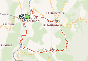
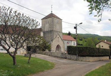
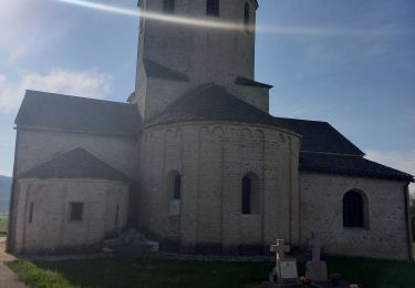
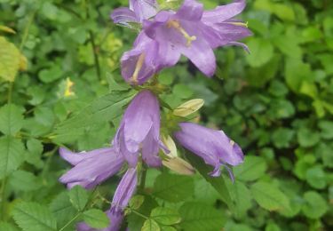
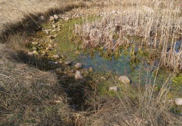
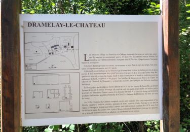
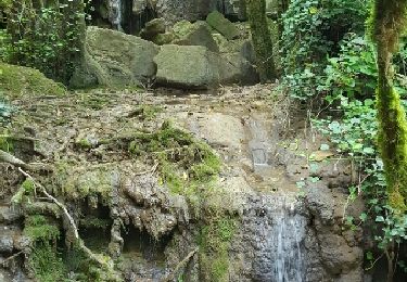
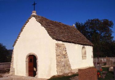
Trail Walking of 10.9 km to be discovered at Bourgogne-Franche-Comté, Jura, Arinthod. This trail is proposed by dominiq.

Description

Très belle randonnée au bord de la Valouse puis retour par le haut d'Arinthod.

Elevation profile

Photos

Positioning

Country:
France
Region :
Bourgogne-Franche-Comté
Department/Province :
Jura
Municipality :
Arinthod
Location:
Arinthod
Start:(UTM)
695665 ; 5140822 (31T) N.

Trails nearby

Trail Cycle Arinthod - Autour d'Arinthod  - Photo
Cycle
tracegps

Cycle

Difficult
(1)
Arinthod, Bourgogne-Franche-Comté, Jura, France
28 km | 37 km-effort
2h 25min
Yes
Trail Walking Valzin-en-Petite-Montagne - La cascade de la Quinquenouille - Photo
Walking
lirycle

Walking

Easy
(1)
Valzin-en-Petite-Montagne, Bourgogne-Franche-Comté, Jura, France
10.1 km | 13.6 km-effort
3h 55min
Yes
Trail Walking Saint-Hymetière-sur-Valouse - st hymetiere jura  - Photo
Walking
colomb24

Walking

Difficult
Saint-Hymetière-sur-Valouse, Bourgogne-Franche-Comté, Jura, France
11.9 km | 15.2 km-effort
21h 27min
Yes
Trail Walking Valzin-en-Petite-Montagne - cascade de quinquenouille - Photo
Walking
Bobzebob

Walking

Medium
Valzin-en-Petite-Montagne, Bourgogne-Franche-Comté, Jura, France
9.3 km | 13.4 km-effort
2h 16min
Yes
Trail Walking Vescles - Vescles Sous le pic d'oliferne  - Photo
Walking
Jackoyo

Walking

Medium
Vescles, Bourgogne-Franche-Comté, Jura, France
13.3 km | 18 km-effort
3h 5min
Yes
Trail Walking Montlainsia - Grange de Dessia - la tour de Dramelay - Photo
Walking
dominiq

Walking

Easy
Montlainsia, Bourgogne-Franche-Comté, Jura, France
14.2 km | 18.6 km-effort
3h 58min
Yes
Trail Walking Saint-Hymetière-sur-Valouse - gorges de la valouse - Photo
Walking
patou39

Walking

Easy
(1)
Saint-Hymetière-sur-Valouse, Bourgogne-Franche-Comté, Jura, France
7.2 km | 9.4 km-effort
1h 58min
Yes
Trail Other activity Arinthod - Arinthod - Photo
Other activity
dominiq

Other activity

Easy
(1)
Arinthod, Bourgogne-Franche-Comté, Jura, France
7.6 km | 10.7 km-effort
2h 19min
Yes
Trail Cycle Saint-Hymetière-sur-Valouse - Vallée de la Valouse - Saint-Hymetière - Photo
Cycle
tracegps

Cycle

Medium
Saint-Hymetière-sur-Valouse, Bourgogne-Franche-Comté, Jura, France
19.8 km | 26 km-effort
1h 40min
Yes


Close
My subscriptions