Trail Walking Ibos - S-J-IBOS/BARTRES - Photo

S-J-IBOS/BARTRES

 CANON2
CANON2

User

© OpenStreetMap contributors
Length
Length
19.3 km
Max alt
Max alt
551 m
Uphill gradient
Uphill gradient
337 m
Km-Effort
Km-Effort  
23 km
Min alt
Min alt
314 m
Downhill gradient
Downhill gradient
164 m
Boucle
Boucle
No
Creation date :
2019-05-15 13:09:44.849
Updated on :
2019-05-15 13:09:45.269

(0 Reviews)

Walking
Walking
5h06
Difficulty : Easy

Scan this QR Code to open this trail in the SityTrail application

FREE GPS app for hiking

Logo SityTrail SityTrail

IGN / Geographical institutes

Download SityTrail from the App Store Download SityTrail from Google Play

Logo SityTrail SityTrail World

The world is yours!

Download SityTrail from the App Store Download SityTrail from Google Play Download SityTrail on Huawei AppGallery

About

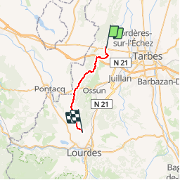
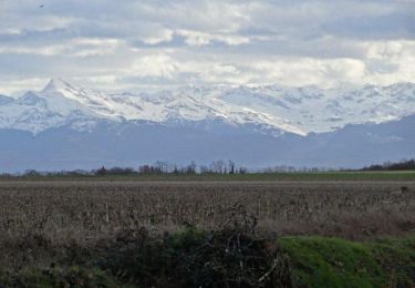
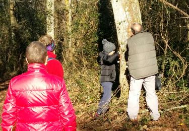
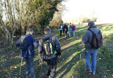
Trail Walking of 19.3 km to be discovered at Occitania, Hautespyrenees, Ibos. This trail is proposed by CANON2.

Description


ferme Laurens
3, route d'Adé
65100, Bartrès
Contact
Tel : 05 62 42 34 96
Fax : 05 62 42 34 96
E-mail : ferme.laurens@wanadoo.fr

Elevation profile

Positioning

Country:
France
Region :
Occitania
Department/Province :
Hautespyrenees
Municipality :
Ibos
Location:
Unknown
Start:(UTM)
743366 ; 4792268 (30T) N.

Comments

Please log in to post a review or rate the element


Très bien


Trails nearby

Trail Walking Ger - Le plateau de Ger en Béarn - Photo
Walking
tracegps

Walking

Medium
(2)
Ger, New Aquitaine, Pyrénées-Atlantiques, France
23 km | 28 km-effort
6h 30min
Yes
Trail Walking Ger - GER MANAS balisage creation   3055925 - Photo
Walking
GUIDE
marmotte65

Walking

Easy
(1)
Ger, New Aquitaine, Pyrénées-Atlantiques, France
2.7 km | 3.1 km-effort
55min
Yes
Trail Walking Ger - GER la galette de ses reines et rois le 4/01/2023
Walking
GUIDE
marmotte65

Walking

Easy
Ger, New Aquitaine, Pyrénées-Atlantiques, France
5 km | 5.5 km-effort
1h 30min
Yes
Trail Walking Ibos - MN2 ibos bois de bergos   - Photo
Walking
nadami

Walking

Medium
(1)
Ibos, Occitania, Hautespyrenees, France
8.9 km | 11.5 km-effort
2h 19min
Yes
Trail On foot Tarbes - Le Chemin Vert - Photo
On foot
PRO

On foot

Medium
Tarbes, Occitania, Hautespyrenees, France
18.6 km | 22 km-effort
4h 54min
No
Trail Nordic walking Ibos - MN1 serre Caute BOIS DE BROUHENA - Photo
Nordic walking
nadami

Nordic walking

Very easy
(1)
Ibos, Occitania, Hautespyrenees, France
11.5 km | 14 km-effort
2h 32min
Yes
Trail Nordic walking Ibos - bergos nordique fait - Photo
Nordic walking
LouisROGER

Nordic walking

Very easy
Ibos, Occitania, Hautespyrenees, France
8.5 km | 10.2 km-effort
2h 21min
Yes
Trail Nordic walking Bordères-sur-l'Échez - bois du Commandeur  - Photo
Nordic walking
GIRAUDEL

Nordic walking

Very easy
Bordères-sur-l'Échez, Occitania, Hautespyrenees, France
5 km | 5.6 km-effort
1h 22min
Yes
Trail Other activity Bordères-sur-l'Échez - Sans titre - Photo
Other activity
GIRAUDEL

Other activity

Very easy
Bordères-sur-l'Échez, Occitania, Hautespyrenees, France
5 km | 5.6 km-effort
1h 22min
Yes


Close
My subscriptions