


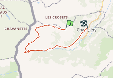


3.6 km | 4.8 km-effort


User


FREE GPS app for hiking
 SityTrail
IGN / Geographical institutes
SityTrail World
The world is yours!
Trail Walking of 13 km to be discovered at Valais/Wallis, Monthey, Champéry. This trail is proposed by otchampery.
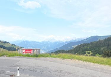
Mit der Gondel von Champéry gelangen sie schnell und einfach zum Croix-de-Culet auf 2000 Meter über dem Meeresspiegel. Nehmen Sie sich die Zeit die Landschaft zu bewundern, den Glocken der Bergkühe zu lauschen und für ein Picknick auf einer der grünen Wiesen oder in einem der Bergrestaurants auf dem Weg. Auf dieser Strecke passieren sie zauberhafte Aussichtspunkte auf die Dents Blanches und die Dents du Midi. Tipp: Auf Anfrage können sie sich auf den Höfen Lapisa und La Pierre die Herstellung des Bergkäses zeigen lassen.
On foot

Walking
Walking
Walking

sport
Walking
Walking
Walking
Walking