


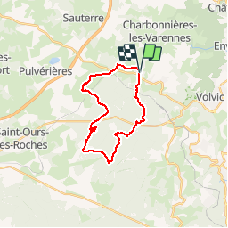

11.1 km | 15.6 km-effort


User


FREE GPS app for hiking
 SityTrail
IGN / Geographical institutes
SityTrail World
The world is yours!
Trail Walking of 22 km to be discovered at Auvergne-Rhône-Alpes, Puy-de-Dôme, Charbonnières-les-Varennes. This trail is proposed by selmak.
On foot
Walking

Walking

Mountain bike

Nordic walking

Walking

Walking

Walking
On foot
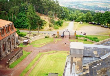
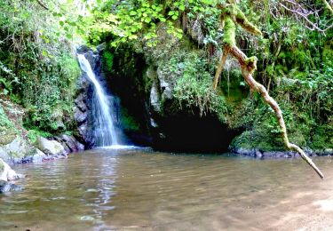
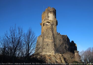
belle promenade. assez physique tout de même avec de beaux parcours en forêt. merci au contributeur.