Trail Walking Brétigny-sur-Orge - Saint Michel sur orge PR - Photo

Saint Michel sur orge PR

© OpenStreetMap contributors
Length
Length
11.7 km
Max alt
Max alt
59 m
Uphill gradient
Uphill gradient
96 m
Km-Effort
Km-Effort  
13 km
Min alt
Min alt
36 m
Downhill gradient
Downhill gradient
95 m
Boucle
Boucle
Yes
Creation date :
2017-01-17 00:00:00.0
Updated on :
2017-01-17 00:00:00.0

(1 Reviews)

Walking
Walking
2h53
Difficulty : Easy

Scan this QR Code to open this trail in the SityTrail application

FREE GPS app for hiking

Logo SityTrail SityTrail

IGN / Geographical institutes

Download SityTrail from the App Store Download SityTrail from Google Play

Logo SityTrail SityTrail World

The world is yours!

Download SityTrail from the App Store Download SityTrail from Google Play Download SityTrail on Huawei AppGallery

About

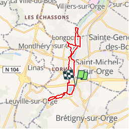
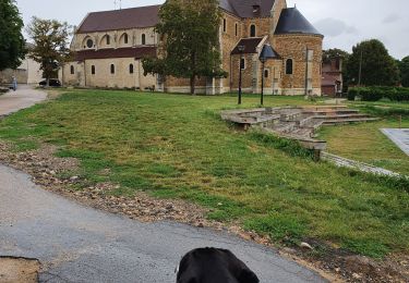
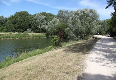
Trail Walking of 11.7 km to be discovered at Ile-de-France, Essonne, Brétigny-sur-Orge. This trail is proposed by jctinchebray.

Description

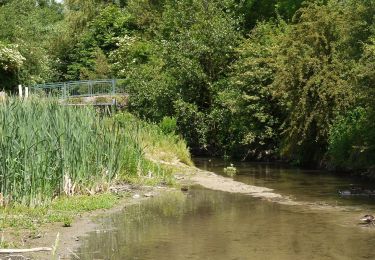
Randonnée boucle de 12 km au autour des bassins de l'orge départ de la base de loisirs le carouge à Brétigny et passant par Longpont.

Elevation profile

Positioning

Country:
France
Region :
Ile-de-France
Department/Province :
Essonne
Municipality :
Brétigny-sur-Orge
Location:
Unknown
Start:(Dec)
Start:(UTM)
448257 ; 5385690 (31U) N.

Comments

Please log in to post a review or rate the element


Excellent logiciel bien adapté pour les randonneurs.


Trails nearby

Trail Walking Marcoussis - Autour de Leuville sur Orge - Photo
Walking
tracegps

Walking

Medium
(1)
Marcoussis, Ile-de-France, Essonne, France
27 km | 32 km-effort
5h 30min
Yes
Trail Walking Longpont-sur-Orge - SityTrail - Bassins du Carouge-Longpont sur Orge - Photo
Walking
albg

Walking

Medium
(1)
Longpont-sur-Orge, Ile-de-France, Essonne, France
9.3 km | 10.4 km-effort
2h 22min
Yes
Trail On foot Morsang-sur-Orge - Boucle 20 km Morsang sur Orge - Photo
On foot
chessyca

On foot

Easy
Morsang-sur-Orge, Ile-de-France, Essonne, France
20 km | 22 km-effort
5h 6min
Yes
Trail Walking Saint-Michel-sur-Orge - Le long de l'Orge et de la Boëlle - Photo
Walking
c.chehere

Walking

Easy
Saint-Michel-sur-Orge, Ile-de-France, Essonne, France
14.9 km | 17.1 km-effort
3h 38min
Yes
Trail On foot La Norville - FR-7 - Photo
On foot
PRO

On foot

Easy
La Norville, Ile-de-France, Essonne, France
4.1 km | 4.7 km-effort
1h 4min
No
Trail Walking Longpont-sur-Orge - longpont/orge - Photo
Walking
philou91

Walking

Very easy
Longpont-sur-Orge, Ile-de-France, Essonne, France
6.2 km | 7 km-effort
2h 33min
Yes
Trail Walking Saint-Michel-sur-Orge - Autour de Montlhéry  - Photo
Walking
dmatignon

Walking

Easy
(1)
Saint-Michel-sur-Orge, Ile-de-France, Essonne, France
11.2 km | 13.3 km-effort
2h 54min
Yes
Trail Walking Longpont-sur-Orge - autour de l'abbaye de Longpont sur Orge - Photo
Walking
JeanLucA4

Walking

Easy
(1)
Longpont-sur-Orge, Ile-de-France, Essonne, France
9.3 km | 10.5 km-effort
2h 13min
Yes
Trail Walking Saint-Michel-sur-Orge - Randonnée entre l'Yvette et l'Orge - Photo
Walking
tracegps

Walking

Medium
Saint-Michel-sur-Orge, Ile-de-France, Essonne, France
24 km | 28 km-effort
5h 0min
Yes


Close
My subscriptions