Trail Walking Montaner - montaner17-2 - Photo
© OpenStreetMap contributors
Length
Length
10.5 km
Max alt
Max alt
352 m
Uphill gradient
Uphill gradient
256 m
Km-Effort
Km-Effort  
14 km
Min alt
Min alt
243 m
Downhill gradient
Downhill gradient
257 m
Boucle
Boucle
Yes
Creation date :
2017-02-22 00:00:00.0
Updated on :
2017-02-22 00:00:00.0

(1 Reviews)

Walking
Walking
2h58
Difficulty : Unknown

Scan this QR Code to open this trail in the SityTrail application

FREE GPS app for hiking

Logo SityTrail SityTrail

IGN / Geographical institutes

Download SityTrail from the App Store Download SityTrail from Google Play

Logo SityTrail SityTrail World

The world is yours!

Download SityTrail from the App Store Download SityTrail from Google Play Download SityTrail on Huawei AppGallery

About

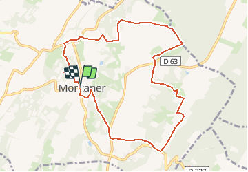
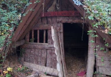
Trail Walking of 10.5 km to be discovered at New Aquitaine, Pyrénées-Atlantiques, Montaner. This trail is proposed by LouisROGER.

Elevation profile

Positioning

Country:
France
Region :
New Aquitaine
Department/Province :
Pyrénées-Atlantiques
Municipality :
Montaner
Location:
Unknown
Start:(UTM)
742462 ; 4803542 (30T) N.

Comments

Please log in to post a review or rate the element


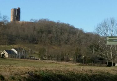
fait le 22/02/2017superbe paysage


Trails nearby

Trail On foot Montaner - MONTANER La Milouloise M2 82 ans le 5/02/2020 - Photo
On foot
GUIDE
marmotte65

On foot

Easy
Montaner, New Aquitaine, Pyrénées-Atlantiques, France
7 km | 8.7 km-effort
Unknown
Yes
Trail Walking Montaner - MONTANER 85 Ans de JC - Photo
Walking
GUIDE
marmotte65

Walking

Medium
Montaner, New Aquitaine, Pyrénées-Atlantiques, France
6.7 km | 8.9 km-effort
1h 50min
Yes
Trail Nordic walking Escaunets - MN2 Lac du Louet avt travaux - Photo
Nordic walking
nadami

Nordic walking

Very easy
(1)
Escaunets, Occitania, Hautespyrenees, France
8.1 km | 9.4 km-effort
Unknown
Yes
Trail Walking Oroix - Oroix RS longFait - Photo
Walking
LouisROGER

Walking

Very easy
Oroix, Occitania, Hautespyrenees, France
5.1 km | 5.6 km-effort
2h 34min
Yes
Trail Mountain bike Saint-Lézer - Les coteaux de Saint-Lézer  - Photo
Mountain bike
tracegps

Mountain bike

Easy
Saint-Lézer, Occitania, Hautespyrenees, France
11.9 km | 14.5 km-effort
1h 0min
Yes
Trail Walking Saint-Lézer - Les coteaux de Saint-Lézer  - Photo
Walking
tracegps

Walking

Medium
Saint-Lézer, Occitania, Hautespyrenees, France
11.9 km | 14.5 km-effort
3h 0min
Yes
Trail On foot Talazac - Variante GR 101 - Photo
On foot
PRO

On foot

Easy
Talazac, Occitania, Hautespyrenees, France
8.9 km | 11 km-effort
2h 30min
No
Trail On foot Saint-Lézer - SityTrail - Les coteaux de Saint-Lézer  - Photo
On foot
GUIDE
marmotte65

On foot

Easy
Saint-Lézer, Occitania, Hautespyrenees, France
10.1 km | 12.4 km-effort
2h 49min
Yes
Trail Walking Montaner - RS Montaner 2021 - Photo
Walking
LouisROGER

Walking

Easy
Montaner, New Aquitaine, Pyrénées-Atlantiques, France
4.4 km | 5.8 km-effort
1h 23min
Yes


Close
My subscriptions