Trail Walking Béost - montagneverteG2 - Photo
© OpenStreetMap contributors
Length
Length
13.1 km
Max alt
Max alt
1188 m
Uphill gradient
Uphill gradient
679 m
Km-Effort
Km-Effort  
22 km
Min alt
Min alt
523 m
Downhill gradient
Downhill gradient
679 m
Boucle
Boucle
Yes
Creation date :
2017-03-17 00:00:00.0
Updated on :
2017-03-17 00:00:00.0

(0 Reviews)

Walking
Walking
4h52
Difficulty : Unknown

Scan this QR Code to open this trail in the SityTrail application

FREE GPS app for hiking

Logo SityTrail SityTrail

IGN / Geographical institutes

Download SityTrail from the App Store Download SityTrail from Google Play

Logo SityTrail SityTrail World

The world is yours!

Download SityTrail from the App Store Download SityTrail from Google Play Download SityTrail on Huawei AppGallery

About

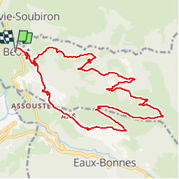
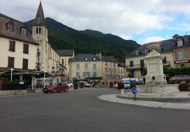
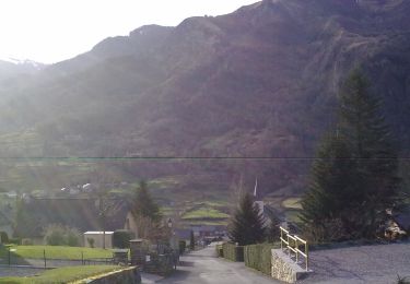
Trail Walking of 13.1 km to be discovered at New Aquitaine, Pyrénées-Atlantiques, Béost. This trail is proposed by LouisROGER.

Description

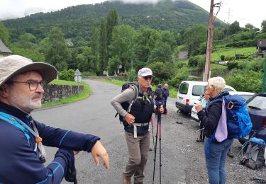
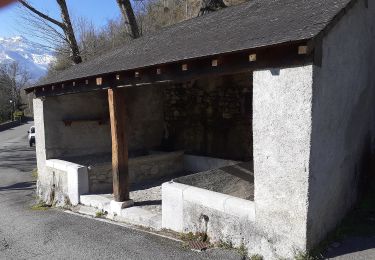
fait en groupe le 17/03/2017A la sortie de Beost prendre beau chemin vers  Bagès avec indications botaniques nombreuses et variées, puis longue et régulière montée au bord de route goudronnée, belle vues sur le pic de Listo (faux pic du midi d'Ossau)et le village du même nom nom. pique nique prés du point coté 1197 les plus courageux auront  envie d'aller jusqu'au sommet de Lavize. descente par un sentier à flanc de pente sans dévers jusqu'à Aas, puis de nouveau goudron jusqu'au chemin creux sur la gauche.

Elevation profile

Positioning

Country:
France
Region :
New Aquitaine
Department/Province :
Pyrénées-Atlantiques
Municipality :
Béost
Location:
Unknown
Start:(UTM)
710768 ; 4763229 (30T) N.

Trails nearby

Trail Walking Béost - Behost - Photo
Walking
swp648

Walking

Easy
(1)
Béost, New Aquitaine, Pyrénées-Atlantiques, France
6 km | 9.9 km-effort
2h 59min
Yes
Trail Walking Bielle - Pics de Cambeilh et petit Gerbe  - Photo
Walking
DuMarsan

Walking

Easy
(1)
Bielle, New Aquitaine, Pyrénées-Atlantiques, France
13.7 km | 27 km-effort
5h 24min
Yes
Trail Walking Laruns - LARUNS le tour du valentin G3
Walking
GUIDE
marmotte65

Walking

Difficult
Laruns, New Aquitaine, Pyrénées-Atlantiques, France
8.2 km | 12.9 km-effort
2h 56min
Yes
Trail On foot Eaux-Bonnes - La promenade horizontale - Photo
On foot
PRO

On foot

Easy
Eaux-Bonnes, New Aquitaine, Pyrénées-Atlantiques, France
3.5 km | 5.3 km-effort
1h 12min
Yes
Trail On foot Eaux-Bonnes - Les thermes - Photo
On foot
PRO

On foot

Easy
Eaux-Bonnes, New Aquitaine, Pyrénées-Atlantiques, France
3.6 km | 5.9 km-effort
1h 20min
Yes
Trail On foot Laruns - L'eau - Photo
On foot
PRO

On foot

Easy
Laruns, New Aquitaine, Pyrénées-Atlantiques, France
4.8 km | 5.9 km-effort
1h 20min
Yes
Trail On foot Eaux-Bonnes - La montagne verte - Photo
On foot
PRO

On foot

Easy
Eaux-Bonnes, New Aquitaine, Pyrénées-Atlantiques, France
10.4 km | 17.8 km-effort
4h 2min
Yes
Trail On foot Louvie-Soubiron - Les carrières - Photo
On foot
PRO

On foot

Easy
Louvie-Soubiron, New Aquitaine, Pyrénées-Atlantiques, France
3.4 km | 7 km-effort
1h 35min
Yes
Trail On foot Béost - La promenade des trois villages - Photo
On foot
PRO

On foot

Easy
Béost, New Aquitaine, Pyrénées-Atlantiques, France
5.1 km | 8.6 km-effort
1h 56min
Yes


Close
My subscriptions