Trail Other activity Charolles - rondje charolles - Photo
© OpenStreetMap contributors
Length
Length
6.7 km
Max alt
Max alt
339 m
Uphill gradient
Uphill gradient
104 m
Km-Effort
Km-Effort  
8.1 km
Min alt
Min alt
277 m
Downhill gradient
Downhill gradient
103 m
Boucle
Boucle
Yes
Creation date :
2017-06-05 00:00:00.0
Updated on :
2017-06-05 00:00:00.0

(0 Reviews)

Other activity
Other activity
1h38
Difficulty : Easy

Scan this QR Code to open this trail in the SityTrail application

FREE GPS app for hiking

Logo SityTrail SityTrail

IGN / Geographical institutes

Download SityTrail from the App Store Download SityTrail from Google Play

Logo SityTrail SityTrail World

The world is yours!

Download SityTrail from the App Store Download SityTrail from Google Play Download SityTrail on Huawei AppGallery

About

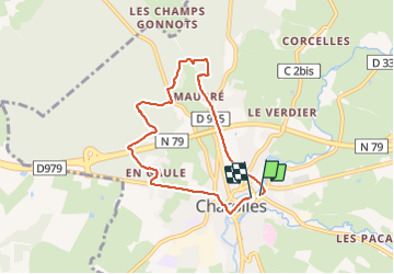
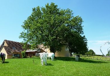
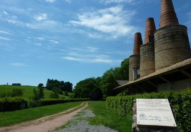
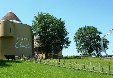
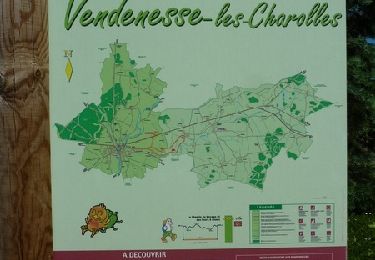
Trail Other activity of 6.7 km to be discovered at Bourgogne-Franche-Comté, Saône-et-Loire, Charolles. This trail is proposed by fritsaubin.

Description

Door bos laatste 1,5 km door stadje. Start in stadje.

Elevation profile

Positioning

Country:
France
Region :
Bourgogne-Franche-Comté
Department/Province :
Saône-et-Loire
Municipality :
Charolles
Location:
Unknown
Start:(UTM)
598240 ; 5143336 (31T) N.

Trails nearby

Trail Mountain bike Champlecy - VTT autour de Champlecy - Photo
Mountain bike
tracegps

Mountain bike

Easy
Champlecy, Bourgogne-Franche-Comté, Saône-et-Loire, France
26 km | 31 km-effort
2h 19min
Yes
Trail Running Charolles - La perte du ruisseau de Collanges - Charolles - Photo
Running
tracegps

Running

Easy
Charolles, Bourgogne-Franche-Comté, Saône-et-Loire, France
5.6 km | 6.5 km-effort
45min
Yes
Trail Mountain bike Charolles - La perte du ruisseau de Collanges - Charolles - Photo
Mountain bike
tracegps

Mountain bike

Easy
Charolles, Bourgogne-Franche-Comté, Saône-et-Loire, France
5.6 km | 6.5 km-effort
30min
Yes
Trail Walking Charolles - La perte du ruisseau de Collanges - Charolles - Photo
Walking
tracegps

Walking

Easy
Charolles, Bourgogne-Franche-Comté, Saône-et-Loire, France
5.6 km | 6.5 km-effort
1h 30min
Yes
Trail Running Charolles - Chemin du bocage et des fours à chaux, via Charolles - Photo
Running
tracegps

Running

Medium
Charolles, Bourgogne-Franche-Comté, Saône-et-Loire, France
11.5 km | 13.2 km-effort
1h 45min
Yes
Trail Mountain bike Charolles - Chemin du bocage et des fours à chaux, via Charolles - Photo
Mountain bike
tracegps

Mountain bike

Easy
Charolles, Bourgogne-Franche-Comté, Saône-et-Loire, France
11.5 km | 13.2 km-effort
1h 15min
Yes
Trail Walking Charolles - Chemin du bocage et des fours à chaux, via Charolles - Photo
Walking
tracegps

Walking

Medium
Charolles, Bourgogne-Franche-Comté, Saône-et-Loire, France
11.5 km | 13.2 km-effort
3h 0min
Yes
Trail Running Charolles - Chemin du bocage et des fours à chaux - Charolles - Photo
Running
tracegps

Running

Easy
Charolles, Bourgogne-Franche-Comté, Saône-et-Loire, France
6.7 km | 7.9 km-effort
1h 0min
Yes
Trail Mountain bike Charolles - Chemin du bocage et des fours à chaux - Charolles - Photo
Mountain bike
tracegps

Mountain bike

Easy
Charolles, Bourgogne-Franche-Comté, Saône-et-Loire, France
6.7 km | 7.9 km-effort
45min
Yes


Close
My subscriptions