Trail Walking Plateau-des-Petites-Roches - Tour de La Dent de Crolles par les sangles et la Vire Est - Photo

Tour de La Dent de Crolles par les sangles et la Vire Est

 patjobou
patjobou

User

© OpenStreetMap contributors
Length
Length
12.3 km
Max alt
Max alt
2039 m
Uphill gradient
Uphill gradient
1054 m
Km-Effort
Km-Effort  
26 km
Min alt
Min alt
1432 m
Downhill gradient
Downhill gradient
1056 m
Boucle
Boucle
Yes
Creation date :
2017-06-12 00:00:00.0
Updated on :
2017-06-12 00:00:00.0

(0 Reviews)

Walking
Walking
5h55
Difficulty : Difficult

Scan this QR Code to open this trail in the SityTrail application

FREE GPS app for hiking

Logo SityTrail SityTrail

IGN / Geographical institutes

Download SityTrail from the App Store Download SityTrail from Google Play

Logo SityTrail SityTrail World

The world is yours!

Download SityTrail from the App Store Download SityTrail from Google Play Download SityTrail on Huawei AppGallery

About

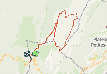
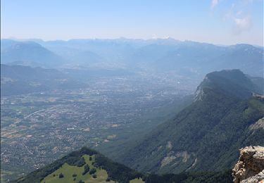
Trail Walking of 12.3 km to be discovered at Auvergne-Rhône-Alpes, Isère, Plateau-des-Petites-Roches. This trail is proposed by patjobou.

Description

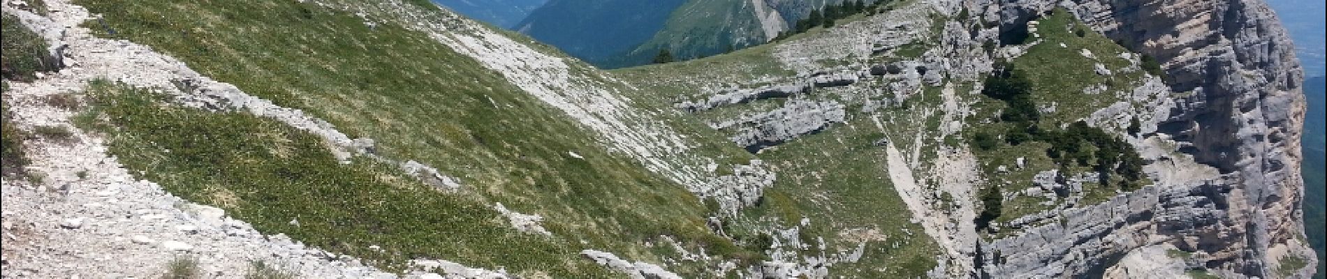
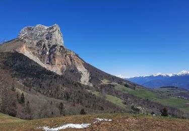
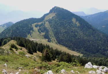
Tour de la dent de Crolles par le sangle Barrère, la vire Est, l'arche à l'aiguille, et la vire Ouest.
Très belle boucle hors des sentiers battus. Pour la vire Est, baudrier et longe de via ferrata indispensables, pour un passage de 10m cablé, mais sans aucune autre protection. Le reste de la vire est exposé, avec du gaz, mais toujours sur sentier. Prudence de rigueur, vertige s'abstenir.

Elevation profile

Photos

Positioning

Country:
France
Region :
Auvergne-Rhône-Alpes
Department/Province :
Isère
Municipality :
Plateau-des-Petites-Roches
Location:
Saint-Pancrasse
Start:(UTM)
722480 ; 5020609 (31T) N.

Trails nearby

Trail Walking Saint-Nazaire-les-Eymes - Chateau-Nardent par le C9 - Photo
Walking
GuyVachet

Walking

Difficult
(2)
Saint-Nazaire-les-Eymes, Auvergne-Rhône-Alpes, Isère, France
8.2 km | 17.7 km-effort
6h 23min
Yes
Trail Walking Plateau-des-Petites-Roches - Dent de Crolles - Photo
Walking
srabany

Walking

Medium
(2)
Plateau-des-Petites-Roches, Auvergne-Rhône-Alpes, Isère, France
5.7 km | 14.7 km-effort
4h 0min
Yes
Trail Walking Saint-Pierre-de-Chartreuse - Le Charmant Som 1867m, par les dalles - Photo
Walking
tracegps

Walking

Medium
(1)
Saint-Pierre-de-Chartreuse, Auvergne-Rhône-Alpes, Isère, France
9.7 km | 21 km-effort
5h 0min
Yes
Trail Walking Plateau-des-Petites-Roches - Piton et Dôme de Bellefont - Photo
Walking
tracegps

Walking

Difficult
(1)
Plateau-des-Petites-Roches, Auvergne-Rhône-Alpes, Isère, France
10.1 km | 24 km-effort
6h 45min
Yes
Trail On foot Plateau-des-Petites-Roches - Tour de Pravouta - Photo
On foot
PRO

On foot

Easy
Plateau-des-Petites-Roches, Auvergne-Rhône-Alpes, Isère, France
3.9 km | 7.5 km-effort
1h 42min
Yes
Trail Walking Plateau-des-Petites-Roches - Dent de Crolles tour - Photo
Walking
SylvestreV

Walking

Very easy
(1)
Plateau-des-Petites-Roches, Auvergne-Rhône-Alpes, Isère, France
14.2 km | 32 km-effort
8h 33min
Yes
Trail Walking Saint-Pierre-de-Chartreuse - Dent de Crolles depuis Perquelin  - Photo
Walking
patpounet73

Walking

Difficult
(1)
Saint-Pierre-de-Chartreuse, Auvergne-Rhône-Alpes, Isère, France
12.7 km | 28 km-effort
6h 19min
Yes
Trail Walking Plateau-des-Petites-Roches - dent de crolles   boucle trou du glaz et pas de loeille - Photo
Walking
aztec

Walking

Easy
(1)
Plateau-des-Petites-Roches, Auvergne-Rhône-Alpes, Isère, France
8 km | 19.3 km-effort
3h 49min
Yes
Trail Walking Plateau-des-Petites-Roches - Dent de Crolles - Photo
Walking
simon.paume

Walking

Difficult
(1)
Plateau-des-Petites-Roches, Auvergne-Rhône-Alpes, Isère, France
8.4 km | 18 km-effort
3h 40min
Yes


Close
My subscriptions