Trail Walking Les Angles - Boucle des pics Peric - Photo
© OpenStreetMap contributors
Length
Length
21 km
Max alt
Max alt
2795 m
Uphill gradient
Uphill gradient
1014 m
Km-Effort
Km-Effort  
35 km
Min alt
Min alt
2003 m
Downhill gradient
Downhill gradient
1015 m
Boucle
Boucle
Yes
Creation date :
2017-07-17 00:00:00.0
Updated on :
2017-07-17 00:00:00.0

(0 Reviews)

Walking
Walking
5h57
Difficulty : Difficult

Scan this QR Code to open this trail in the SityTrail application

FREE GPS app for hiking

Logo SityTrail SityTrail

IGN / Geographical institutes

Download SityTrail from the App Store Download SityTrail from Google Play

Logo SityTrail SityTrail World

The world is yours!

Download SityTrail from the App Store Download SityTrail from Google Play Download SityTrail on Huawei AppGallery

About

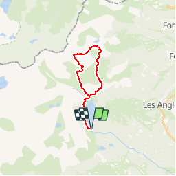
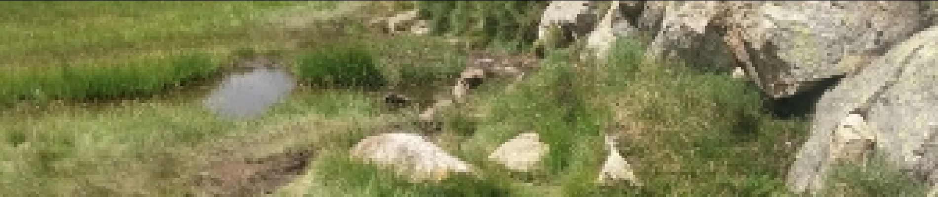
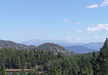
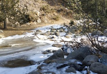
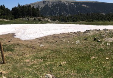
Trail Walking of 21 km to be discovered at Occitania, Pyrénées-Orientales, Les Angles. This trail is proposed by PVERTICAL.

Description

depuis le lac des Bouillouses (accès réglementé l'été). possibilité l'été de prendre la route avant 7h puis au retour suivre un bus qui fait la navette. autrement après 7h accès fermé et navette bus 5 euros a/r. arête du Grand Peric sans difficulté avec l'aide des mains.  possibilité de raccourcir par talweg entre grand et petit Peric. aussi en descendant crête du petit Peric.

Elevation profile

Photos

Points of interest

Point of interest Angoustrine-Villeneuve-des-Escaldes - bifurcation  (ne plus suivre GR10) - Photo
PVERTICAL
ANGOUSTRINE-VILLENEUVE-DES-ESCALDES 
Point of interest Angoustrine-Villeneuve-des-Escaldes - Pont de la têt  - Photo
PVERTICAL
ANGOUSTRINE-VILLENEUVE-DES-ESCALDES 
Point of interest Formiguères - Pic grand Peric - Photo
PVERTICAL
FORMIGUÈRES 
Point of interest Formiguères - Autre point de vue - Photo
PVERTICAL
FORMIGUÈRES 
Point of interest Formiguères - Pic du petit Peric - Photo
PVERTICAL
FORMIGUÈRES 
Point of interest Formiguères - Lac de Camporels - Photo
PVERTICAL
FORMIGUÈRES 
Point of interest Formiguères - Pont pour rejoindre refuge des Camporels - Photo
PVERTICAL
Point of interest Formiguères - suivre traces jaune et rouge - Photo
PVERTICAL

Positioning

Country:
France
Region :
Occitania
Department/Province :
Pyrénées-Orientales
Municipality :
Les Angles
Location:
Unknown
Start:(UTM)
418047 ; 4712365 (31T) N.

Trails nearby

Trail Walking Font-Romeu-Odeillo-Via - Coll del Pam lac des  Bouillouses - Photo
Walking
jcmartin

Walking

Medium
(2)
Font-Romeu-Odeillo-Via, Occitania, Pyrénées-Orientales, France
13.3 km | 19.3 km-effort
4h 10min
Yes
Trail Walking Les Angles - le tour des lacs de carli - Photo
Walking
mouss65

Walking

Medium
(2)
Les Angles, Occitania, Pyrénées-Orientales, France
11.4 km | 16.6 km-effort
3h 51min
No
Trail Walking Les Angles - Rando des 12 lacs - Photo
Walking
stp130678

Walking

Easy
(1)
Les Angles, Occitania, Pyrénées-Orientales, France
14.1 km | 20 km-effort
6h 30min
Yes
Trail Walking Les Angles - les 12 lacs Les Fouillousses - Photo
Walking
GUIDE
nadinebondoux

Walking

Medium
Les Angles, Occitania, Pyrénées-Orientales, France
12.1 km | 17.9 km-effort
5h 19min
Yes
Trail Walking Les Angles - les Angles - Photo
Walking
GUIDE
nadinebondoux

Walking

Difficult
Les Angles, Occitania, Pyrénées-Orientales, France
14.5 km | 20 km-effort
4h 58min
No
Trail Nordic walking Font-Romeu-Odeillo-Via - mauroux - Photo
Nordic walking
oliviercaty

Nordic walking

Medium
(2)
Font-Romeu-Odeillo-Via, Occitania, Pyrénées-Orientales, France
11.2 km | 14.7 km-effort
1h 20min
Yes
Trail Walking Les Angles - Boucle du lac d'Aude - Photo
Walking
stp130678

Walking

Very easy
(1)
Les Angles, Occitania, Pyrénées-Orientales, France
11.1 km | 16.8 km-effort
3h 36min
No
Trail Walking La Llagonne - 2024-01-22 Les bouillouses  - Photo
Walking
eric.mignot

Walking

Difficult
La Llagonne, Occitania, Pyrénées-Orientales, France
10.3 km | 15 km-effort
3h 25min
Yes
Trail Walking Angoustrine-Villeneuve-des-Escaldes - Les bones hores refuge des Camporeils - Photo
Walking
fb30

Walking

Medium
Angoustrine-Villeneuve-des-Escaldes, Occitania, Pyrénées-Orientales, France
21 km | 27 km-effort
6h 30min
No


Close
My subscriptions