Trail Mountain bike Grimaud - VTT de Port -Grimaud - Photo
 pascalou73
pascalou73

User GUIDE

© OpenStreetMap contributors
Length
Length
21 km
Max alt
Max alt
277 m
Uphill gradient
Uphill gradient
423 m
Km-Effort
Km-Effort  
26 km
Min alt
Min alt
0 m
Downhill gradient
Downhill gradient
425 m
Boucle
Boucle
Yes
Creation date :
2017-07-25 00:00:00.0
Updated on :
2017-07-25 00:00:00.0

(0 Reviews)

Mountain bike
Mountain bike
1h45
Difficulty : Medium

Scan this QR Code to open this trail in the SityTrail application

FREE GPS app for hiking

Logo SityTrail SityTrail

IGN / Geographical institutes

Download SityTrail from the App Store Download SityTrail from Google Play

Logo SityTrail SityTrail World

The world is yours!

Download SityTrail from the App Store Download SityTrail from Google Play Download SityTrail on Huawei AppGallery

About

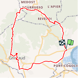
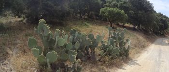
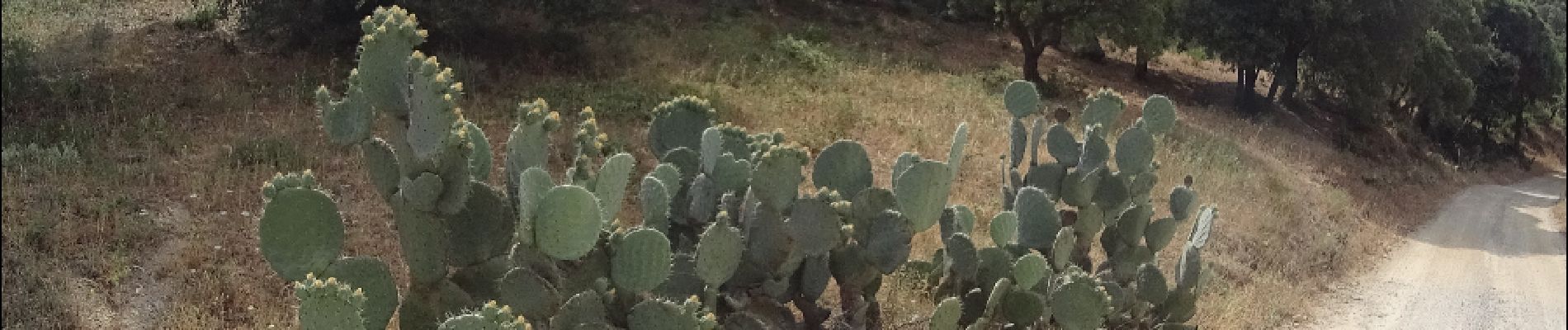
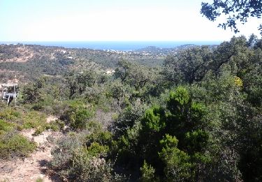
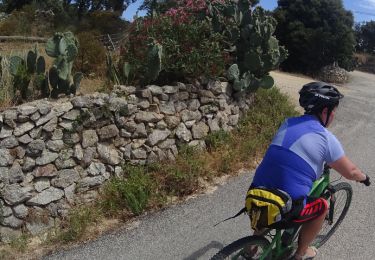
Trail Mountain bike of 21 km to be discovered at Provence-Alpes-Côte d'Azur, Var, Grimaud. This trail is proposed by pascalou73.

Description

Voilà une VTT dans la région de Port -Grimaud .Sur la randonnée il y a un sentier plus difficile sur  - 1 km500 ou il y a du portage une très belle randonnée entre la mer et les terres et le beau village de grimaud. bonne randonnée

Elevation profile

Photos

Points of interest

Point of interest Saint-Coulomb - 001 - Photo
pascalou73
SAINT-COULOMB 
Point of interest Saint-Coulomb - 002 - Photo
pascalou73
SAINT-COULOMB 
Point of interest Saint-Coulomb - 003 - Photo
pascalou73
SAINT-COULOMB 
Point of interest Saint-Coulomb - 004 - Photo
pascalou73
SAINT-COULOMB 
Point of interest Grimaud - vtt port grimaud - Photo
pascalou73
Point of interest Le Plan-de-la-Tour - vtt port grimaud - Photo
pascalou73
LE PLAN-DE-LA-TOUR 
Point of interest Grimaud - vtt port grimaud - Photo
pascalou73
Point of interest Le Plan-de-la-Tour - vtt port grimaud - Photo
pascalou73
LE PLAN-DE-LA-TOUR 
Point of interest La Garde-Freinet - vtt port grimaud - Photo
pascalou73
LA GARDE-FREINET 

Positioning

Country:
France
Region :
Provence-Alpes-Côte d'Azur
Department/Province :
Var
Municipality :
Grimaud
Location:
Unknown
Start:(UTM)
303491 ; 4794886 (32T) N.

Trails nearby

Trail Walking Sainte-Maxime - la baumette - Photo
Walking
perrucheone

Walking

Easy
(1)
Sainte-Maxime, Provence-Alpes-Côte d'Azur, Var, France
8.1 km | 10.6 km-effort
2h 25min
Yes
Trail Mountain bike Cogolin - peinier - Photo
Mountain bike
trailer.nono

Mountain bike

Medium
(1)
Cogolin, Provence-Alpes-Côte d'Azur, Var, France
30 km | 40 km-effort
1h 57min
Yes
Trail Walking Saint-Tropez - Golfe de St Tropez - Photo
Walking
tracegps

Walking

Difficult
(2)
Saint-Tropez, Provence-Alpes-Côte d'Azur, Var, France
15.1 km | 17.6 km-effort
4h 30min
Yes
Trail Walking Cogolin - val d\'Astier,St Ferreol, Pradels,val d\'Astier - Photo
Walking
GUIDE
affinetataille

Walking

Difficult
(1)
Cogolin, Provence-Alpes-Côte d'Azur, Var, France
12 km | 17.3 km-effort
5h 0min
Yes
Trail Mountain bike Grimaud - VTT du Plan de la Tour - Photo
Mountain bike
GUIDE
pascalou73

Mountain bike

Difficult
(1)
Grimaud, Provence-Alpes-Côte d'Azur, Var, France
35 km | 46 km-effort
2h 59min
Yes
Trail Mountain bike Gassin - La Nartelle- depart Bourrian - Photo
Mountain bike
jm.lemore

Mountain bike

Medium
(1)
Gassin, Provence-Alpes-Côte d'Azur, Var, France
24 km | 31 km-effort
3h 11min
Yes
Trail Mountain bike Gassin - Patapan - Photo
Mountain bike
trailer.nono

Mountain bike

Medium
(1)
Gassin, Provence-Alpes-Côte d'Azur, Var, France
37 km | 47 km-effort
2h 24min
No
Trail Walking Grimaud - Grimaud - Photo
Walking
Catherine VANELSTRAETE

Walking

Easy
Grimaud, Provence-Alpes-Côte d'Azur, Var, France
22 km | 27 km-effort
2h 41min
No
Trail Walking Le Plan-de-la-Tour - Le Plan de la Tour - Photo
Walking
Chantheys

Walking

Medium
(1)
Le Plan-de-la-Tour, Provence-Alpes-Côte d'Azur, Var, France
7.7 km | 10.6 km-effort
2h 16min
Yes


Close
My subscriptions