Trail Walking Gavarnie-Gèdre - Pyrénées 2017 Vignemal par le glacier d'Oussue depuis le barrage d 'Oussoue - Photo

Pyrénées 2017 Vignemal par le glacier d'Oussue depuis le barrage d 'Oussoue

 PatDev
PatDev

User

© OpenStreetMap contributors
Length
Length
18.3 km
Max alt
Max alt
3197 m
Uphill gradient
Uphill gradient
1665 m
Km-Effort
Km-Effort  
40 km
Min alt
Min alt
1737 m
Downhill gradient
Downhill gradient
1605 m
Boucle
Boucle
No
Creation date :
2017-12-22 00:00:00.0
Updated on :
2017-12-22 00:00:00.0

(0 Reviews)

Walking
Walking
7h46
Difficulty : Very difficult

Scan this QR Code to open this trail in the SityTrail application

FREE GPS app for hiking

Logo SityTrail SityTrail

IGN / Geographical institutes

Download SityTrail from the App Store Download SityTrail from Google Play

Logo SityTrail SityTrail World

The world is yours!

Download SityTrail from the App Store Download SityTrail from Google Play Download SityTrail on Huawei AppGallery

About

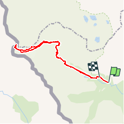
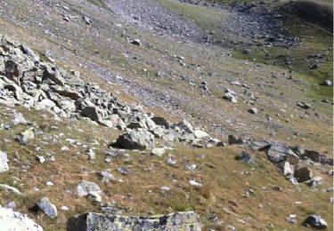
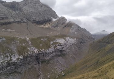
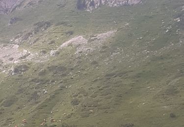
Trail Walking of 18.3 km to be discovered at Occitania, Hautespyrenees, Gavarnie-Gèdre. This trail is proposed by PatDev.

Description

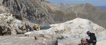
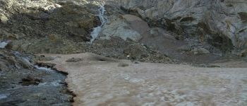
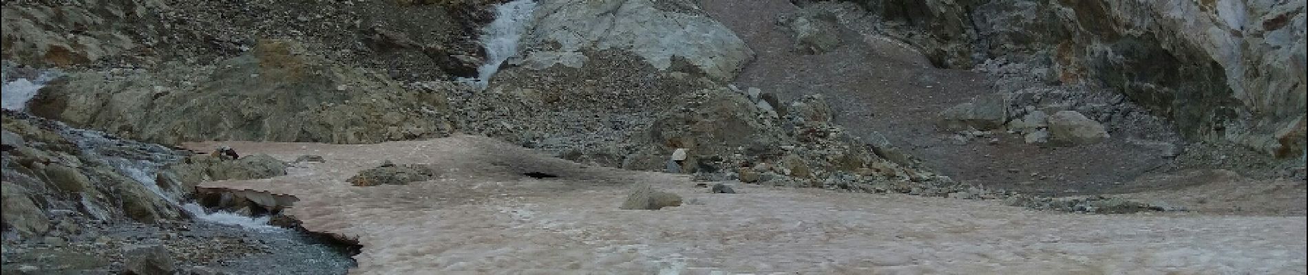
Randonnée magnifique mais très difficile. un maîtrise de la haute montagne est nécessaire (escalade, progression sur glacier avec crampon et corde).
 

Elevation profile

Photos

Points of interest

Point of interest Gavarnie-Gèdre - Sortie du glacier - Photo
PatDev
GAVARNIE-GÈDRE 
Point of interest Gavarnie-Gèdre - Ancien départ du glacier - Photo
PatDev
GAVARNIE-GÈDRE 

Positioning

Country:
France
Region :
Occitania
Department/Province :
Hautespyrenees
Municipality :
Gavarnie-Gèdre
Location:
Gavarnie
Start:(UTM)
738809 ; 4737678 (30T) N.

Trails nearby

Trail Walking Torla-Ordesa - Soum Blanc des Espécières-Col des Tentes - Photo
Walking
1037

Walking

Difficult
(7)
Torla-Ordesa, Aragon, Huesca, Spain
4 km | 5.7 km-effort
1h 42min
No
Trail Walking Gavarnie-Gèdre - Lac de la Bernatoire - Photo
Walking
2034

Walking

Medium
(8)
Gavarnie-Gèdre, Occitania, Hautespyrenees, France
12.7 km | 22 km-effort
4h 36min
Yes
Trail Walking Gavarnie-Gèdre - Breche de Rolland - Photo
Walking
reneperrin

Walking

Easy
(3)
Gavarnie-Gèdre, Occitania, Hautespyrenees, France
12.1 km | 22 km-effort
4h 34min
Yes
Trail Walking Gavarnie-Gèdre - Faja de las Flores - Photo
Walking
tracegps

Walking

Very difficult
(1)
Gavarnie-Gèdre, Occitania, Hautespyrenees, France
22 km | 45 km-effort
13h 0min
Yes
Trail Walking Gavarnie-Gèdre - Le Soum Blanc des Especières 2685m depuis le col de Tentes - Photo
Walking
tracegps

Walking

Difficult
(2)
Gavarnie-Gèdre, Occitania, Hautespyrenees, France
5.6 km | 12.6 km-effort
3h 0min
Yes
Trail Walking Gavarnie-Gèdre - Le Casque du Marboré 3006m depuis le col de Tentes (2208m)  - Photo
Walking
tracegps

Walking

Very difficult
(1)
Gavarnie-Gèdre, Occitania, Hautespyrenees, France
7 km | 16.4 km-effort
7h 0min
No
Trail Walking Cauterets - 2012-08-09 Ref des Oulettes de Gaube -ref Wallon via col des Mulets, col de Letrero et Port du Marcadau - Photo
Walking
bgirard

Walking

Difficult
(4)
Cauterets, Occitania, Hautespyrenees, France
22 km | 41 km-effort
7h 39min
No
Trail Walking Gavarnie-Gèdre - 65-Brèche-de-Roland(AR)-12Km/700m - Photo
Walking
SyMA

Walking

Difficult
Gavarnie-Gèdre, Occitania, Hautespyrenees, France
11.6 km | 21 km-effort
4h 46min
Yes
Trail Walking Gavarnie-Gèdre - refuge baysellence refuge des holles - Photo
Walking
RoMo

Walking

Very difficult
Gavarnie-Gèdre, Occitania, Hautespyrenees, France
15.4 km | 23 km-effort
5h 54min
No


Close
My subscriptions