Trail Walking Mongauzy - BL du Mec - Photo
 Elbe
Elbe

User

© OpenStreetMap contributors
Length
Length
4.8 km
Max alt
Max alt
109 m
Uphill gradient
Uphill gradient
143 m
Km-Effort
Km-Effort  
6.5 km
Min alt
Min alt
27 m
Downhill gradient
Downhill gradient
82 m
Boucle
Boucle
No
Creation date :
2014-12-10 00:00:00.0
Updated on :
2014-12-10 00:00:00.0

(0 Reviews)

Walking
Walking
45m
Difficulty : Very easy

Scan this QR Code to open this trail in the SityTrail application

FREE GPS app for hiking

Logo SityTrail SityTrail

IGN / Geographical institutes

Download SityTrail from the App Store Download SityTrail from Google Play

Logo SityTrail SityTrail World

The world is yours!

Download SityTrail from the App Store Download SityTrail from Google Play Download SityTrail on Huawei AppGallery

About

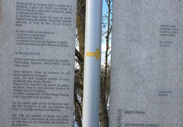
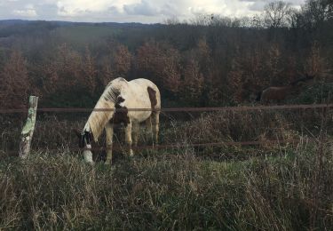
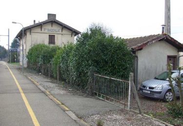
Trail Walking of 4.8 km to be discovered at New Aquitaine, Gironde, Mongauzy. This trail is proposed by Elbe.

Description

Boucle locale au départ de Mongauzy (Pl du cimetière)

Elevation profile

Positioning

Country:
France
Region :
New Aquitaine
Department/Province :
Gironde
Municipality :
Mongauzy
Location:
Unknown
Start:(UTM)
264462 ; 4939166 (31T) N.

Trails nearby

Trail Walking Jusix - Jusix - Photo
Walking
Briarwood

Walking

Very easy
Jusix, New Aquitaine, Lot-et-Garonne, France
7.9 km | 8.2 km-effort
2h 18min
Yes
Trail Walking Mongauzy - Mongauzy - Boucle du Médier - Photo
Walking
Briarwood

Walking

Medium
Mongauzy, New Aquitaine, Gironde, France
7.3 km | 9.3 km-effort
1h 52min
Yes
Trail Walking Sainte-Bazeille - Sainte-Bazeille, Paysage et Archéologie - Pays Val de Garonne - Gascogne - Photo
Walking
tracegps

Walking

Easy
Sainte-Bazeille, New Aquitaine, Lot-et-Garonne, France
3.4 km | 3.9 km-effort
1h 15min
Yes
Trail Walking Jusix - Jusix, presqu'île de Garonne - Pays Val de Garonne - Gascogne - Photo
Walking
tracegps

Walking

Medium
Jusix, New Aquitaine, Lot-et-Garonne, France
7.7 km | 8 km-effort
2h 30min
Yes
Trail Walking Saint-Hilaire-de-la-Noaille - sthilaire092022 - Photo
Walking
lesmarmandais

Walking

Difficult
Saint-Hilaire-de-la-Noaille, New Aquitaine, Gironde, France
11.3 km | 14.2 km-effort
2h 42min
Yes
Trail Walking Saint-Michel-de-Lapujade - Boucle St Michel de Lapujade - Photo
Walking
Patrice47200

Walking

Difficult
Saint-Michel-de-Lapujade, New Aquitaine, Gironde, France
12.1 km | 14.5 km-effort
2h 40min
Yes
Trail Walking Montagoudin - randogps33-510 - Photo
Walking
lesmarmandais

Walking

Difficult
Montagoudin, New Aquitaine, Gironde, France
12.4 km | 16.1 km-effort
3h 26min
Yes
Trail Walking Saint-Sève - Saint Sève - Photo
Walking
leglisemichel

Walking

Easy
Saint-Sève, New Aquitaine, Gironde, France
9 km | 11.1 km-effort
2h 35min
Yes
Trail Walking Roquebrune - pied de mouton  - Photo
Walking
leglisemichel

Walking

Very easy
Roquebrune, New Aquitaine, Gironde, France
3.5 km | 3.8 km-effort
2h 17min
Yes


Close
My subscriptions