Trail Walking Lus-la-Croix-Haute - R41   le lac de Lauzon - Photo

Les Hautes Alpes à découvrir ! GUIDE+

© OpenStreetMap contributors
Length
Length
8.1 km
Max alt
Max alt
2032 m
Uphill gradient
Uphill gradient
799 m
Km-Effort
Km-Effort  
18.7 km
Min alt
Min alt
1239 m
Downhill gradient
Downhill gradient
800 m
Boucle
Boucle
Yes
Creation date :
2018-03-23 05:40:58.665
Updated on :
2018-10-17 06:42:27.483

(0 Reviews)

Walking
Walking
3h40
Difficulty : Difficult

Scan this QR Code to open this trail in the SityTrail application

FREE GPS app for hiking

Logo SityTrail SityTrail

IGN / Geographical institutes

Download SityTrail from the App Store Download SityTrail from Google Play

Logo SityTrail SityTrail World

The world is yours!

Download SityTrail from the App Store Download SityTrail from Google Play Download SityTrail on Huawei AppGallery

About

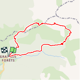
Trail Walking of 8.1 km to be discovered at Auvergne-Rhône-Alpes, Drôme, Lus-la-Croix-Haute. This trail is proposed by Camping Les Rives du Lac.

Description

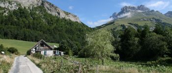
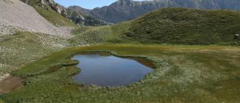
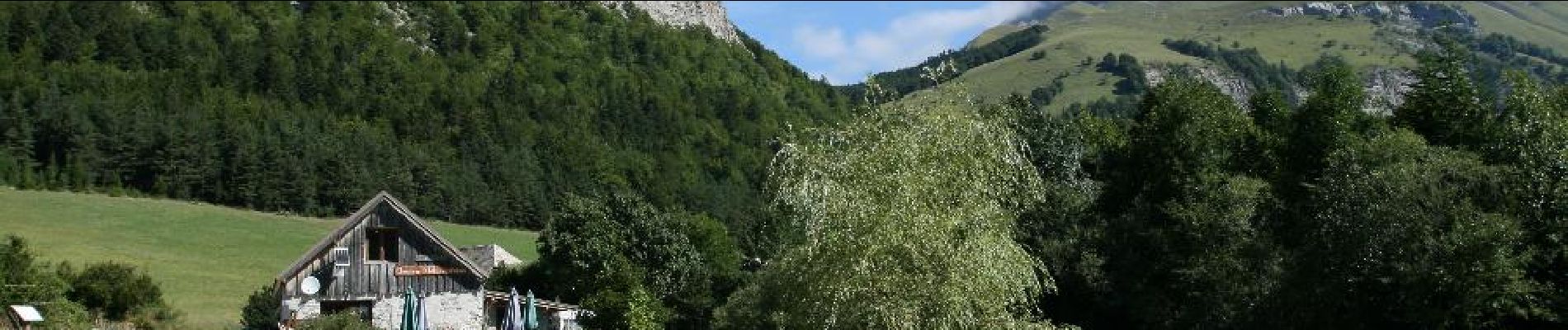
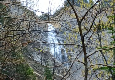
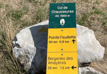
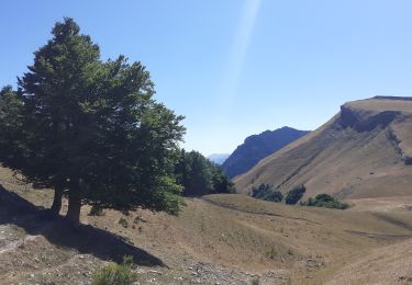
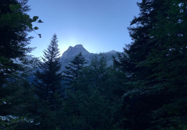
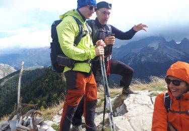
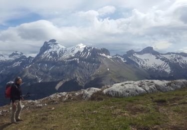
"Long and beautiful hike from the wild valley of Jarjatte, to follow a steep climb on the alpine pastures to the lake.More mineral environment.It is quite possible to make the loop in both directions. Griffon vultures are very common.The trek is difficult because it includes a steep part, it does not present any technical difficulties, or passage exposed (we did it with children 6 years.)
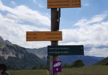
We really recommend it to walkers looking for wild and very preserved valleys. From Lake Lauzon, possibility to climb another 200m to reach the Col du Charnier. Magnificent !
Possibility of scooters on the grass and mountain biking downhill ski resort La Jarjatte. On your return, refresh yourself in the river: click here to discover 2 friendly swimming spots "

Elevation profile

Photos

Points of interest

Point of interest Lus-la-Croix-Haute - Petite baignade - Photo
CampingLesRivesduLac
LUS-LA-CROIX-HAUTE 
Point of interest Lus-la-Croix-Haute - Petite baignade - Photo
CampingLesRivesduLac
LUS-LA-CROIX-HAUTE 
Point of interest Lus-la-Croix-Haute - Vallon de La Jarjatte - Photo
CampingLesRivesduLac
LUS-LA-CROIX-HAUTE 
Point of interest Lus-la-Croix-Haute - Montée au Lac du Lauzon - Photo
CampingLesRivesduLac
LUS-LA-CROIX-HAUTE 
Point of interest Lus-la-Croix-Haute - Le Lac de Lauzon - Photo
CampingLesRivesduLac
LUS-LA-CROIX-HAUTE 
Point of interest Lus-la-Croix-Haute - Col de la Croix - Photo
CampingLesRivesduLac
LUS-LA-CROIX-HAUTE 

Positioning

Country:
France
Region :
Auvergne-Rhône-Alpes
Department/Province :
Drôme
Municipality :
Lus-la-Croix-Haute
Location:
Unknown
Start:(UTM)
719897 ; 4952329 (31T) N.

Trails nearby

Trail Walking Lus-la-Croix-Haute - R38   Col des Aiguilles depuis Lus - Photo
Walking
GUIDE+

Walking

Medium
Lus-la-Croix-Haute, Auvergne-Rhône-Alpes, Drôme, France
5.6 km | 15 km-effort
2h 53min
Yes
Trail Walking Lus-la-Croix-Haute - R37   Col de la Croix - Photo
Walking
GUIDE+

Walking

Medium
Lus-la-Croix-Haute, Auvergne-Rhône-Alpes, Drôme, France
3.7 km | 7 km-effort
1h 27min
Yes
Trail Walking Le Dévoluy - cabane col des Aiguilles La Jarjatte  - Photo
Walking
Atchoum26

Walking

Difficult
Le Dévoluy, Provence-Alpes-Côte d'Azur, Hautes-Alpes, France
12.8 km | 21 km-effort
5h 32min
No
Trail Walking Lus-la-Croix-Haute - MAS REBUFAT - POINTE FEUILLETTE  - Photo
Walking
RD78-38

Walking

Medium
Lus-la-Croix-Haute, Auvergne-Rhône-Alpes, Drôme, France
11.7 km | 20 km-effort
3h 33min
Yes
Trail Walking Lus-la-Croix-Haute - vallon jarjatte. lac lozon. col la croix - Photo
Walking
Matamimi

Walking

Very difficult
Lus-la-Croix-Haute, Auvergne-Rhône-Alpes, Drôme, France
9 km | 19.9 km-effort
6h 31min
No
Trail Walking Tréminis - Le col de La Croix - Photo
Walking
dominiq

Walking

Difficult
Tréminis, Auvergne-Rhône-Alpes, Isère, France
8.8 km | 16.5 km-effort
3h 31min
Yes
Trail Walking Lus-la-Croix-Haute - Pic de l'Aigle en circuit - Photo
Walking
Emelle

Walking

Medium
Lus-la-Croix-Haute, Auvergne-Rhône-Alpes, Drôme, France
7.4 km | 16.2 km-effort
4h 17min
Yes
Trail Walking Lus-la-Croix-Haute - col du charnier et lac lauzet - Photo
Walking
gibello

Walking

Medium
Lus-la-Croix-Haute, Auvergne-Rhône-Alpes, Drôme, France
10 km | 23 km-effort
6h 4min
Yes
Trail Walking Tréminis - Treminis :  Montagne de Paille, col de la Croix. - Photo
Walking
ranchoup

Walking

Medium
Tréminis, Auvergne-Rhône-Alpes, Isère, France
11 km | 21 km-effort
5h 29min
Yes


Close
My subscriptions