


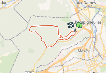

18.7 km | 24 km-effort


User


FREE GPS app for hiking
 SityTrail
IGN / Geographical institutes
SityTrail World
The world is yours!
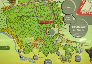
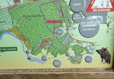
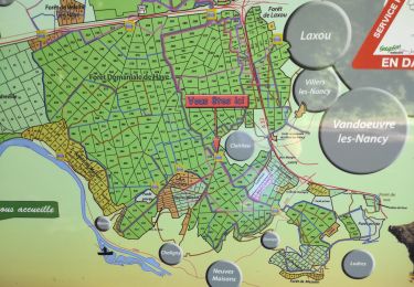
Trail Walking of 11.5 km to be discovered at Grand Est, Meurthe-et-Moselle, Champigneulles. This trail is proposed by DanielROLLET.
2018 02 28 Reco ASPV 4 personnes
Beau temps sec et assez froid
On foot

On foot
On foot

Bicycle tourism
Walking
Walking
Walking

On foot
On foot