22 km | 29 km-effort
xtrail stavelot 13 km
Vincentstephane
User
Length
13.5 km
Max alt
510 m
Uphill gradient
473 m
Km-Effort
19.8 km
Min alt
284 m
Downhill gradient
472 m
Boucle
Yes
Creation date :
2018-04-17 20:49:10.117
Updated on :
2018-04-17 20:49:10.117
3h12
Difficulty : Medium
FREE GPS app for hiking
About
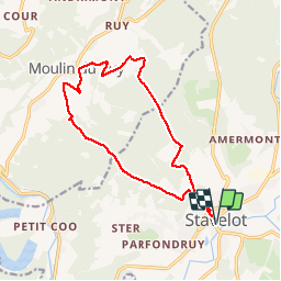
Trail Walking of 13.5 km to be discovered at Wallonia, Liège, Stavelot. This trail is proposed by Vincentstephane.
Description
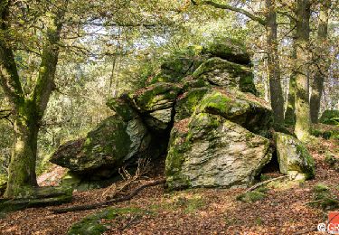
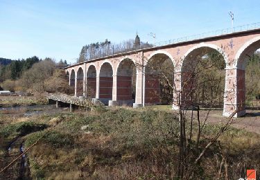
Superbe randos vallonnée,beaux panoramas
Positioning
Country:
Belgium
Region :
Wallonia
Department/Province :
Liège
Municipality :
Stavelot
Location:
Stavelot
Start:(Dec)
Start:(UTM)
708306 ; 5586469 (31U) N.
Comments
Trails nearby
RB-Lg-27_Trois-Ponts
Walking
Very difficult
(7)
Trois-Ponts,
Wallonia,
Liège,
Belgium
23 km | 33 km-effort
6h 58min
Yes
2021-06-30_12h14m27_stavelot_13km_new
Walking
Medium
(2)
Stavelot,
Wallonia,
Liège,
Belgium
13.4 km | 19.8 km-effort
4h 30min
Yes
2021-03-10_14h59m08_1227
Walking
Difficult
(3)
Stavelot,
Wallonia,
Liège,
Belgium
18.8 km | 26 km-effort
5h 53min
No
RB-Lg-29_Wanne_via-racc-2
Walking
Very difficult
(3)
Trois-Ponts,
Wallonia,
Liège,
Belgium
14.2 km | 19.2 km-effort
4h 21min
Yes
RB-Lg-27_Trois-Ponts_via-racc
Walking
Very difficult
(1)
Trois-Ponts,
Wallonia,
Liège,
Belgium
17 km | 25 km-effort
5h 12min
Yes
Chemin des Sources |stage 3 STAVELOT - HOCKAI
Walking
Very difficult
(1)
Stavelot,
Wallonia,
Liège,
Belgium
19 km | 25 km-effort
5h 45min
No
Extratrail - Stavelot (red) 23km
Trail
Very difficult
(1)
Stavelot,
Wallonia,
Liège,
Belgium
23 km | 35 km-effort
Unknown
Yes
Extra Trail - Stavelot (blue) 13km
Trail
Difficult
(1)
Stavelot,
Wallonia,
Liège,
Belgium
13.4 km | 19.5 km-effort
Unknown
Yes