Trail Walking Mérifons - Chemin Vicinal N°13 de Carlencas - Photo

Chemin Vicinal N°13 de Carlencas

© OpenStreetMap contributors
Length
Length
8.5 km
Max alt
Max alt
432 m
Uphill gradient
Uphill gradient
265 m
Km-Effort
Km-Effort  
12 km
Min alt
Min alt
204 m
Downhill gradient
Downhill gradient
265 m
Boucle
Boucle
Yes
Creation date :
2018-04-17 22:00:01.541
Updated on :
2021-04-08 18:42:59.701

(2 Reviews)

Walking
Walking
2h30
Difficulty : Medium

Scan this QR Code to open this trail in the SityTrail application

FREE GPS app for hiking

Logo SityTrail SityTrail

IGN / Geographical institutes

Download SityTrail from the App Store Download SityTrail from Google Play

Logo SityTrail SityTrail World

The world is yours!

Download SityTrail from the App Store Download SityTrail from Google Play Download SityTrail on Huawei AppGallery

About

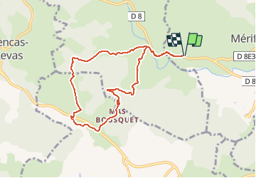
Trail Walking of 8.5 km to be discovered at Occitania, Hérault, Mérifons. This trail is proposed by jdelettrez.

Description

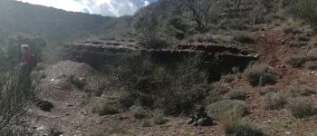
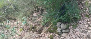
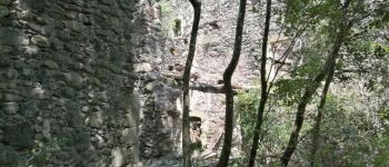
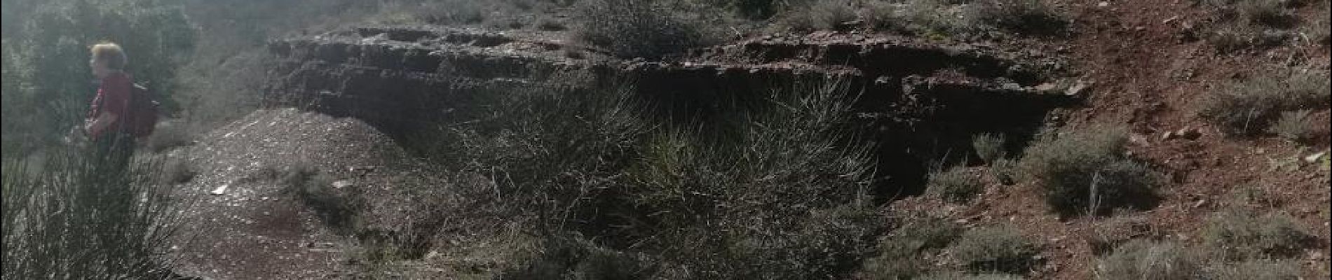
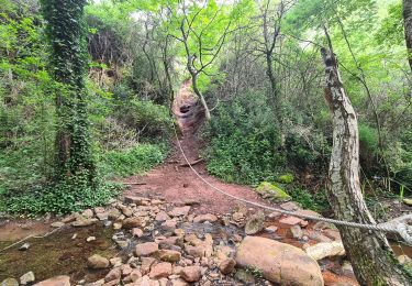
Une montée sur le causse basaltique de Carlencas par un vieux chemin retrouvé sur le cadaste de 1827.
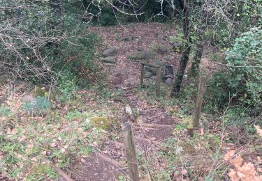
Pour randonneur averti.
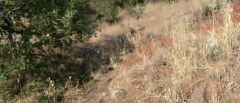
Montée raide dans les châtaignés.

Elevation profile

Photos

Points of interest

Point of interest Brenas - Unnamed POI - Photo
jdelettrez
BRENAS 
Point of interest Brenas - Unnamed POI - Photo
jdelettrez
BRENAS 
Point of interest Brenas - Unnamed POI - Photo
jdelettrez
BRENAS 
Point of interest Brenas - Unnamed POI - Photo
jdelettrez
BRENAS 
Point of interest Brenas - Unnamed POI - Photo
jdelettrez
BRENAS 
Point of interest Brenas - Unnamed POI - Photo
jdelettrez
BRENAS 
Point of interest Pézènes-les-Mines - Suivre la piste - Photo
jdelettrez
PÉZÈNES-LES-MINES 
Point of interest Pézènes-les-Mines - Unnamed POI - Photo
jdelettrez
PÉZÈNES-LES-MINES 
Point of interest Pézènes-les-Mines - Au calvaire moderne - Photo
jdelettrez
PÉZÈNES-LES-MINES 
Point of interest Brenas - Unnamed POI - Photo
jdelettrez
BRENAS 

Positioning

Country:
France
Region :
Occitania
Department/Province :
Hérault
Municipality :
Mérifons
Location:
Unknown
Start:(UTM)
521746 ; 4831002 (31T) N.

Comments

Please log in to post a review or rate the element


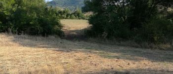
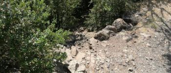
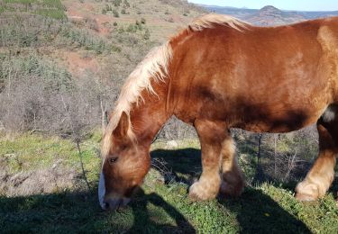
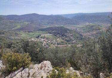
Promenade en dehors des sentiers battus. Heureusement, les indications permettent de ne pas se perdre. Beaux points de vue.
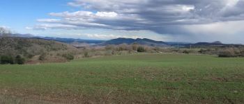
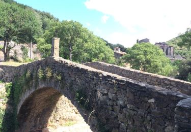
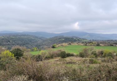
  

vallée sauvage


Trails nearby

Trail Nordic walking Mérifons - Malavieille - Montagne de la Boutine - Photo
Nordic walking
mdauzat

Nordic walking

Easy
(1)
Mérifons, Occitania, Hérault, France
7 km | 9.7 km-effort
Unknown
Yes
Trail Walking Pézènes-les-Mines - PEZENES les mines / FOS - Photo
Walking
mrclic34

Walking

Easy
(1)
Pézènes-les-Mines, Occitania, Hérault, France
14.5 km | 19.2 km-effort
3h 45min
Yes
Trail Mountain bike Octon - Octon 2017 - Photo
Mountain bike
pates_au_chaud

Mountain bike

Difficult
(1)
Octon, Occitania, Hérault, France
37 km | 48 km-effort
3h 4min
Yes
Trail Walking Mérifons - malevielle  - Photo
Walking
pipette12

Walking

Very easy
(1)
Mérifons, Occitania, Hérault, France
14.8 km | 20 km-effort
4h 19min
Yes
Trail Walking Octon - ND_Roubignac - Photo
Walking
v.rabot

Walking

Medium
Octon, Occitania, Hérault, France
8.1 km | 11.4 km-effort
3h 11min
Yes
Trail Walking Dio-et-Valquières - rando gourmande - Photo
Walking
Paulodst

Walking

Medium
Dio-et-Valquières, Occitania, Hérault, France
14.4 km | 19.3 km-effort
3h 27min
Yes
Trail Walking Octon - Octon bis - Photo
Walking
mrclic34

Walking

Medium
Octon, Occitania, Hérault, France
7.9 km | 11.2 km-effort
2h 13min
Yes
Trail Nordic walking Octon - Octon Dolmens de Toucou - Photo
Nordic walking
mdauzat

Nordic walking

Very easy
(1)
Octon, Occitania, Hérault, France
9.7 km | 13.1 km-effort
4h 58min
Yes
Trail Walking Octon - Octon-Chapelle ND de Roubignac - Photo
Walking
v.rabot

Walking

Medium
Octon, Occitania, Hérault, France
11.4 km | 15.4 km-effort
3h 55min
Yes


Close
My subscriptions