Trail Walking Compiègne - en forêt de Compiegne_14_Guet du Nid_Royallieu_la Bouverie_Marché Dupuis - Photo

en forêt de Compiegne_14_Guet du Nid_Royallieu_la Bouverie_Marché Dupuis

mes randos en forêt

© OpenStreetMap contributors
Length
Length
26 km
Max alt
Max alt
74 m
Uphill gradient
Uphill gradient
237 m
Km-Effort
Km-Effort  
29 km
Min alt
Min alt
36 m
Downhill gradient
Downhill gradient
237 m
Boucle
Boucle
Yes
Creation date :
2018-12-30 18:22:51.925
Updated on :
2020-11-08 10:32:35.516

(0 Reviews)

Walking
Walking
7h30
Difficulty : Difficult

Scan this QR Code to open this trail in the SityTrail application

FREE GPS app for hiking

Logo SityTrail SityTrail

IGN / Geographical institutes

Download SityTrail from the App Store Download SityTrail from Google Play

Logo SityTrail SityTrail World

The world is yours!

Download SityTrail from the App Store Download SityTrail from Google Play Download SityTrail on Huawei AppGallery

About

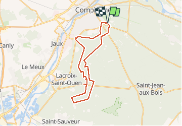
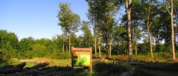
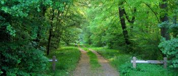
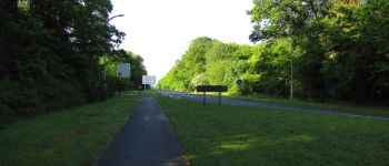
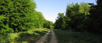
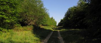
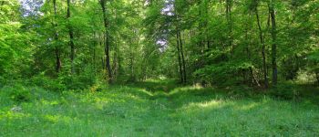
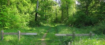
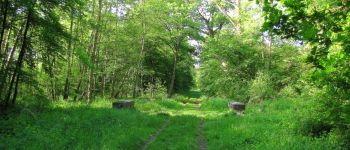
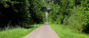
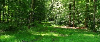
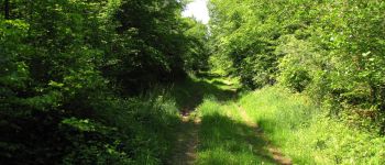
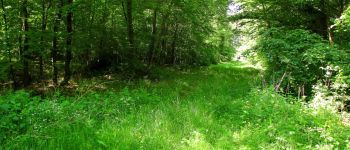
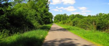
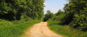
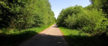
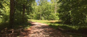
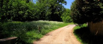
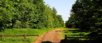
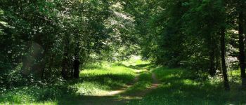
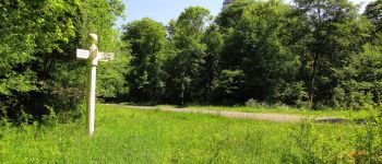
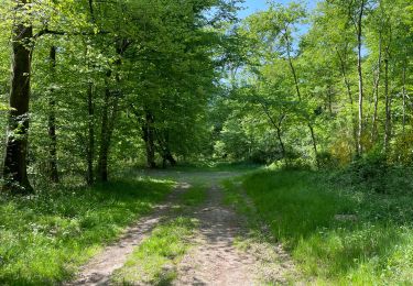
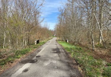
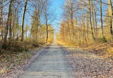
Trail Walking of 26 km to be discovered at Hauts-de-France, Oise, Compiègne. This trail is proposed by en forêt de Compiègne.

Description

05/ 2018

voir aussi:

http://foret-de-compiegne.over-blog.com/

batterie de recharge pour iphone indispensable.
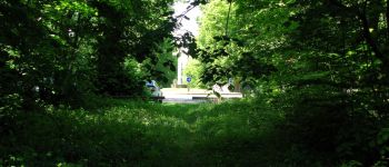
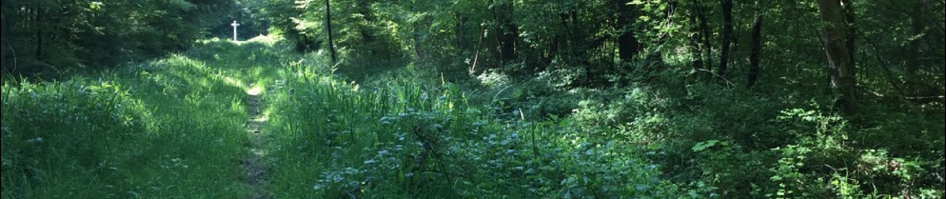
rando facile jusqu'au point de rebroussement mais sur la première moitié du retour, très difficile (petits sentiers très encombrés avec boue et eau).
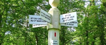
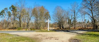
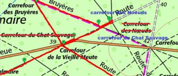
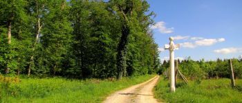
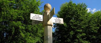
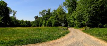
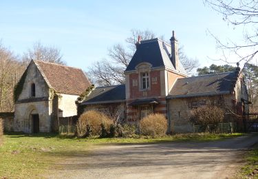
Au départ du carrefour Royal, rejoindre le carrefour Napoléon par l'avenue Napoléon puis suivre à gauche l'avenue de Marigny et le bout de la Route du Moulin. Prendre à gauche la route du Guet du Nid pour atteindre le carrefour de l'Abbaye.  Suivre la route de Royallieu jusqu'au carrefour des Dames puis à droite la route des Lorrains jusqu'au carrefour des Lorrains. Tourner à gauche dans la route du Bout de Jaux jusqu'au carrefour du Bout de Jaux. Suivre à gauche la route de la Bouverie jusqu'au carrefour suivant et tourner à droite dans un chemin qui rejoint le carrefour du Poulinet. Tourner à gauche puis à droite dans le chemin du Vivier (voir le Trou Romain) et suivre jusqu'au carrefour de Joinville. Prendre à droite la route de Béthisy (écart pour voir le carrefour des Noeuds) et continuer jusqu'au carrefour de Saint-Ouen. Tourner à droite dans la route de la Volière et la suivre jusqu'au carrefour de la Volière. Tourner à gauche dans le chemin de Béthisy . Suivre à gauche dans la route de la Queue du Renard puis tourner à gauche dans la route du Hazoy. La suivre jusqu'au carrefour du Puits Féron. Tourner à gauche dans la route du Pont de l'Auge et continuer jusqu'au carrefour du Cyclope (très difficile). Prendre à droite la route de Bussa jusqu'au carrefour Julie (difficile). Tourner à gauche dans la route du Carnois puis à droite au carrefour Narcisse pour rejoindre le carrefour du Vivier Corax. Prendre à droite la route de la Gouvernante pour rejoindre le carrefour de la Petite Patte d'Oie (facile). Suivre à gauche la route du Moulin jusqu'au carrefour des Bordages puis tourner à droite dans la route de Tilloye et continuer jusqu'au carrefour Godot. Retrouver à gauche le GR655 et continuer jusqu'au carrefour du Guet du Nid. Tourner à droite dans la route du Guet du Nid pour aller jusqu'au carrefour de Pierrefonds. Traverser la D973 et prendre à gauche un petit chemin pour rejoindre le carrefour Royal.

Elevation profile

Photos

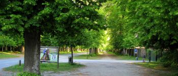
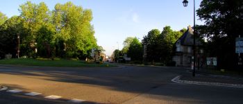
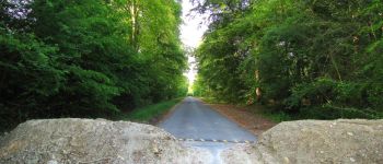
115 photos in total. Please click on a photo to see them all in the gallery.

Points of interest

Point of interest Compiègne - Départ - Photo
JeanLucA4
COMPIÈGNE 
Point of interest Compiègne - Point 1 - Photo
JeanLucA4
COMPIÈGNE 
Point of interest Compiègne - Point 2 - Photo
JeanLucA4
COMPIÈGNE 
Point of interest Compiègne - Point 3 - Photo
JeanLucA4
COMPIÈGNE 
Point of interest Compiègne - Point 4 - Photo
JeanLucA4
COMPIÈGNE 
Point of interest Compiègne - Point 5 - Photo
JeanLucA4
COMPIÈGNE 
Point of interest Compiègne - Point 6 - Photo
JeanLucA4
COMPIÈGNE 
Point of interest Compiègne - Point 7 - Photo
JeanLucA4
COMPIÈGNE 
Point of interest Compiègne - Point 8 - Photo
JeanLucA4
COMPIÈGNE 
Point of interest Compiègne - Point 9 - Photo
JeanLucA4
COMPIÈGNE 
Point of interest Compiègne - Point 10 - Photo
JeanLucA4
COMPIÈGNE 
Point of interest Compiègne - Point 11 - Photo
JeanLucA4
COMPIÈGNE 
Point of interest Compiègne - Point 12 - Photo
JeanLucA4
COMPIÈGNE 
Point of interest Compiègne - Point 13 - Photo
JeanLucA4
COMPIÈGNE 
Point of interest Compiègne - Point 14 - Photo
JeanLucA4
COMPIÈGNE 
Point of interest Lacroix-Saint-Ouen - Point 15 - Photo
JeanLucA4
LACROIX-SAINT-OUEN 
Point of interest Lacroix-Saint-Ouen - Point 17 - Photo
JeanLucA4
LACROIX-SAINT-OUEN 
Point of interest Lacroix-Saint-Ouen - Point 18 - Photo
JeanLucA4
LACROIX-SAINT-OUEN 
Point of interest Lacroix-Saint-Ouen - Point 19 - Photo
JeanLucA4
LACROIX-SAINT-OUEN 
Point of interest Lacroix-Saint-Ouen - Point 20 - Photo
JeanLucA4
LACROIX-SAINT-OUEN 
Point of interest Lacroix-Saint-Ouen - Point 21 - Photo
JeanLucA4
LACROIX-SAINT-OUEN 
Point of interest Lacroix-Saint-Ouen - Unnamed POI - Photo
JeanLucA4
LACROIX-SAINT-OUEN 
Point of interest Lacroix-Saint-Ouen - Point 23 - Photo
JeanLucA4
LACROIX-SAINT-OUEN 
Point of interest Lacroix-Saint-Ouen - Point 24 - Photo
JeanLucA4
LACROIX-SAINT-OUEN 
Point of interest Lacroix-Saint-Ouen - Point 25 - Photo
JeanLucA4
LACROIX-SAINT-OUEN 
Point of interest Lacroix-Saint-Ouen - Point 26 - Photo
JeanLucA4
LACROIX-SAINT-OUEN 
Point of interest Lacroix-Saint-Ouen - Point 27 - Photo
JeanLucA4
LACROIX-SAINT-OUEN 
Point of interest Lacroix-Saint-Ouen - Point 28 - Photo
JeanLucA4
LACROIX-SAINT-OUEN 
Point of interest Lacroix-Saint-Ouen - Point 29 - Photo
JeanLucA4
LACROIX-SAINT-OUEN 
Point of interest Saint-Sauveur - Point 30 - Photo
JeanLucA4
SAINT-SAUVEUR 
Point of interest Saint-Sauveur - Point 31 - Photo
JeanLucA4
SAINT-SAUVEUR 
Point of interest Saint-Sauveur - Unnamed POI - Photo
JeanLucA4
SAINT-SAUVEUR 
Point of interest Saint-Sauveur - Point 33 - Photo
JeanLucA4
SAINT-SAUVEUR 
Point of interest Saint-Sauveur - Point 34 - Photo
JeanLucA4
SAINT-SAUVEUR 
Point of interest Saint-Sauveur - Point 35 - Photo
JeanLucA4
SAINT-SAUVEUR 
Point of interest Saint-Sauveur - Point 36 - Photo
JeanLucA4
SAINT-SAUVEUR 
Point of interest Lacroix-Saint-Ouen - Point 37 - Photo
JeanLucA4
LACROIX-SAINT-OUEN 
Point of interest Lacroix-Saint-Ouen - Point 38 - Photo
JeanLucA4
LACROIX-SAINT-OUEN 
Point of interest Lacroix-Saint-Ouen - Point 39 - Photo
JeanLucA4
LACROIX-SAINT-OUEN 
Point of interest Lacroix-Saint-Ouen - Point 40 - Photo
JeanLucA4
LACROIX-SAINT-OUEN 
Point of interest Lacroix-Saint-Ouen - Point 41 - Photo
JeanLucA4
LACROIX-SAINT-OUEN 
Point of interest Compiègne - Point 42 - Photo
JeanLucA4
COMPIÈGNE 
Point of interest Compiègne - Point 43 - Photo
JeanLucA4
COMPIÈGNE 
Point of interest Compiègne - Point 44 - Photo
JeanLucA4
COMPIÈGNE 
Point of interest Compiègne - Point 46 - Photo
JeanLucA4
COMPIÈGNE 
Point of interest Compiègne - Point 47 - Photo
JeanLucA4
COMPIÈGNE 
Point of interest Compiègne - Point 48 - Photo
JeanLucA4
COMPIÈGNE 
Point of interest Compiègne - Point 49 - Photo
JeanLucA4
COMPIÈGNE 
Point of interest Compiègne - Point 50 - Photo
JeanLucA4
COMPIÈGNE 
Point of interest Compiègne - Point 51 - Photo
JeanLucA4
COMPIÈGNE 
Point of interest Compiègne - Arrivée - Photo
JeanLucA4
COMPIÈGNE 
Point of interest Compiègne - Point 45 - Photo
JeanLucA4
COMPIÈGNE 

Positioning

Country:
France
Region :
Hauts-de-France
Department/Province :
Oise
Municipality :
Compiègne
Location:
Unknown
Start:(UTM)
488821 ; 5472601 (31U) N.

Trails nearby

Trail Walking Choisy-au-Bac - en forêt de Laigue_9_06_2020_Chemin du Fau Bidaud et la Route de Royaumont - Photo
Walking

Walking

Very difficult
(1)
Choisy-au-Bac, Hauts-de-France, Oise, France
9.6 km | 12.8 km-effort
3h 0min
Yes
Trail Walking Clairoix - Randonnée au fort Ganelon ( Clairoix) - Photo
Walking
dudu42

Walking

Medium
Clairoix, Hauts-de-France, Oise, France
10.5 km | 14 km-effort
2h 33min
Yes
Trail Walking Jaux - JAUX, Oise - Photo
Walking
jeannine grandjean

Walking

Medium
Jaux, Hauts-de-France, Oise, France
6.4 km | 7.7 km-effort
1h 45min
Yes
Trail Walking Compiègne - en Forêt de Compiègne_50_les Routes des Beaux Monts, de Morpigny et des Nymphes - Photo
Walking

Walking

Very difficult
Compiègne, Hauts-de-France, Oise, France
17 km | 20 km-effort
5h 2min
Yes
Trail Walking Compiègne - en forêt de Compiègne_48_sur les Routes de la Mariolle et du Grand Veneur - Photo
Walking

Walking

Very difficult
Compiègne, Hauts-de-France, Oise, France
17 km | 19.9 km-effort
5h 21min
Yes
Trail Walking Compiègne - Compiegne rond point de l’Armistice 13,4 km - Photo
Walking
GUIDE
rvapeldo

Walking

Easy
Compiègne, Hauts-de-France, Oise, France
13.4 km | 17.5 km-effort
3h 36min
Yes
Trail Walking Compiègne - en forêt de Compiègne_47_autour des Beaux Monts - Photo
Walking

Walking

Medium
Compiègne, Hauts-de-France, Oise, France
4.8 km | 6.4 km-effort
1h 27min
No
Trail Walking Lacroix-Saint-Ouen - en forêt de Compiègne_45_sur les Routes de Morienval et de Champlieu - Photo
Walking

Walking

Medium
Lacroix-Saint-Ouen, Hauts-de-France, Oise, France
15 km | 17.4 km-effort
4h 29min
Yes
Trail On foot Compiègne - Promenade du Point de Vue des beaux Monts - Photo
On foot
PRO

On foot

Easy
Compiègne, Hauts-de-France, Oise, France
3.1 km | 3.8 km-effort
51min
Yes


Close
My subscriptions