Randonnée Marche Ayen - Ayen-160622 - Ayen-SaintCyprien - Photo

Ayen-160622 - Ayen-SaintCyprien

 randodan
randodan

Utilisateur

© OpenStreetMap contributors
Longueur
Longueur
9,3 km
Altitude max
Altitude max
369 m
Dénivelé positif
Dénivelé positif
271 m
Km-Effort
Km-Effort  
12,9 km
Altitude min
Altitude min
147 m
Dénivelé négatif
Dénivelé négatif
288 m
Boucle
Boucle
Non
Date de création :
2016-09-07 00:00:00.0
Dernière modification :
2016-09-07 00:00:00.0

(0 Avis)

Marche
Marche
2h40
Difficulté : Facile

Scannez ce code QR pour ouvrir la randonnée dans l'application SityTrail

Application GPS de randonnée GRATUITE

Logo SityTrail SityTrail

IGN / Instituts géographiques

Télécharger SityTrail sur l'App Store Télécharger SityTrail sur Google Play

Logo SityTrail SityTrail World

Le monde est à vous

Télécharger SityTrail sur l'App Store Télécharger SityTrail sur Google Play Télécharger SityTrail sur Huawei AppGallery

À propos

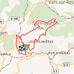
Randonnée Marche de 9,3 km à découvrir à Nouvelle-Aquitaine, Corrèze, Ayen. Cette randonnée est proposée par randodan.

Description

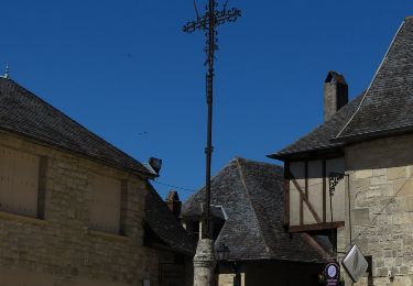
Ayen, 22 juin 2016<br>
- Les Chemins de Saint-Cyprien -<br>
<small>(d'après la fiche VVF RaNdO.2)</small><br>
9h, départ du VVF.<br>
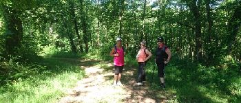
Oups, dès le départ, ça n'arrête pas de descendre, on angoisse à la pensée qu'il faudra tout remonter en final ! <br>
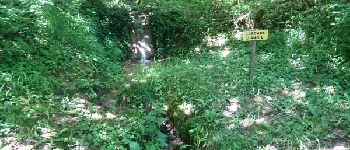
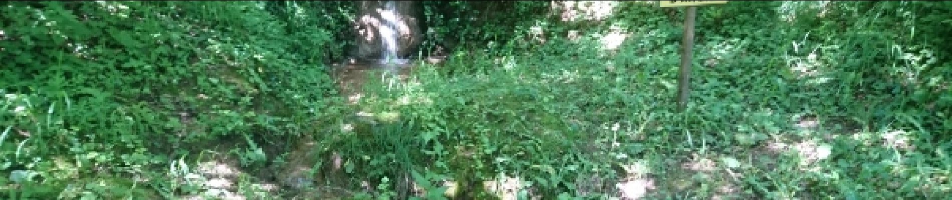
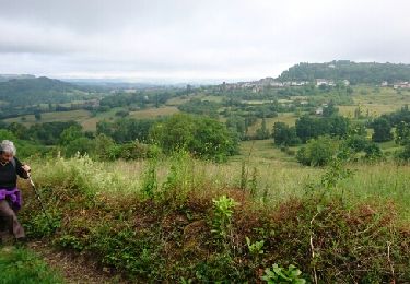
35° à l'ombre, dur-dur sur le bitume . De Saint-Cyprien, beau point de vue sur nos bungalows . Au retour, un petit sentier botanique imprévu compense le pénible macadam.<br>
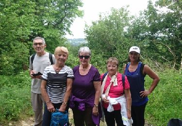
4 participants (Jo,Ca,Li,Da).

Profil altimétrique

Photos

Points d'intérêt

Point d'intérêt Saint-Cyprien - 01- De Saint-Cyprien, beau point de vue sur nos bungalows - Photo
randodan
Point d'intérêt Saint-Cyprien - 02 - L'église de Saint-Cyprien - Photo
randodan
Point d'intérêt Saint-Cyprien - 03 - L'église de Saint-Cyprien - Photo
randodan
Point d'intérêt Saint-Cyprien - 04 - Sur la route du retour - Photo
randodan
Point d'intérêt Saint-Cyprien - 05 - Pause réflexion - Photo
randodan
SAINT-CYPRIEN 
Point d'intérêt Saint-Cyprien - 06 - La Cascade d'Angie - Photo
randodan

Localisation

Pays :
France
Région :
Nouvelle-Aquitaine
Département/Province :
Corrèze
Commune :
Ayen
Localité :
Unknown
Départ:(Dec)
Départ:(UTM)
369546 ; 5010688 (31T) N.

Randonnées à proximité

Randonnée Marche Ayen - Ayen-160621 - CoteauxAyenSud - Photo
Marche
randodan

Marche

Facile
(1)
Ayen, Nouvelle-Aquitaine, Corrèze, France
6,4 km | 8,8 km-effort
1h 50min
Non
Randonnée Marche Ayen - Ayen  - Photo
Marche
guy63

Marche

Facile
(2)
Ayen, Nouvelle-Aquitaine, Corrèze, France
5,5 km | 7,5 km-effort
1h 10min
Oui
Randonnée Marche Perpezac-le-Blanc - perpezac_3 - Photo
Marche
fanthou

Marche

Moyen
(1)
Perpezac-le-Blanc, Nouvelle-Aquitaine, Corrèze, France
7,4 km | 10,3 km-effort
2h 13min
Oui
Randonnée Marche Saint-Cyprien - Ruisseaux et côteaux- Saint-Cyprien - Photo
Marche
houbart

Marche

Facile
(3)
Saint-Cyprien, Nouvelle-Aquitaine, Corrèze, France
6,4 km | 9,1 km-effort
1h 59min
Oui
Randonnée Marche Ayen - Ayen, lavoirs, châteaux et puys - Photo
Marche
houbart

Marche

Facile
Ayen, Nouvelle-Aquitaine, Corrèze, France
5,5 km | 7,6 km-effort
2h 0min
Oui
Randonnée Marche Segonzac - Ayen-160624 - Segonzac-PuyGuimont - Photo
Marche
randodan

Marche

Facile
Segonzac, Nouvelle-Aquitaine, Corrèze, France
8,3 km | 10,3 km-effort
2h 10min
Oui
Randonnée Marche Ayen - Ayen-160620 - CoteauxAyenNord - Photo
Marche
randodan

Marche

Facile
Ayen, Nouvelle-Aquitaine, Corrèze, France
6,4 km | 8,5 km-effort
2h 0min
Non
Randonnée Marche Ayen - Ayen-160619 - TableOrientationAyen - Photo
Marche
randodan

Marche

Très facile
Ayen, Nouvelle-Aquitaine, Corrèze, France
8,5 km | 10,8 km-effort
2h 15min
Oui
Randonnée Marche Saint-Robert - Saint-Robert- Le lavoir des Tuffets - Photo
Marche
houbart

Marche

Facile
Saint-Robert, Nouvelle-Aquitaine, Corrèze, France
5,6 km | 7,5 km-effort
1h 20min
Oui


Fermer
Mes abonnements