Randonnée Marche Orcières - Sommet Drouvet - Dormillouse  - Photo
 Joludov
Joludov

Utilisateur

© OpenStreetMap contributors
Longueur
Longueur
14,7 km
Altitude max
Altitude max
2782 m
Dénivelé positif
Dénivelé positif
386 m
Km-Effort
Km-Effort  
23 km
Altitude min
Altitude min
1681 m
Dénivelé négatif
Dénivelé négatif
1253 m
Boucle
Boucle
Non
Date de création :
2016-08-29 00:00:00.0
Dernière modification :
2016-08-29 00:00:00.0

(0 Avis)

Marche
Marche
6h31
Difficulté : Facile

Scannez ce code QR pour ouvrir la randonnée dans l'application SityTrail

Application GPS de randonnée GRATUITE

Logo SityTrail SityTrail

IGN / Instituts géographiques

Télécharger SityTrail sur l'App Store Télécharger SityTrail sur Google Play

Logo SityTrail SityTrail World

Le monde est à vous

Télécharger SityTrail sur l'App Store Télécharger SityTrail sur Google Play Télécharger SityTrail sur Huawei AppGallery

À propos

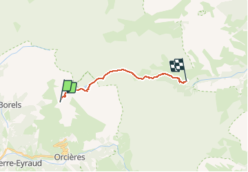
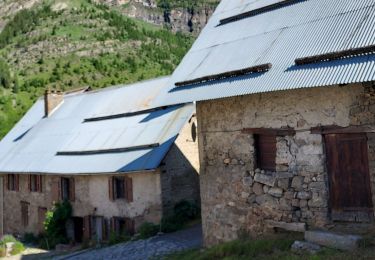
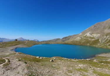
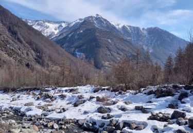
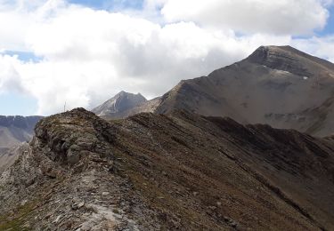
Randonnée Marche de 14,7 km à découvrir à Provence-Alpes-Côte d'Azur, Hautes-Alpes, Orcières. Cette randonnée est proposée par Joludov.

Description

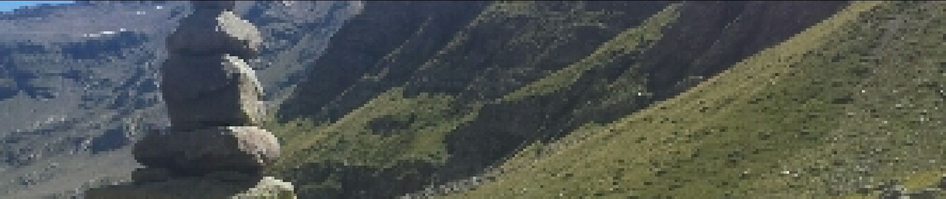
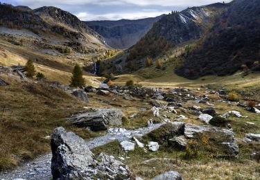
Lac des Estaris, Col de Freissinieres puis torent de Chichin.

Profil altimétrique

Photos

Points d'intérêt

Point d'intérêt Freissinières - Point 7 - Photo
Joludov
FREISSINIÈRES 

Localisation

Pays :
France
Région :
Provence-Alpes-Côte d'Azur
Département/Province :
Hautes-Alpes
Commune :
Orcières
Localité :
Unknown
Départ:(Dec)
Départ:(UTM)
287607 ; 4955647 (32T) N.

Randonnées à proximité

Randonnée Marche Orcières - Le Forest des marches - Photo
Marche
GUIDE
nadinebondoux

Marche

Facile
(2)
Orcières, Provence-Alpes-Côte d'Azur, Hautes-Alpes, France
6,3 km | 9,9 km-effort
1h 42min
Oui
Randonnée Marche Orcières - R45   Marmottes a Prapic - Photo
Marche
GUIDE+

Marche

Moyen
(2)
Orcières, Provence-Alpes-Côte d'Azur, Hautes-Alpes, France
9 km | 14 km-effort
2h 57min
Oui
Randonnée Marche Orcières - Orcieres (Hautes Alpes) - Photo
Marche
ISATR

Marche

Très difficile
(1)
Orcières, Provence-Alpes-Côte d'Azur, Hautes-Alpes, France
12 km | 19,4 km-effort
4h 24min
Oui
Randonnée Marche Orcières - Roc Diolon par le col de Freissinières - Photo
Marche
GUIDE
R@ph

Marche

Très difficile
Orcières, Provence-Alpes-Côte d'Azur, Hautes-Alpes, France
16,3 km | 32 km-effort
7h 21min
Oui
Randonnée Marche Champoléon - Balade Vallée Champoléon - Photo
Marche
GUIDE
nadinebondoux

Marche

Facile
Champoléon, Provence-Alpes-Côte d'Azur, Hautes-Alpes, France
9,5 km | 12,2 km-effort
2h 40min
Oui
Randonnée Marche Orcières - Col des Tourettes - Croix Lorraine - Photo
Marche
GUIDE
R@ph

Marche

Difficile
Orcières, Provence-Alpes-Côte d'Azur, Hautes-Alpes, France
21 km | 37 km-effort
5h 30min
Oui
Randonnée Marche Orcières - Prapic Basset Cabane de la Barre - Photo
Marche
Orage

Marche

Moyen
(1)
Orcières, Provence-Alpes-Côte d'Azur, Hautes-Alpes, France
17,6 km | 30 km-effort
6h 10min
Oui
Randonnée Marche Orcières - 08072013 - Photo
Marche
mikaelerouzic

Marche

Moyen
(1)
Orcières, Provence-Alpes-Côte d'Azur, Hautes-Alpes, France
10,5 km | 17,9 km-effort
2h 36min
Oui
Randonnée Marche Orcières - Merlette Les Lacs - Photo
Marche
frederique.marti@laposte.net

Marche

Facile
(1)
Orcières, Provence-Alpes-Côte d'Azur, Hautes-Alpes, France
18,4 km | 32 km-effort
4h 39min
Oui


Fermer
Mes abonnements