Randonnée Marche Champigneulles - Champigneulles 11 600m +233m - Photo
 DanielROLLET
DanielROLLET

Utilisateur

© OpenStreetMap contributors
Longueur
Longueur
11,5 km
Altitude max
Altitude max
346 m
Dénivelé positif
Dénivelé positif
207 m
Km-Effort
Km-Effort  
14,2 km
Altitude min
Altitude min
211 m
Dénivelé négatif
Dénivelé négatif
200 m
Boucle
Boucle
Oui
Date de création :
2018-04-17 20:20:15.079
Dernière modification :
2018-04-17 20:20:15.079

(0 Avis)

Marche
Marche
3h09
Difficulté : Facile

Scannez ce code QR pour ouvrir la randonnée dans l'application SityTrail

Application GPS de randonnée GRATUITE

Logo SityTrail SityTrail

IGN / Instituts géographiques

Télécharger SityTrail sur l'App Store Télécharger SityTrail sur Google Play

Logo SityTrail SityTrail World

Le monde est à vous

Télécharger SityTrail sur l'App Store Télécharger SityTrail sur Google Play Télécharger SityTrail sur Huawei AppGallery

À propos

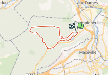
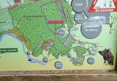
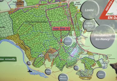
Randonnée Marche de 11,5 km à découvrir à Grand Est, Meurthe-et-Moselle, Champigneulles. Cette randonnée est proposée par DanielROLLET.

Description

2018 02 28 Reco ASPV 4 personnes
Beau temps sec et assez froid

Profil altimétrique

Localisation

Pays :
France
Région :
Grand Est
Département/Province :
Meurthe-et-Moselle
Commune :
Champigneulles
Localité :
Unknown
Départ:(Dec)
Départ:(UTM)
290508 ; 5401007 (32U) N.

Randonnées à proximité

Randonnée A pied Champigneulles - Circuit G - Photo
A pied
PRO

A pied

Moyen
Champigneulles, Grand Est, Meurthe-et-Moselle, France
18,7 km | 24 km-effort
5h 24min
Non
Randonnée A pied Champigneulles - Circuit du Val Saint-Barthélémy - Photo
A pied
PRO

A pied

Facile
Champigneulles, Grand Est, Meurthe-et-Moselle, France
7 km | 8,6 km-effort
1h 57min
Oui
Randonnée A pied Champigneulles - Circuit du Noirval - Photo
A pied
PRO

A pied

Facile
Champigneulles, Grand Est, Meurthe-et-Moselle, France
11,1 km | 13,5 km-effort
3h 4min
Oui
Randonnée Cyclotourisme Frouard - 4ème rando vélo Frouard - Lagarde 62 km - Photo
Cyclotourisme
GUIDE
jeanmarcMasson

Cyclotourisme

Très difficile
Frouard, Grand Est, Meurthe-et-Moselle, France
62 km | 67 km-effort
4h 32min
Non
Randonnée Marche Nancy - Ma rando du jour - Photo
Marche
Toyot 8

Marche

Difficile
Nancy, Grand Est, Meurthe-et-Moselle, France
35 km | 41 km-effort
5h 55min
Oui
Randonnée Marche Nancy - Nancy Gondreville Nancy - Photo
Marche
Toyot 8

Marche

Difficile
Nancy, Grand Est, Meurthe-et-Moselle, France
64 km | 74 km-effort
10h 57min
Oui
Randonnée Marche Nancy - Nancy Saizeray Jaillon Pierre la Treiche Marion Nancy  - Photo
Marche
Toyot 8

Marche

Difficile
Nancy, Grand Est, Meurthe-et-Moselle, France
73 km | 85 km-effort
12h 13min
Oui
Randonnée A pied Lay-Saint-Christophe - Circuit L - Photo
A pied
PRO

A pied

Facile
Lay-Saint-Christophe, Grand Est, Meurthe-et-Moselle, France
14,7 km | 18,5 km-effort
4h 11min
Oui
Randonnée A pied Champigneulles - Circuit G : Circuit principal - Photo
A pied
PRO

A pied

Facile
Champigneulles, Grand Est, Meurthe-et-Moselle, France
8,4 km | 11,1 km-effort
2h 31min
Non


Fermer
Mes abonnements