Randonnée Marche Saint-Jean-le-Thomas - st jean thomas AR par terres et sentier littoral - Photo

st jean thomas AR par terres et sentier littoral

 doclocjl
doclocjl

Utilisateur

© OpenStreetMap contributors
Longueur
Longueur
14,6 km
Altitude max
Altitude max
102 m
Dénivelé positif
Dénivelé positif
239 m
Km-Effort
Km-Effort  
17,8 km
Altitude min
Altitude min
9 m
Dénivelé négatif
Dénivelé négatif
238 m
Boucle
Boucle
Oui
Date de création :
2018-04-18 00:15:35.555
Dernière modification :
2018-04-18 00:15:35.555

(0 Avis)

Marche
Marche
5h26
Difficulté : Facile

Scannez ce code QR pour ouvrir la randonnée dans l'application SityTrail

Application GPS de randonnée GRATUITE

Logo SityTrail SityTrail

IGN / Instituts géographiques

Télécharger SityTrail sur l'App Store Télécharger SityTrail sur Google Play

Logo SityTrail SityTrail World

Le monde est à vous

Télécharger SityTrail sur l'App Store Télécharger SityTrail sur Google Play Télécharger SityTrail sur Huawei AppGallery

À propos

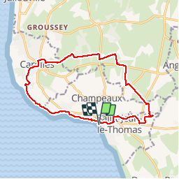
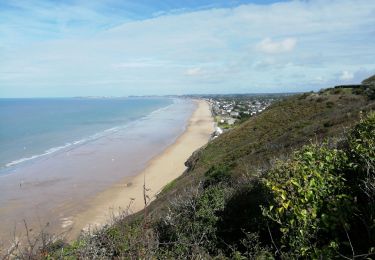
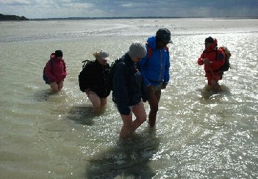
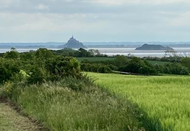
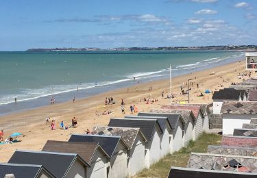
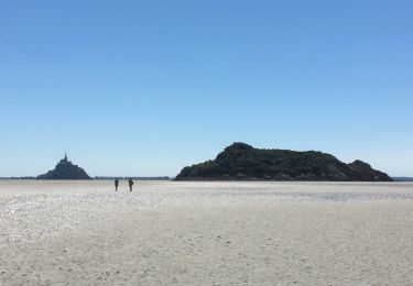
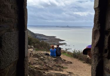
Randonnée Marche de 14,6 km à découvrir à Normandie, Manche, Saint-Jean-le-Thomas. Cette randonnée est proposée par doclocjl.

Description

circuit boisé et retour par sentier littoral

Profil altimétrique

Localisation

Pays :
France
Région :
Normandie
Département/Province :
Manche
Commune :
Saint-Jean-le-Thomas
Localité :
Unknown
Départ:(Dec)
Départ:(UTM)
608179 ; 5398486 (30U) N.

Randonnées à proximité

Randonnée Marche Carolles - La Vallée du Lude - Carolles - Photo
Marche
tracegps

Marche

Moyen
(1)
Carolles, Normandie, Manche, France
6,7 km | 8,6 km-effort
2h 30min
Non
Randonnée Marche Carolles - Falaises de Carolles  - Photo
Marche
SyMA

Marche

Très facile
Carolles, Normandie, Manche, France
4,1 km | 5,4 km-effort
1h 6min
Oui
Randonnée Marche Genêts - La Baie du Mont Saint Michel - Photo
Marche
PatRando

Marche

Moyen
Genêts, Normandie, Manche, France
13,1 km | 13,3 km-effort
3h 3min
Oui
Randonnée Marche Dragey-Ronthon - Le Bec d’Andaine - Photo
Marche
serleb

Marche

Facile
Dragey-Ronthon, Normandie, Manche, France
10,2 km | 11,2 km-effort
3h 1min
Oui
Randonnée Marche Carolles - Carolles - Photo
Marche
serleb

Marche

Difficile
Carolles, Normandie, Manche, France
9,7 km | 12 km-effort
3h 7min
Oui
Randonnée Marche Genêts - Baie Mont Saint Michel  - Photo
Marche
DROCHON

Marche

Facile
Genêts, Normandie, Manche, France
13,1 km | 13,3 km-effort
3h 0min
Oui
Randonnée Marche Carolles - Cabane Vauban et port du Lude - Photo
Marche
Vasseur Jean Marc

Marche

Facile
Carolles, Normandie, Manche, France
4,4 km | 5,7 km-effort
2h 17min
Oui
Randonnée Marche Carolles - cabane vauban - Photo
Marche
lionelnottat

Marche

Moyen
Carolles, Normandie, Manche, France
6,8 km | 8,6 km-effort
1h 53min
Oui
Randonnée V.T.T. Jullouville - Bouillon Granville VTT - Photo
V.T.T.
pln

V.T.T.

Moyen
Jullouville, Normandie, Manche, France
27 km | 31 km-effort
2h 51min
Non


Fermer
Mes abonnements