Randonnée Marche Touvérac - Touverac 16. 15 mai 2018 - Photo
 bert16
bert16

Utilisateur

© OpenStreetMap contributors
Longueur
Longueur
3,9 km
Altitude max
Altitude max
131 m
Dénivelé positif
Dénivelé positif
68 m
Km-Effort
Km-Effort  
4,8 km
Altitude min
Altitude min
96 m
Dénivelé négatif
Dénivelé négatif
67 m
Boucle
Boucle
Oui
Date de création :
2018-06-26 14:02:02.476
Dernière modification :
2018-06-26 14:02:02.476

(0 Avis)

Marche
Marche
1h02
Difficulté : Très facile

Scannez ce code QR pour ouvrir la randonnée dans l'application SityTrail

Application GPS de randonnée GRATUITE

Logo SityTrail SityTrail

IGN / Instituts géographiques

Télécharger SityTrail sur l'App Store Télécharger SityTrail sur Google Play

Logo SityTrail SityTrail World

Le monde est à vous

Télécharger SityTrail sur l'App Store Télécharger SityTrail sur Google Play Télécharger SityTrail sur Huawei AppGallery

À propos

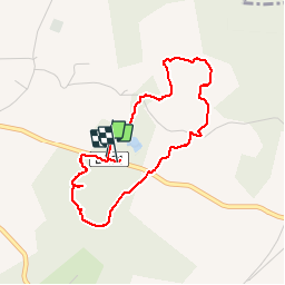
Randonnée Marche de 3,9 km à découvrir à Nouvelle-Aquitaine, Charente, Touvérac. Cette randonnée est proposée par bert16.

Description

asso brie/Chalais: 8 randonneurs

Profil altimétrique

Photos

Localisation

Pays :
France
Région :
Nouvelle-Aquitaine
Département/Province :
Charente
Commune :
Touvérac
Localité :
Unknown
Départ:(Dec)
Départ:(UTM)
719353 ; 5028407 (30T) N.

Randonnées à proximité

Randonnée V.T.T. Baignes-Sainte-Radegonde - Les Cagouilles 50 km - Baignes Sainte Radegonde - Photo
V.T.T.
tracegps

V.T.T.

Moyen
Baignes-Sainte-Radegonde, Nouvelle-Aquitaine, Charente, France
48 km | 55 km-effort
4h 0min
Oui
Randonnée V.T.T. Baignes-Sainte-Radegonde - Les Cagouilles - Baignes Sainte Radegonde - Photo
V.T.T.
tracegps

V.T.T.

Moyen
Baignes-Sainte-Radegonde, Nouvelle-Aquitaine, Charente, France
35 km | 40 km-effort
3h 0min
Oui
Randonnée Cheval Condéon - juin 2013 2 - Photo
Cheval
NEU

Cheval

Très facile
Condéon, Nouvelle-Aquitaine, Charente, France
15,3 km | 18,3 km-effort
1h 57min
Oui
Randonnée Marche Condéon - Condéon 16 km - Photo
Marche
JACQUOU

Marche

Facile
Condéon, Nouvelle-Aquitaine, Charente, France
16,2 km | 19,2 km-effort
4h 31min
Oui
Randonnée Marche Condéon - Condéon - Photo
Marche
JACQUOU

Marche

Facile
Condéon, Nouvelle-Aquitaine, Charente, France
12,7 km | 15,3 km-effort
3h 25min
Oui
Randonnée Marche Touvérac - Touverac 11 km - Photo
Marche
JACQUOU

Marche

Facile
Touvérac, Nouvelle-Aquitaine, Charente, France
11 km | 12,6 km-effort
2h 54min
Oui
Randonnée Marche Touvérac - Touverac deux boucles - Photo
Marche
JACQUOU

Marche

Très facile
(1)
Touvérac, Nouvelle-Aquitaine, Charente, France
21 km | 25 km-effort
5h 10min
Oui
Randonnée Marche Chantillac - Chantillac 2 - Photo
Marche
JACQUOU

Marche

Très facile
Chantillac, Nouvelle-Aquitaine, Charente, France
13,5 km | 15,2 km-effort
3h 8min
Oui
Randonnée Marche Chantillac - Chantillac - Photo
Marche
JACQUOU

Marche

Très facile
Chantillac, Nouvelle-Aquitaine, Charente, France
15,5 km | 17,9 km-effort
3h 26min
Oui


Fermer
Mes abonnements