Randonnée Marche Plouhinec - Rando Noz Plouhinec 2018 - Photo

Rando Noz Plouhinec 2018

 dlenaour56
dlenaour56

Utilisateur

© OpenStreetMap contributors
Longueur
Longueur
15,3 km
Altitude max
Altitude max
18 m
Dénivelé positif
Dénivelé positif
114 m
Km-Effort
Km-Effort  
16,8 km
Altitude min
Altitude min
-1 m
Dénivelé négatif
Dénivelé négatif
114 m
Boucle
Boucle
Oui
Date de création :
2018-06-26 15:59:09.188
Dernière modification :
2018-06-26 15:59:09.188

(0 Avis)

Marche
Marche
4h10
Difficulté : Facile

Scannez ce code QR pour ouvrir la randonnée dans l'application SityTrail

Application GPS de randonnée GRATUITE

Logo SityTrail SityTrail

IGN / Instituts géographiques

Télécharger SityTrail sur l'App Store Télécharger SityTrail sur Google Play

Logo SityTrail SityTrail World

Le monde est à vous

Télécharger SityTrail sur l'App Store Télécharger SityTrail sur Google Play Télécharger SityTrail sur Huawei AppGallery

À propos

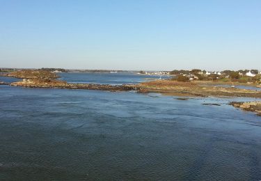
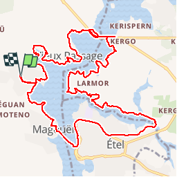
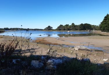
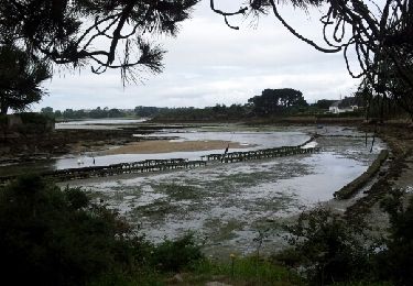
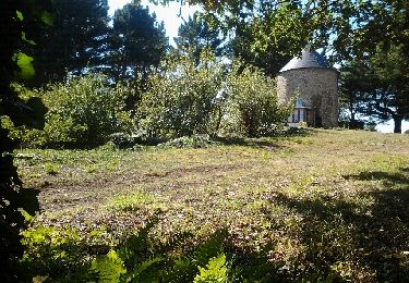
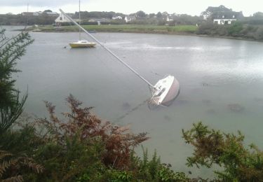
Randonnée Marche de 15,3 km à découvrir à Bretagne, Morbihan, Plouhinec. Cette randonnée est proposée par dlenaour56.

Description

Départ de Locquênin Plouhinec, traversée jusqu'à Etel en bateau du Magouer, et retour par Pont-Lorois

Profil altimétrique

Localisation

Pays :
France
Région :
Bretagne
Département/Province :
Morbihan
Commune :
Plouhinec
Localité :
Unknown
Départ:(Dec)
Départ:(UTM)
483435 ; 5279565 (30T) N.

Randonnées à proximité

Randonnée Marche Plouhinec - PR_56_Plouhinec_AA_01_Circuit1b_La-Ria-Par-Les-Pinedes_20200712 - Photo
Marche
patrickdanilo

Marche

Très facile
(2)
Plouhinec, Bretagne, Morbihan, France
9,7 km | 10,6 km-effort
2h 14min
Oui
Randonnée Marche Plouhinec - Rivière d'Etel - Photo
Marche
ilur56

Marche

Moyen
(1)
Plouhinec, Bretagne, Morbihan, France
15,4 km | 16,7 km-effort
3h 42min
Oui
Randonnée Marche nordique Plouhinec - D'Etel au Pont Laurois par les deux côtés de la Ria  - Photo
Marche nordique
yago1404

Marche nordique

Facile
(2)
Plouhinec, Bretagne, Morbihan, France
13,3 km | 14,5 km-effort
2h 25min
Non
Randonnée Marche Étel - bignac - Photo
Marche
guizouarn

Marche

Très facile
(3)
Étel, Bretagne, Morbihan, France
7,1 km | 7,8 km-effort
1h 36min
Oui
Randonnée Marche nordique Belz - Bignac 05-11-17 . - Photo
Marche nordique
guizouarn

Marche nordique

Très facile
(1)
Belz, Bretagne, Morbihan, France
9,8 km | 10,7 km-effort
1h 53min
Oui
Randonnée Marche Belz - L 'Île de Saint Cado (07- 06-15 - Photo
Marche
Dervalmarc

Marche

Très facile
(1)
Belz, Bretagne, Morbihan, France
2,2 km | 2,4 km-effort
55min
Oui
Randonnée Marche Plouhinec - tour ria etel bretagne - Photo
Marche
legereric

Marche

Facile
(1)
Plouhinec, Bretagne, Morbihan, France
15,3 km | 16,8 km-effort
3h 57min
Oui
Randonnée A pied Belz - Etre douar ar mor - Photo
A pied
PRO

A pied

Facile
Belz, Bretagne, Morbihan, France
4 km | 4,5 km-effort
1h 0min
Non
Randonnée A pied Belz - Pointe de Larmor - Photo
A pied
PRO

A pied

Facile
Belz, Bretagne, Morbihan, France
6,1 km | 6,7 km-effort
1h 31min
Oui


Fermer
Mes abonnements