Randonnée Marche Hastière - Balade de Hastière à Hermeton - Photo

Balade de Hastière à Hermeton

 Desrumaux
Desrumaux

Utilisateur GUIDE

© OpenStreetMap contributors
Longueur
Longueur
13,1 km
Altitude max
Altitude max
248 m
Dénivelé positif
Dénivelé positif
283 m
Km-Effort
Km-Effort  
16,8 km
Altitude min
Altitude min
92 m
Dénivelé négatif
Dénivelé négatif
280 m
Boucle
Boucle
Oui
Date de création :
2018-06-26 16:10:35.169
Dernière modification :
2018-06-26 16:10:35.169

(1 Avis)

Marche
Marche
3h37
Difficulté : Facile

Scannez ce code QR pour ouvrir la randonnée dans l'application SityTrail

Application GPS de randonnée GRATUITE

Logo SityTrail SityTrail

IGN / Instituts géographiques

Télécharger SityTrail sur l'App Store Télécharger SityTrail sur Google Play

Logo SityTrail SityTrail World

Le monde est à vous

Télécharger SityTrail sur l'App Store Télécharger SityTrail sur Google Play Télécharger SityTrail sur Huawei AppGallery

À propos

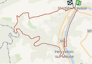
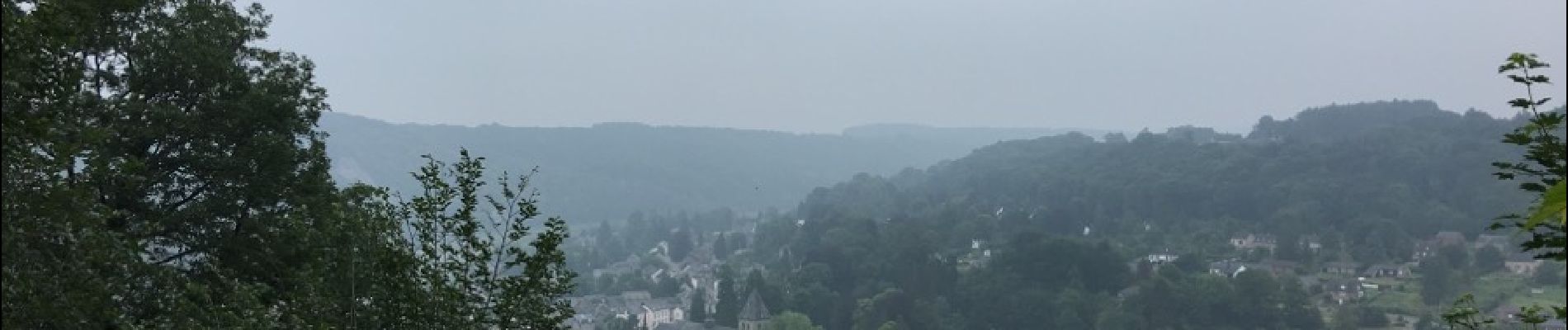
Randonnée Marche de 13,1 km à découvrir à Wallonie, Namur, Hastière. Cette randonnée est proposée par Desrumaux.

Description

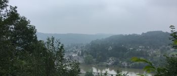
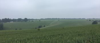
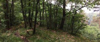
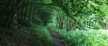
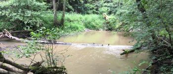
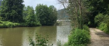
Balade dans la pittoresque et sauvage vallée de l'Hermeton, de Hastière au village de Hermeton.

Profil altimétrique

Photos

Points d'intérêt

Point d'intérêt Hastière - Hastière - Photo
Desrumaux
HASTIÈRE 
Point d'intérêt Hastière - Hastière - Photo
Desrumaux
HASTIÈRE 
Point d'intérêt Hastière - Hastière - Photo
Desrumaux
HASTIÈRE 
Point d'intérêt Hastière - Hastière - Photo
Desrumaux
HASTIÈRE 
Point d'intérêt Hastière - Hastière - Photo
Desrumaux
HASTIÈRE 
Point d'intérêt Hastière - Hastière - Photo
Desrumaux
HASTIÈRE 

Localisation

Pays :
Belgique
Région :
Wallonie
Département/Province :
Namur
Commune :
Hastière
Localité :
Hastière-Lavaux
Départ:(Dec)
Départ:(UTM)
630255 ; 5564293 (31U) N.

Commentaires

Veuillez vous connecter pour laisser un commentaire ou une note


superbe


Randonnées à proximité

Randonnée Marche Hastière - Balade de Hastière à Waulsort - Photo
Marche
GUIDE
Desrumaux

Marche

Moyen
(2)
Hastière, Wallonie, Namur, Belgique
10,8 km | 13,8 km-effort
3h 2min
Oui
Randonnée Marche Hastière - RB-Na-10_Hastière-racc2 - Photo
Marche
PRO

Marche

Facile
(2)
Hastière, Wallonie, Namur, Belgique
18,1 km | 25 km-effort
4h 29min
Oui
Randonnée Marche Hastière - RB-Na-10_Hastière-racc1 - Photo
Marche
PRO

Marche

Moyen
(3)
Hastière, Wallonie, Namur, Belgique
15,3 km | 21 km-effort
5h 28min
Oui
Randonnée Marche Hastière - RB-Na-10_Hastière - Photo
Marche
PRO

Marche

Moyen
(4)
Hastière, Wallonie, Namur, Belgique
22 km | 29 km-effort
6h 21min
Oui
Randonnée Marche Hastière - Hastiere - Photo
Marche
DoBelle

Marche

Difficile
(1)
Hastière, Wallonie, Namur, Belgique
32 km | 41 km-effort
6h 22min
Oui
Randonnée Marche Hastière - Waulsort - Circuit Natura 2000, des sites qui valent le détour - Na08 - Photo
Marche
GUIDE+

Marche

Très facile
(4)
Hastière, Wallonie, Namur, Belgique
4,5 km | 6,9 km-effort
1h 40min
Oui
Randonnée Marche Doische - De Gochenee vers Soulme par la vallee de l'Ermeton - Photo
Marche
GUIDE
Desrumaux

Marche

Moyen
(1)
Doische, Wallonie, Namur, Belgique
18,5 km | 24 km-effort
4h 40min
Oui
Randonnée Marche Onhaye - Balade entre Flavion et Molignée - Photo
Marche
GUIDE
Desrumaux

Marche

Facile
(5)
Onhaye, Wallonie, Namur, Belgique
13,3 km | 16,9 km-effort
3h 20min
Oui
Randonnée Marche Onhaye - De Gérin à Anthée par le village de Maurenne - Photo
Marche
GUIDE
Desrumaux

Marche

Moyen
(1)
Onhaye, Wallonie, Namur, Belgique
18,1 km | 23 km-effort
4h 10min
Oui


Fermer
Mes abonnements