Tocht Stappen Paliseul - Fays-les-Veneurs 28 km - Photo

Fays-les-Veneurs 28 km

 rvapeldo
rvapeldo

Gebruiker GUIDE

© OpenStreetMap contributors
Lengte
Lengte
29 km
Max. hoogte
Max. hoogte
454 m
Positief hoogteverschil
533 m
Km-Effort
Km-Effort  
36 km
Min. hoogte
Min. hoogte
294 m
Negatief hoogteverschil
537 m
Boucle
Boucle
Ja
Datum van aanmaak :
2019-05-07 01:24:25.57
Laatste wijziging :
2019-05-07 01:24:25.57

(0 Bericht)

Stappen
Stappen
7h26
Moeilijkheid : Medium

Scan deze QR-code om de tocht te openen in de SityTrail-applicatie

Gratisgps-wandelapplicatie

Logo SityTrail SityTrail

IGN / Geografische instituten

SityTrail uit de App Store downloaden SityTrail uit Google Play downloaden

Logo SityTrail SityTrail World

De wereld gaat voor u open

SityTrail uit de App Store downloaden SityTrail uit Google Play downloaden SityTrail op Huawei AppGallery downloaden

Over ons

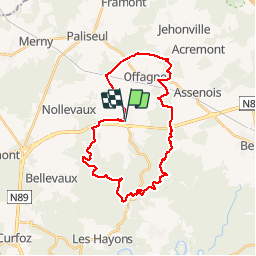
Tocht Stappen van 29 km beschikbaar op Wallonië, Luxemburg, Paliseul. Deze tocht wordt voorgesteld door rvapeldo.

Beschrijving

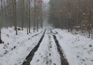
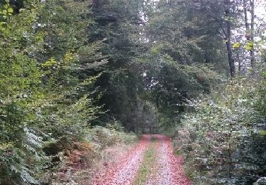
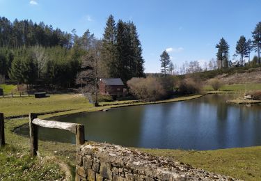
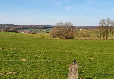
Parcours intéressant, surtout dans la partie où il longe le Rau de Pont le Prêtre (sud de la boucle), dans les forêts. La partie nord est plus rapide, sur les hauteurs dégagées de l'Ardenne agricole. Hormis le départ, vous ne traverserez aucun village, donc il faut s'approvisionner. Je n'ai pas vu de point d'eau non plus.

Hoogteprofiel

Foto's

22 fotos in totaal. Klik op een foto om ze allemaal in de galerij weer te geven.

Plaatsbepaling

Land:
Belgium
Regio :
Wallonië
Departement/Provincie :
Luxemburg
Gemeente :
Paliseul
Locatie:
Fays-les-Veneurs
Vertrek:(Dec)
Vertrek:(UTM)
655342 ; 5525945 (31U) N.

Wandeltochten in de omgeving

Tocht Andere activiteiten Bertrix - BX12 - Photo
Andere activiteiten
PRO

Andere activiteiten

Gemakkelijk
(14)
Bertrix, Wallonië, Luxemburg, Belgium
6,2 km | 7,9 km-effort
2h 0min
Ja
Tocht Stappen Paliseul - RB-Lu-24_Launoy_Boucle-1 - Photo
Stappen
PRO

Stappen

Heel gemakkelijk
(1)
Paliseul, Wallonië, Luxemburg, Belgium
20 km | 26 km-effort
5h 32min
Ja
Tocht Stappen Bertrix - cornichai 02 - Photo
Stappen
vene

Stappen

Medium
(3)
Bertrix, Wallonië, Luxemburg, Belgium
10,5 km | 13,7 km-effort
2h 5min
Ja
Tocht Andere activiteiten Bertrix - BX14 - Photo
Andere activiteiten
PRO

Andere activiteiten

Medium
(4)
Bertrix, Wallonië, Luxemburg, Belgium
10,3 km | 12,8 km-effort
3h 0min
Ja
Tocht Andere activiteiten Bertrix - BX13 - Photo
Andere activiteiten
PRO

Andere activiteiten

Medium
(5)
Bertrix, Wallonië, Luxemburg, Belgium
9,6 km | 12,6 km-effort
2h 40min
Ja
Tocht Andere activiteiten Bertrix - BX01 - Photo
Andere activiteiten
PRO

Andere activiteiten

Gemakkelijk
(8)
Bertrix, Wallonië, Luxemburg, Belgium
9,2 km | 11,1 km-effort
2h 30min
Ja
Tocht Te voet Paliseul - Fays-les-Veneurs : Aux moulins de Pont le Prêtre - Photo
Te voet
GUIDE+

Te voet

Gemakkelijk
Paliseul, Wallonië, Luxemburg, Belgium
10,8 km | 13,5 km-effort
3h 3min
Ja
Tocht Mountainbike Paliseul - Paliseul : circuit VTT jaune - Photo
Mountainbike
GUIDE+

Mountainbike

Medium
Paliseul, Wallonië, Luxemburg, Belgium
20 km | 26 km-effort
1h 46min
Ja
Tocht Te voet Paliseul - Paliseul : Paul Verlaine - Photo
Te voet
GUIDE+

Te voet

Gemakkelijk
(2)
Paliseul, Wallonië, Luxemburg, Belgium
5,9 km | 7,1 km-effort
1h 37min
Ja


Sluiten
Mijn abonnementen