


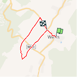


16,8 km | 22 km-effort

Gebruiker


Gratisgps-wandelapplicatie
 SityTrail
IGN / Geografische instituten
SityTrail World
De wereld gaat voor u open
Tocht Stappen van 4,7 km beschikbaar op Wallonië, Luxemburg, Durbuy. Deze tocht wordt voorgesteld door RandoTFE.
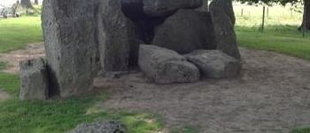
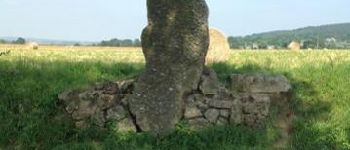
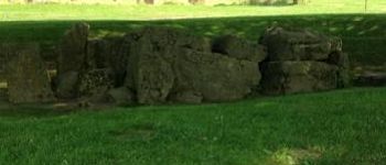
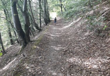
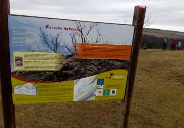
La Maison du Tourisme du Pays d''Ourthe et Aisne a le plaisir de vous présenter ce circuit thématique, orienté autour des monuments mégalithiques. Durant le parcours de ce dernier, vous découvrirez ce qui a rendu le village de Wéris si célèbre. Dolmens et menhirs vous conteront leur histoire tout au long de la balade.


Stappen

Stappen
Stappen
Stappen
Stappen
Stappen
Stappen
Stappen
Stappen