Tocht Stappen Villemus - Le relais de Villemus - Photo
 liocol
liocol

Gebruiker

© OpenStreetMap contributors
Lengte
Lengte
4,8 km
Max. hoogte
Max. hoogte
774 m
Positief hoogteverschil
183 m
Km-Effort
Km-Effort  
7,2 km
Min. hoogte
Min. hoogte
586 m
Negatief hoogteverschil
184 m
Boucle
Boucle
Ja
Datum van aanmaak :
2018-04-17 23:47:13.492
Laatste wijziging :
2018-04-17 23:47:13.492

(0 Bericht)

Stappen
Stappen
1h36
Moeilijkheid : Gemakkelijk

Scan deze QR-code om de tocht te openen in de SityTrail-applicatie

Gratisgps-wandelapplicatie

Logo SityTrail SityTrail

IGN / Geografische instituten

SityTrail uit de App Store downloaden SityTrail uit Google Play downloaden

Logo SityTrail SityTrail World

De wereld gaat voor u open

SityTrail uit de App Store downloaden SityTrail uit Google Play downloaden SityTrail op Huawei AppGallery downloaden

Over ons

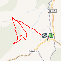
Tocht Stappen van 4,8 km beschikbaar op Provence-Alpes-Côte d'Azur, Alpes-de-Haute-Provence, Villemus. Deze tocht wordt voorgesteld door liocol.

Beschrijving

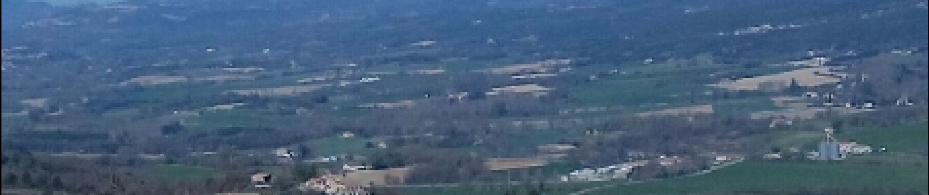
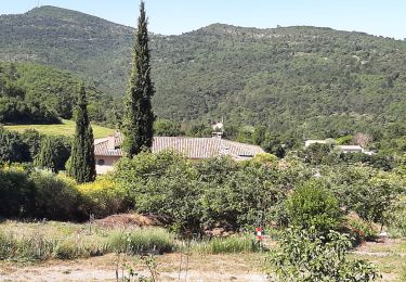
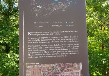
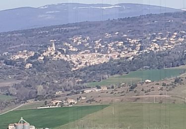
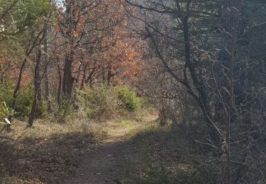
Attention, nous marchons le long d'une route peu passante, mais restez bien à droite. Une boucle avec de belles vues sur Villemus, Lincel et Saint Michel l'observatoire.

Hoogteprofiel

Foto's

POI's

POI Villemus - Point 2 - Photo
liocol
VILLEMUS 
POI Villemus - Point 3 - Photo
liocol
VILLEMUS 
POI Villemus - Point 4 - Photo
liocol
VILLEMUS 
POI Villemus - Point 5 - Photo
liocol
VILLEMUS 
POI Villemus - Point 6 - Photo
liocol
VILLEMUS 
POI Villemus - Point 7 - Photo
liocol
VILLEMUS 
POI Villemus - Point 1 - Photo
liocol
VILLEMUS 

Plaatsbepaling

Land:
France
Regio :
Provence-Alpes-Côte d'Azur
Departement/Provincie :
Alpes-de-Haute-Provence
Gemeente :
Villemus
Locatie:
Unknown
Vertrek:(Dec)
Vertrek:(UTM)
719111 ; 4859109 (31T) N.

Wandeltochten in de omgeving

Tocht Stappen Manosque - Le Val des Chats, avant le col de la Mort d'Imbert. - Photo
Stappen
liocol

Stappen

Gemakkelijk
(2)
Manosque, Provence-Alpes-Côte d'Azur, Alpes-de-Haute-Provence, France
4,7 km | 6,5 km-effort
1h 23min
Ja
Tocht Stappen Saint-Michel-l'Observatoire - LINCEL Moulin de l Agnelier - Photo
Stappen
RobinMicheline

Stappen

Gemakkelijk
(1)
Saint-Michel-l'Observatoire, Provence-Alpes-Côte d'Azur, Alpes-de-Haute-Provence, France
13,6 km | 17,8 km-effort
6h 22min
Ja
Tocht Stappen Manosque - Le tour de la borie '' pain de sucre ''  - Photo
Stappen
PITOUSSAINT

Stappen

Gemakkelijk
(1)
Manosque, Provence-Alpes-Côte d'Azur, Alpes-de-Haute-Provence, France
5,1 km | 7,4 km-effort
1h 43min
Ja
Tocht Stappen Manosque - Quartier des Espels, départ Piscine. - Photo
Stappen
liocol

Stappen

Gemakkelijk
(1)
Manosque, Provence-Alpes-Côte d'Azur, Alpes-de-Haute-Provence, France
4,8 km | 7,3 km-effort
1h 50min
Ja
Tocht Stappen Manosque - 1Les speels, le relais, le pain de sucre. Depart Crématoriome. - Photo
Stappen
liocol

Stappen

Medium
(1)
Manosque, Provence-Alpes-Côte d'Azur, Alpes-de-Haute-Provence, France
6,1 km | 9,7 km-effort
2h 4min
Ja
Tocht Stappen Saint-Michel-l'Observatoire - de Saint Martin les eaux à biabaux . la chapelle de hurage - Photo
Stappen
Roger

Stappen

Gemakkelijk
Saint-Michel-l'Observatoire, Provence-Alpes-Côte d'Azur, Alpes-de-Haute-Provence, France
9,4 km | 13,1 km-effort
2h 51min
Ja
Tocht Stappen Saint-Martin-les-Eaux - 1Domaine de Bourne - Photo
Stappen
liocol

Stappen

Medium
Saint-Martin-les-Eaux, Provence-Alpes-Côte d'Azur, Alpes-de-Haute-Provence, France
5,6 km | 8,3 km-effort
2h 2min
Ja
Tocht Stappen Montfuron - 1Montfuron, Villemus via la Colle et le Moulin. - Photo
Stappen
liocol

Stappen

Gemakkelijk
Montfuron, Provence-Alpes-Côte d'Azur, Alpes-de-Haute-Provence, France
7,6 km | 9,9 km-effort
2h 4min
Ja
Tocht Stappen Manosque - 1Pélicier, chemin des collines, le Chateau via l'Ausselet - Photo
Stappen
liocol

Stappen

Gemakkelijk
Manosque, Provence-Alpes-Côte d'Azur, Alpes-de-Haute-Provence, France
7,1 km | 9,7 km-effort
2h 9min
Ja


Sluiten
Mijn abonnementen