


psmflnegl

pythonmichel
Gebruiker

Lengte
1 km

Max. hoogte
314 m

Positief hoogteverschil
27 m
Km-Effort
1,4 km

Min. hoogte
255 m

Negatief hoogteverschil
50 m
Boucle
Neen
Datum van aanmaak :
2019-04-05 08:19:00.367
Laatste wijziging :
2019-04-05 09:43:08.48
1h08
Moeilijkheid : Heel gemakkelijk

Gratisgps-wandelapplicatie
 SityTrail
IGN / Geografische instituten
SityTrail Plus
De wereld gaat voor u open
Over ons
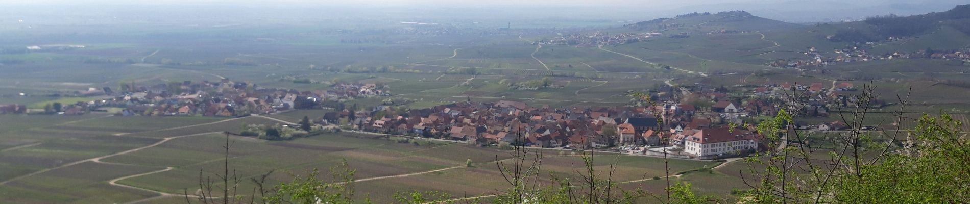
Tocht Lopen van 1 km beschikbaar op Grand Est, Bas-Rhin, Orschwiller. Deze tocht wordt voorgesteld door pythonmichel.
Foto's


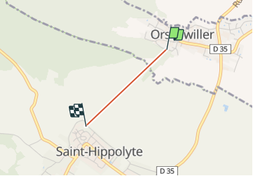
Plaatsbepaling
Land:
France
Regio :
Grand Est
Departement/Provincie :
Bas-Rhin
Gemeente :
Orschwiller
Locatie:
Unknown
Vertrek:(Dec)
Vertrek:(UTM)
379580 ; 5344358 (32U) N.
Opmerkingen