


17,3 km | 21 km-effort
Saint-Benoît : Entdecken Sie die besten Touren : 2 zu fuß, 74 wandern und 1 pfad. Alle diese Touren, Trails, Routen und Outdoor-Aktivitäten sind in unseren SityTrail-Apps für Smartphones und Tablets verfügbar.
Wandern


Wandern

Wandern

Wandern
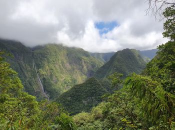
• sentier forêt bebour /belouve

Wandern
• sentier forêt bebour /belouve
Wandern
• Boucle du Grand Étang en passant par la cascade du Bras d'Annette. Circuit assez boueux comme beaucoup de circuit de ...

Wandern
• Balade dans les sous-bois du secteur de la Confiance. Le terrain retour est assez gras après des pluies dans la Régio...

Wandern
Wandern
Zu Fuß
Wandern

Wandern
Wandern

Wandern

Wandern
Wandern
Wandern

Wandern
Wandern

Wandern
20 Angezeigte Touren bei 77
Kostenlosegpshiking-Anwendung
 SityTrail
IGN / Geografische Institute
SityTrail World
Die Welt öffnet sich für Sie