Cervières, Hautes-Alpes, Miscellaneous: Best trails, routes and walks

16 comments

Cervières: Discover the best trails: . All these trails, routes and outdoor activities are available in our SityTrail applications for smartphones and tablets.


The best trails (8)
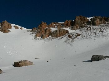
Trail Other activity Cervières - crête de Bugnet.  crête des Granges. Col des Peygus  - Photo
Other activity 14.313
Km
GUIDE

Other activity

Medium
Cervières, Provence-Alpes-Côte d'Azur, Hautes-Alpes, France
14.3 km | 30 km-effort
8h 17min
1185 m
1185 m
Yes
nadd73

• Départ route du col d'Izoard. Le Laus vers 2144m se garer au virage direction les chalets d'Izoard. Nous avons voul...

Trail Other activity Cervières - Briançon 2012 - Photo
Other activity 15.531
Km

Other activity

Very easy
Cervières, Provence-Alpes-Côte d'Azur, Hautes-Alpes, France
15.5 km | 27 km-effort
7h 0min
850 m
851 m
Yes
fortiffsere

Trail Other activity Cervières - lundi cerviere - Photo
Other activity 22.662
Km

Other activity

Very easy
Cervières, Provence-Alpes-Côte d'Azur, Hautes-Alpes, France
23 km | 30 km-effort
3h 46min
516 m
515 m
Yes
napoli

Trail Other activity Cervières - Cervier Aiguille - Photo
Other activity 13.383
Km

Other activity

Medium
Cervières, Provence-Alpes-Côte d'Azur, Hautes-Alpes, France
13.4 km | 26 km-effort
7h 0min
776 m
1344 m
No
klein.raymond

Trail Other activity Cervières - GR58 - étape2 - Photo
Other activity 15.672
Km

Other activity

Very easy
Cervières, Provence-Alpes-Côte d'Azur, Hautes-Alpes, France
15.7 km | 26 km-effort
5h 30min
636 m
1296 m
No
poussin18

Trail Other activity Cervières - Queyras 7 - Photo
Other activity 19.69
Km

Other activity

Very easy
Cervières, Provence-Alpes-Côte d'Azur, Hautes-Alpes, France
19.7 km | 35 km-effort
Unknown
1076 m
1293 m
No
goedz

Trail Other activity Cervières - J4 Queyras raccourci - Photo
Other activity 24.216
Km

Other activity

Very easy
Cervières, Provence-Alpes-Côte d'Azur, Hautes-Alpes, France
24 km | 45 km-effort
Unknown
1643 m
1408 m
No
lol63

Trail Other activity Cervières - J4 queyras - Photo
Other activity 34.629
Km

Other activity

Very easy
Cervières, Provence-Alpes-Côte d'Azur, Hautes-Alpes, France
35 km | 64 km-effort
Unknown
2295 m
2051 m
No
lol63

8 trails displayed on 8

FREE GPS app for hiking

Logo SityTrail SityTrail

IGN / Geographical institutes

Download SityTrail from the App Store Download SityTrail from Google Play

Logo SityTrail SityTrail World

The world is yours!

Download SityTrail from the App Store Download SityTrail from Google Play Download SityTrail on Huawei AppGallery

Activities

Close
My subscriptions